Campaign Summary
| Inclusive Dates | June 9-30, 2007 |
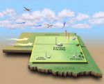
| Campaign Location | Ponca City, Oklahoma |
| Principal Investigator | Dr. Charles K. Gatebe |
| Co-Principal Investigator | Dr. Michael D. King |
| Pilots | David Thrasher and Scott Kaiser |
| Online Photo Album | CLASIC Photos |
CAR Data Summary
| CAR Missions Flown | 11 |
| Dates for CAR Measurements | June 13-25 |
CAR Mission (Flight) Pages
(Click on flight number or map to load mission page)
Flight # 1919 2007-06-13 |
Flight # 1920 2007-06-16 |
Flight # 1921 2007-06-18 |
Flight # 1922 2007-06-19 |
Flight # 1923 2007-06-20 |
Flight # 1924 2007-06-21 |
Flight # 1925 2007-06-22 |
Flight # 1926 2007-06-22 |
Flight # 1927 2007-06-23 |
Flight # 1928 2007-06-24 |
Flight # 1929 2007-06-25 |
CLASIC (Cloud and Land Surface Interaction Campaign) focuses on advancing the understanding of how land surface processes influence cumulus convection. Cumulus convection is an important component in the atmospheric radiation budget and hydrologic cycle of the US Southern Grain Plain (encompassing sites in Oklahoma and Kansas), particularly during the summertime growing season. Human induced changes in the land surface structure associated with plowing, crop rotation, and irrigation can induce changes in the surface latent heat flux, sensible heat flux, albedo, and carbon flux. Changes in surface energy balance and moisture transport to the boundary layer influence cloud processes, thus create a feedback loop.
CLASIC measurements for the intensive observing period were taken between June 9-30, 2007 with main operations based in Ponca City, Oklahoma. The measurements were conducted with a wide range of instruments at ground sites, on aircraft, and satellites. The main ground locations include the Southern Grain Plain Central Facility (36.60°N, 97.48°E), Little Washita (35.044°N, 97.914°W), and the Forest Site.
CLASIC was collocated with the CHAPS (Cumulus Humilis, Aerosol Processing Study) campaign, which focus on characterizing and contrasting freshly emitted aerosols above, within and below fields of cumulus humilis (fair-weather cumulus, FWC) and to use these observations to address how below-cloud and above-cloud aerosol optical and cloud nucleating properties differ downwind of a mid-size city relative to similar aerosols in air less affected by emissions. The observations from this campaign will also be used to aid in the development and evaluation of parameterizations of the transformation and transport of these aerosols by FWC for use in regional-scale and Global Climate Models.
Nine instrumented research aircraft: NASA aircraft (ER-2, King Air B-200, Jetstream-31, and P-3B), US Department of Energy Gulfstream-G1, the Center for Inter-Disciplinary Remotely Piloted Aircraft Studies (CIRPAS) Twin Otter, Cessna 206, Duke University Observing Platform (HOP), and US Department of Agriculture Twin Otter International participated in the joint CLASIC/CHAPS experiment. Five aircraft were based in Ponca City (G-1, CIRPAS Twin Otter, Cessna 206 and Jetstream-31, three in Oklahoma City (Twin Otter International, P-3B, and HOP), and one, ER-2, in Houston, Texas.
The CAR flew aboard Sky Research Jetstream-31 and measured spectral and angular distribution of scattered light by clouds and aerosols, and provided bidirectional reflectance of various surfaces, and imagery of cloud and Earth surface features. By making such diverse measurements, our goal is to widen the audience of potential end-users and to foster collaborations among campaign participants and with outside users.
The CAR was funded by NASA's EOS Program.