2008-06-22 (Flight #2010) |
Flight Photo Album |
Aircraft Flight SummaryDate: 2008-06-22 |
Flight Track Map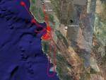
Larger image (new window) Download KMZ/KML File (right click, save as) |
Satellite Image from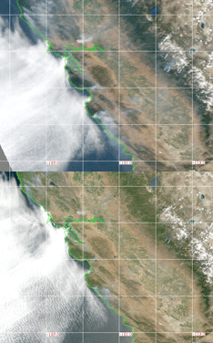
MODIS/Terra larger image (morning) (new window) MODIS/Aqua larger image (afternoon) (new window) |
Satellite Images from GOES-11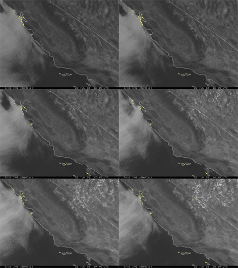 1615 - 2015 UTC |
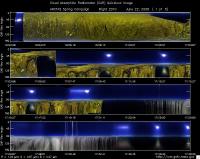
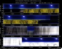
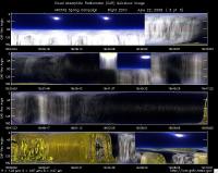
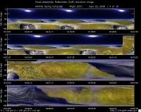
CAR - (QuickLook)
Imagery from CAR Instrument
Click browse image thumbnail to load more detailed version (images open in a new window)
| Flight Direction | Flight Direction |
|
|
|
|
|
|
|
|
Flight Mission Details
Overview:
This was the test flight out of NASA Ames in preparation for the CARB and ARCTAS missions. Preflight goals included leak tests, other instruments preliminary checkout, sample Pittsburg Power Plant plume, CAR circles, radiation legs and spiral up over San Pablo Bay, and look for ships and plumes between Farallon Islands and Golden Gate.
P-3B instrument payload:
AATS: Ames Airborne Tracking Sunphotomter (AATS) measured direct solar beam transmission at 14 wavelengths between 354 and 2139 nm in narrow channels with bandwidths between 2 and 5.6 nm for the wavelengths less than 1640 nm and 17.3 nm for the 2139 nm channel.
AERO3X: measured aerosol extinction and scattering at 405 nm
and 675 nm, scattering in Forward and Back directions at both wavelengths and NO2 mixing ratio.
BBR: Broad Band Radiometer measured: Down- and Up-welling
Solar (0.2-3.6 µm) and IR Irradiance (4.2-42 micron).
CAR - Cloud Absorption Radiometer measured angular distribution of scattered radiation and acquired imagery of clouds and ocean
CCN Counter - Continuous-Flow Streamwise Thermal Gradient Cloud Condensation Nuclei (CCN) Counter (CFSTGC) - counted the fraction of aerosol particles that become droplets when exposed to a given water vapor supersaturation (RH > 100%).
COBALT - Carbon monOxide By Attenuated Laser Transmission (COBALT), an autonomous instrument based on off-axis integrated cavity output spectroscopy took measurements of carbon monoxide.
HiGEAR - Hawii Group for Environmental Aerosol Research (HiGEAR) suite of instruments measured size resolved aerosols. Least successful flight so far.
PDS Project Data System (PDS) measured base meteorological and navigational measurements. No issues reported.
REVEAL - The Research Environment for Vehicle-Embedded Analysis on Linux (REVEAL) system is a prototype next-generation tool for aerospace vehicle sensor webs and the future Earth Observation System.
SSFR -Solar Spectral Flux Radiometer measured spectrally resolved solar irradiance (380 nm to 2200 nm) over snow/ice and clouds.
Flight Path, Timing, and Measurements
Approximate time in UTC (California time - 7 hours). Activities during CAR flight 2010 on June 22, 2008 out of NASA Ames. Observations by CAR operator/PI, Charles Gatebe.
16:38 -- engines on.
16:46 -- taxing. Cryopump power on.
16:49 -- CAR fans power on.
16:51 -- take off.
16:52 -- CAR power on.
16:53 -- CAR scanning the surface from horizon to horizon perpendicular to the flight track.
16:55 -- CAR filter wheel set to 2.2 µm. Active roll correction working fine.
16:58 -- CANS not saving data.
16:59 -- CANS restarted and working fine.
17:02 -- pics of the California coastline.
17:06 -- pics of Monterey Bay.
17:07 -- CAR scanning in the starboard from zenith to nadir.
17:09 -- pics of power plant plumes.
17:15 -- chocolate clouds.
17:20 -- AOD ~0.9 at 0.499 µm.
17:22 -- CAR bad data packet.
17:25 -- going through marine stratus clouds.
17:28 -- CANS system working fine.
17:30 -- going through a thin marine stratus clouds -- skimming the top.
17:35 -- BRDF over ocean. Circle #1.
17:37 -- BRDF circle #2.
17:39 -- BRDF circle #3.
17:40 -- end of BRDF circles.
17:46 -- BRDF over land. Circle #1.
17:49 -- BRDF circle #2.
17:51 -- BRDF circle #3.
17:54 -- end of BRDF over land.
17:55 -- CANS working well.
18:00 -- CAR scanning the surface from horizon to horizon perpendicular to the flight track.
18:05 -- over marine stratus clouds.
18:06 -- inside clouds. Scanning in the starboard.
18:08 -- CAR scanning the surface from horizon to horizon perpendicular to the flight track.
18:09 -- over marine stratus clouds.
18:17 -- BRDF over marine stratus clouds.
18:18 -- BRDF circle #1.
18:24 -- end of BRDF circle#2. Switched filter wheel to 1.6 µm.
18:27 -- completion of BRDF circle #3.
18:30 -- End of BRDF circles.
18:32 -- CAR scanning the surface from horizon to horizon perpendicular to the flight track. Heading to Monterey Bay.
18:41 -- Scanning in the starboard.
18:44 -- Scanning the surface from horizon to horizon perpendicular to the flight track. Dissecting a plume.
18:54 -- 61 m above ocean.
18:56 --preparing for Aqua satellite overpass.
18:58 -- climbing to 305 m agl.
19:04 -- 61 m over Monterey airport.
19:23 -- spiralling over Monterey airport. Scattered stratus visible. Big fire plume up on the mountain.
19:32 -- scanning the surface from horizon to horizon perpendicular to the flight track.
19:42 -- over smoke plume.
19:51 -- inside smoke plume.
20:07 -- closing the CAR door.
20:08 -- CAR power off.
20:09 -- CANS working fine.
20:13 -- CANS power off.
20:14 -- Landing.
20:17 -- CANS computer power off.
20:18 -- Motor and Ether6 computer power off.
