2008-06-24 (Flight #2011) |
Flight Photo Album |
Aircraft Flight SummaryDate: 2008-06-24 |
Flight Track Map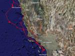
Larger image (new window) Download KMZ/KML File (right click, save as) |
Satellite Image from MODIS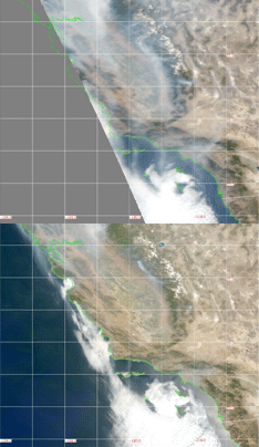
MODIS/Terra larger image (morning) (new window) MODIS/Aqua larger image (afternoon) (new window) |
Satellite Images from GOES-11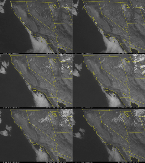 1615 - 2345 UTC |
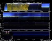
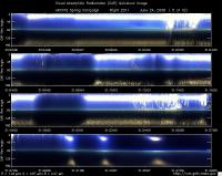
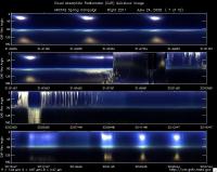
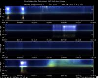
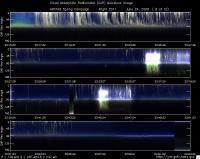
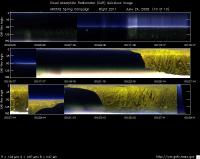
CAR - (QuickLook)
Imagery from CAR Instrument
Click browse image thumbnail to load more detailed version (images open in a new window)
| Flight Direction | Flight Direction |
|
|
|
|
|
|
|
|
|
|
|
|
|
Flight Mission Details
Overview:
This was a flight out of NASA Ames for the CARB mission. Preflight goals included characterization of ship plume between San Francisco and Los Angeles, investigate ship plume-cloud interactions (if possible), spiral near Terra and Aqua overpass at 1847 UTC and 2201 UTC, respectively, perform aerosol gradients (coast to offshore) and do CAR circles and radiation legs.
P-3B instrument payload:
AATS: Ames Airborne Tracking Sunphotomter (AATS) measured direct solar beam transmission at 14 wavelengths between 354 and 2139 nm in narrow channels with bandwidths between 2 and 5.6 nm for the wavelengths less than 1640 nm and 17.3 nm for the 2139 nm channel. Issues reported: salt build up early in the flight.
AERO3X: measured aerosol extinction and scattering at 405 nm
and 675 nm, scattering in Forward and Back directions at both wavelengths and NO2 mixing ratio. Issues: experienced mirror degradation later in the flight.
BBR: Broad Band Radiometer measured: Down- and Up-welling
Solar (0.2-3.6 µm) and IR Irradiance (4.2-42 micron). No issues reported.
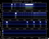
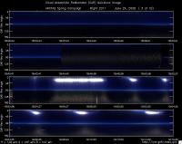
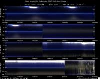
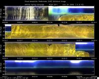
CAR - Cloud Absorption Radiometer measured angular distribution of scattered radiation and acquired imagery of clouds and ocean. Filter wheel channel failed at the end of the flight.
CCN Counter - Continuous-Flow Streamwise Thermal Gradient Cloud Condensation Nuclei (CCN) Counter (CFSTGC) - counted the fraction of aerosol particles that become droplets when exposed to a given water vapor supersaturation (RH > 100%). No issues reported.
COBALT - Carbon monOxide By Attenuated Laser Transmission (COBALT), an autonomous instrument based on off-axis integrated cavity output spectroscopy took measurements of carbon monoxide. Reported max CO of ~2500ppb
HiGEAR - Hawii Group for Environmental Aerosol Research (HiGEAR) suite of instruments measured size resolved aerosols. Least successful flight so far. No issues.
PDS Project Data System (PDS) measured base meteorological and navigational measurements. No issues reported.
REVEAL - The Research Environment for Vehicle-Embedded Analysis on Linux (REVEAL) system is a prototype next-generation tool for aerospace vehicle sensor webs and the future Earth Observation System. Xchart was intermittent and lost coordination with DC-8.
SSFR -Solar Spectral Flux Radiometer measured spectrally resolved solar irradiance (380 nm to 2200 nm) over snow/ice and clouds. No issues reported.
Flight Path, Timing, and Measurements
Approximate time in UTC (California time: -7 hours). Activities during CAR flight 2011 on June 24, 2008 out of NASA Ames. Observations by CAR operator/PI, Charles Gatebe. Adapted some notes from a report by Antony Clarke, flight scientist.
16:15 -- CANS power on.
16:40 -- Engines on.
16:46 -- Taxing.
16:50 -- take off. head to Bay Area, Golden Gate and then Pt. Reyes.
16:53 -- CAR power on.
16:54 -- CAR door open.
16:55 -- CANS working fine.
16:58 -- very hazy. some pics taken.
17:00 -- 800 ppb smoke plume (A. Clarke).
17:03 -- can see surface but lots of smoke around (A. Clarke).
17:05-- AOD at 0.449 µm ~0.45.
17:07 -- flying through heavy pollution -biomass burning plume. CCN reporting more than 6000 particle/cm^3.
17:12 -- Alt. 500 ft, winds 32 kts from NW, air cleaner, scattering 40Mm-1, CO 100 ppb, cargo ship sited ahead, 172 m long (Lat. 38 23.6', lon 124 12.9'). (A Clarke).
17:14 -- wind too gusty ~ 35 kts.
17:22 -- winds at 22 kts.
17:34 -- ship has low and weka plum; heading S for larger cargo ship 350 m long, 42 wide (lat 37.85 deg N, lon 124.73 W). (A. Clarke).
17:42 -- change in roll rate very high. CANS not able to cope.
17:48 -- ship plume, increase in CN but not much extinction or scattering. (A. Clarke).
18:01 -- run in the center of the ship plume and pass on the right, head for larger ship. (A. Clarke).
18:09 -- out of plume, winds 45 kts at surface, climb to 1000 ft, wind at 346 deg at 50 kts.
18:10 -- start CAR BRDF circles at 1000' agl, bank angle ~30 deg. to the right.
18:12 -- BRDF circle #2.
18:14 -- BRDF circle #3.
18:16 -- BRDF circle #4.
18:17 -- end of BRDF circles. Ascend to 2000' agl. Head to cargo ship Anastasia C.
18:22 -- drop to descend to 1000' agl for a 10 min run. (A. Clarke).
18:29 -- descend to 200' for Anastasia C. (A Clarke).
18:33 -- in ship plume and holding; CN-30,000/cc; absorption 4Mm-1, CO up, Ozone down. (A. Clarke).
18:40 -- 10 min run at 200'. (?) (A. Clarke).
18:45 -- see ship MEARSK KIMI, cargo, 300 m long, 42 m wide.
18:47 -- descend to 200' towards ship, wind speed 30 kts.
18:50 -- hit large plume, Aero3X extinction 700Mm-1; CO 145 (background 110); scattering 200Mm-1; absorption 150Mm-1; CCN 12000; lots of organics. (A. Clarke).
18:57 -- circling a ship (3000 m msl.
18:58 -- spiral up to 7000m after hitting plume for Terra overpass (18:47 UTC).
19:04 -- spiraling over a ship.
19:21 - spiraling up (at 6657 m msl). Haze layer clearly seen towards horizon.
19:23 -- at the top of the spiral (7362 m msl). AOD ~0.12 @ 0.499 µm.
19:10 -- some layer at 13000'. (A. Clarke).
19:26 -- BRDF at the top of the layer.
19:30 -- end of BRDF circles. In progress descent to above ship; wind 40 kts.
19:32 -- in progress descent.
19:33 -- CAR scanning the surface from horizon to horizon perpendicular to the flight track.
19:40 -- AOD ~0.11 at 0.499 µm.
19:43 -- AOD increasing at 1000'. Flying in the glint.
19:45 -- hit ship plume, XIN QIN HUANG VAO, 280 m long. (A Clarke).
19:48 -- at 200 ft agl - flying over ship plume. ahit smaller plume BM MIMOSA.
19:50 -- return to XIN QIN HUANG VAO, second pass. (A. Clarke).
19:56 -- CANS doing ok.
20:01 -- CAR scanning the surface from horizon to horizon perpendicular to the flight track.
20:03 -- over marine stratus clouds.
20:05 -- pics of marine stratus taken.
20:10 -- went through heavy smoke plume.
20:17 -- CAR scanning the surface from horizon to horizon perpendicular to the flight track.
20:24 -- active roll problems.
20:33 -- over mountain range.
20:35 -- CANS heading, roll and pitch look suspect.
20:39 -- CANS heading looking ok.
20:43 -- calm seas, lots of pollution haze, ship in view: EVER LIBERTY 285 m long, cargo.
20:51 -- hit a narrow plume, mostly below 200'.
20:54 -- looking for a cargo ship.
20:59 -- hazy over ocean.
21:02 -- marine stratus plus haze.
21:05 -- hit? top of plume of MARIGOLD at 200' -- no visible plume - high CO. (A. Clarke).
21:12 -- at 200', hit plume SANTA MONICA, 234 m long. (A. Clarke).
21:13 -- flying alongside a ship: at 200', try to hit plume ZIM MEDITERRANEAN, 294m cargo (lat 33 25.7', lon 118 05.1'). (A. Clarke).
21:18 -- at 200' - hit plume of ZIM MEDITERRANEAN on retry. (A. Clarke).
21:20 -- flying over a ship.
21:24 -- below marine stratus.
21:30 -- marine stratus field thin. Presence of haze. Prepare for Aqua overpass. Climb to 15000'. AOD ~0.48 (surface); AOD 0.1 at 15000'.
21:31 -- start of profile -- 1000 ft/min, bank angle 40 deg.
21:39 -- in spiral. AOD ~ 0.11.
21:48 -- orbiting at constant altitude. Good for BRDF at 1000'.
21:54 -- broken clouds (marine stratus).
21:57 -- hit pollution at 4000' on descent lot of organic (fires?). (A. Clarke).
21:57 -- Marine stratus below.
21:58 -- CAR scanning the surface from horizon to horizon perpendicular to the flight track.
22:00 -- at 200', Aqua overpass at 22:01 UTC. ( A. Clarke).
22:03 -- flying below clouds.
22:03 -- climb to 1000'(?), cloud passage, PVM appears to be working. (A. Clarke).
22:04 -- hit plume FRISCO MIZAR tanker, 285 m, 50 m wide, (lat. 33 48.6', lon. 118 49.8'.) ( A. Clarke).
22:04 -- going through clouds.
22:05 -- going through clouds -- CAR scanning the surface.
22:07 -- cloud above.
22:14 -- resample ZIM MEDITERRANEAN plume.
22:19 -- go for CAR BRDF circles. (A. Clarke).
22:22 -- Start of BRDF circles at 1000'. AOD ~0.66. winds 10 kts.
22:24 -- BRDF circle #2.
22:26 -- BRDF circle #3.
22:27 -- ship appears as a bright spot near the glint.
22:28 -- BRDF circle #4.
22:31 -- BRDF end of BRDF circles.
22:37 -- at 200'. Weak plum for ANDROMEDA LEADER cargo, 200 m long ( lat. 33 48.6', lon 118 49.8'.) (A. Clarke).
22:46 at 200' plume of BUM EVN tanker, 146 m. (A. Clarke).
22:54 -- climb to 500' (?) ship EVER LIBERTY, Co increases with organics, sulfate decrease, organics double, CCN increase. (A. Clarke).
23:01 -- in the haze. AOD 0.382 at 0.499 µm.
23:05 -- roll is 44 deg.
23:10 -- in the haze layer. Sky looks brownish.
23:14 -- very hazy. CCN 1500/cc. AOD 1.0 @0.499 µm.
23:20 -- hazy + clouds above. Transmission way too low.
22:23 -- broken marine stratus above.
23:31 -- out of the clouds.
23:33 -- ship plume LU HE, cargo 280 m (lat. 34 54.7', lon. 121 17.9). (A. Clarke).
23:36 -- CCN 15000/cc. Roll >50 deg.
23:38 -- cloud leg 1300'. (A. Clarke).
23:41 -- going through some clouds.
23:44 -- switch between CAR imaging modes.
23:45 -- drop to 800' and return under cloud, no plume evident.
23:55 -- low small cumulus, thinning out. (A. Clarke).
23:57 - At 500' AOD 0.45 @0.499 µm. goes down to 0.32 at 2000'. CO increase; CCN decrease.
24:02 -- CAR scanning the surface from horizon to horizon perpendicular to the flight track.
24:04 -- NYK ARGUS, cargo, 300 m (lat. 35 49.2', lon. 122 05.6'); perfect plume visible in clean air. All measurements elevated in the plume axis, UCN over 100,000, etc. (A. Clarke).
24:06 -- turn ahead of ship and re-fly plume in reverse on opposite side to try and stay out of our exhaust. (A. Clarke).
24:10 - CAR scanning in the starboard from zenith through horizon to nadir, perpendicular to the flight track.
24: 13 -- heading back to base.
24:17 -- CAR scanning the surface from horizon to horizon perpendicular to the flight track.
24:30 -- Problems with filter wheel channels. CAR cryo cooler power off. Outside temp well above 20 deg.
24:38 -- packed the CAR instrument, in preparation for landing.
24:39 -- CAR power off.
24:40 -- CANS working fine.
24:41 -- landed.
24:47 -- CANS turned off.
