2008-06-26 (Flight #2012) |
Flight Photo Album |
Aircraft Flight SummaryDate: 2008-06-26 |
Flight Track Map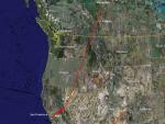
Larger image (new window) Download KMZ/KML File (right click, save as) |
Satellite Image from MODIS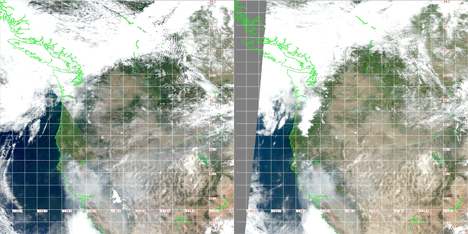
MODIS/Terra larger image (morning) (new window) MODIS/Aqua larger image (afternoon) (new window) |
Satellite Images from GOES-11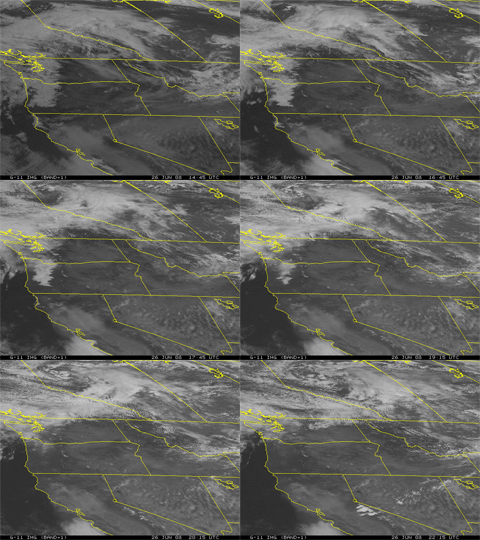 1445 - 2215 UTC |
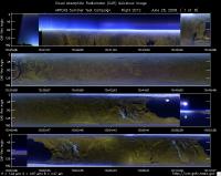
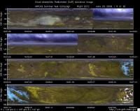
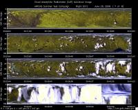
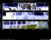
CAR - (QuickLook)
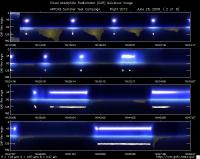
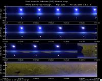
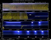
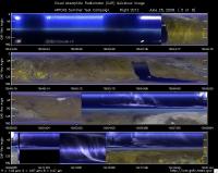
Imagery from CAR Instrument
Click browse image thumbnail to load more detailed version (images open in a new window)
| Flight Direction | Flight Direction |
|
|
|
|
|
|
|
|
|
|
|
Flight Mission Details
This was a transit flight out of NASA Ames to Edmonton, Canada. Preflight goals included characterization of smoke under DC-8 lidar curtain, Terra satellite, and smoke gradient over Lake Tahoe and Central Valley.
P-3B instrument payload:
AATS: Ames Airborne Tracking Sunphotomter (AATS) measured direct solar beam transmission at 14 wavelengths between 354 and 2139 nm in narrow channels with bandwidths between 2 and 5.6 nm for the wavelengths less than 1640 nm and 17.3 nm for the 2139 nm channel. No issues reported.
AERO3X: measured aerosol extinction and scattering at 405 nm
and 675 nm, scattering in Forward and Back directions at both wavelengths and NO2 mixing ratio. No Issues reported.
BBR: Broad Band Radiometer measured: Down- and Up-welling
Solar (0.2-3.6 µm) and IR Irradiance (4.2-42 micron). No issues reported.
CAR - Cloud Absorption Radiometer measured angular distribution of scattered radiation and acquired imagery of clouds and ocean. Filter wheel channel unstable early into the flight.
CCN Counter - Continuous-Flow Streamwise Thermal Gradient Cloud Condensation Nuclei (CCN) Counter (CFSTGC) - counted the fraction of aerosol particles that become droplets when exposed to a given water vapor supersaturation (RH > 100%). No issues reported.
COBALT - Carbon monOxide By Attenuated Laser Transmission (COBALT), an autonomous instrument based on off-axis integrated cavity output spectroscopy took measurements of carbon monoxide. No issues reported.
HiGEAR - Hawii Group for Environmental Aerosol Research (HiGEAR) suite of instruments measured size resolved aerosols. Least successful flight so far. No issues.
PDS Project Data System (PDS) measured base meteorological and navigational measurements. No issues reported.
REVEAL - The Research Environment for Vehicle-Embedded Analysis on Linux (REVEAL) system is a prototype next-generation tool for aerospace vehicle sensor webs and the future Earth Observation System. Xchart showed significant improvement over the previous flights. Received in-flight imagery through Iridium links: DC-8/P-3 flight tracks and DIAL data.
SSFR -Solar Spectral Flux Radiometer measured spectrally resolved solar irradiance (380 nm to 2200 nm) over snow/ice and clouds. No issues reported.
Summary (Colleen Kelly, 29 June 2008):
Both Lake Tahoe smoke radiation studies (in DC-8 lidar curtain and under Terra overpass) were carried out successfully, as were CAR circles over Lake Tahoe. The Central Valley smoke radiation gradient study was shortened to ensure that the second Tahoe smoke study coincided with Terra overpass. Pilot execution of required maneuvers was excellent. We encountered lots of smoke haze everywhere in California. Aerosol optical depth (AOD) on takeoff at Moffett was 1.44, producing a red sun. Over Lake Tahoe AOD was as large as 0.5. So there was plenty of smoke optical depth to cause measurable effects on atmospheric radiation. The data set should be very rich, including in situ measurements of aerosol physics and chemistry, ozone, & carbon monoxide in addition to the radiative measurements. The horizontal gradients in AOD may complicate some analyses, while enabling others.
Flight Path, Timing, and Measurements
Approximate time in UTC (California time: -7 hours; Edmonton: -6 hours). Activities during CAR flight 2012 on June 26, 2008 out of NASA Ames to Edmonton, Canada. Observations by CAR operator/PI, Charles Gatebe. Adapted some notes from a report by Phil Russell, flight scientist.
14:35 -- CANS power on.
15:01 -- NASA Ames AOD 1.44 @ 0.499 µm.
15:01 -- Engines on.
15:11 -- taxing. CANS working fine.
15:23 -- takeoff.
15:25 -- CAR power on. Cryo-cooler power on.
15:28 -- fans power on.
15:32 -- CAR ch 9 unstable -- spikes in the data noticeable.
15:32 -- at 8000' pressure alt., AOD 0.13 @ 0.499 µm. Very hazy below. Brown haze to left, white to the right. (P. Russell).
15:39 -- CAR ch. 9 still spiking.
15:40 -- very hazy, barely see the ground.
15:42 -- CAR ch 9 stable.
15:44 -- Very hazy. looks brown. cloud/smoke plume (whitish/brownish) towards the horizon.
15:46 -- AOD 0.05 @0.499 µm.
15:50 -- over Sierra foothills. Fresh smoke plumes to N & W.
15:52 -- At 21,574'. Few Sierra peak sticking above thick haze. Lake Tahoe South shore barely visible ahead. AOD ~0.01. (P. Russell).
15:58 -- At 23,034'. Start 10 min leg at this altitude (5 min out, 5 min back) for HiGEAR and flux radiometers. (P. Russell).
15:59 -- CAR ch 9 unstable.
16:04 -- CAR ch 9 stable. Nav. temp. 8.33 deg. C.
16:11 -- fresh smoke plumes W of Tahoe and blowing to W. (P. Russell).
16:12 -- start 1000 fpm spiral down over Lake Tahoe. AOD 0.10 0.499 µm. (P. Russell).
16:13 -- Xchart from DC-8 says lidar sees smoke up to 9000'. (P. Russell).
16:13 -- CAR scanning in the starboard from zenith through horizon to nadir perpendicular to the flight track.
16:16 -- AOD 0.09 @0.499 µm. CAR ch 9 unstable.
16:16 -- motor heater power on. Nav temp 3.03 deg C.
16:21 -- CAR ch 9 unstable.
16:24 -- at 11,100' AOD ~0.03, CO ~102 ppb.
16:25 -- CAR cryopump power off/on.
16:26 -- planned DC-8 overpass time.(P. Russell).
16:27 -- at 8100' . AOD ~0.12, CO ~180 ppb. (P. Russell).
16:28 -- CO ~400 ppb. AERO3X does not see aerosol increase seen by other sensors. This is start of discovery of plumbing leak that may have been leaking cabin air into AERO3X & COBALT. Later partially patched with duct tape. (P. Russell).
16:29 --Alt. 6789'. AOD 0.43 @0.499 µm (P. Russell).
16:29 -- Alt. 6515'. AOD >0.5, CO > 500 ppb. (P. Russell).
16:30 -- too murky for straight leg across lake at minimum altitude. Climbing instead. (P. Russell).
16:32 -- Alt. 200' over Lake Tahoe.
16:35 -- Alt. 7800 ft and level. AOD ~0.2 @0.499 µm.
16:36 -- CAR ch 9 stable.
16:41 -- Alt. 8275' Start 3-min radiation leg over Lake Tahoe. AOD ~0.07. (P. Russell).
16:41 -- CAR ch 9 stable.
16:44 -- turn, alt. 8188', scattering 450Mm^-1. (P. Russell).
16:45 -- alt. 8200', AOD 0.13 @ 0.499 µm. (P. Russell).
16:49 -- Parking garage with level radiation legs at 7000' & 8700'. Horizontal variations in AOD observed on each level leg. (P. Russell).
16:51 -- AOD ~0.31.
16:56 -- CAR ch 9 stable. Motor power off.
17:00 -- setting up for BRDF circles.
17:01 -- BRDF circle #1 at 2000' agl.
17:03 -- BRDF circle #2.
17:04 -- AOD varied 0.17-0.23-0.3 during BRDF circles.
17:05 -- CAR ch 9 stable.
17:06 -- BRDF circle #3.
17:07 -- switched filter wheel to position 2 (1.6 µm)
17:08 -- BRDF circle #4.
17:11 -- BRDF circle #5.
17:13 -- BRDF circle #6.
17:15 -- end of BRDF #6; holding a little longer.
17:16 -- AOD 0.2.
17:17 -- end of BRDF. Ch 9 was stable through out BRDF measurements.
17:18 -- Nav temp 20.7 deg. C.
17:19 -- CANS ok; ch 9 stable.
17:30 -- Alt. 19000' heading for Central Valley to attempt gradient study. Wings level for flux radiometer, ramping down. (P. Russell).
17:53 -- Alt 3300' AOD 0.38 @0.499 µm -- increases to 0.45. Lots of scattering and CO. Head back towards Lake Tahoe at this altitude, attempting gradients study. (P. Russell).
17:54 -- climbing to avoid terrain. (P. Russell).
17:57 -- AOD 0.028 @0.499 µm.
18:01 -- CAR ch 9 stable.
18:05 -- over Lake Tahoe.
18:06 -- Nav temp. 24.5 deg. C.
18:07 -- CANS roll angle incorrect.
18:09 -- CANS roll angle now ok.
18:09 -- Alt. 10000'. AOD varies from 0.13 over land to 0.08 over lake. This suggest aerosol layer is rising higher over land than over the lake. Will lidar curtain avoid terrain. (P. Russell).
18:15 -- spiraling down over Lake Tahoe to as low as possible.
18:17 -- spiral down descent over the lake, 10000' to 6200' (200' above water); AOD 0.04 to 0.43. Head for airport for low approach, but conditions are too murky to see obstacles. Instead climb. (P. Russell).
18:21 -- head to the airport. AOD 0.43 @0.499 µm.
18:22 -- 200' straight and level leg.
18:27 -- CAR BRDF circle #1.
18:28 -- BRDF circle #2.
18:32 -- BRDF circle #3. Ch 9 stable. Nav. temp 23 deg. C.
18:34 -- BRDF circle #4. AOD 0.29 @ 0.499 µm.
18:33 -- Terra overpass.
18:35 -- end of BRDF at 600' above the lake. Filter wheel was set at 2.1 µm and 2.2 µm.
18:36 -- Alt. 6560' radiation leg; AOD 0.3 to 0.4.
18:39 -- end of experiments over Lake Tahoe. Start climb and head to Edmonton. Cirrus on horizon, but sky above looks blue. (P. Russell).
18:44 -- CAR scanning the surface from horizon to horizon perpendicular to the flight track.
18:52 -- most to the aerosols are below. No clouds above.
18:53 -- over a lake.
18:55 -- starting to see some cloud wisps.
19:01 -- salt pan. CAR cryocooler power off. Scan#21660.
19:02 -- CAR scanning in the starboard - from zenith to nadir.
19:04 -- CAR ch 9 now unstable because cryocooler has been turned off.
19:07 -- cirrus above.
19:11 - CAR scanning the sky from horizon to horizon.
19:12 -- Nav temp 6.4 deg. C. Motor heater power on.
19:13 -- thin cirrus above. Alt. 7343 m msl.
19:14 -- thick cirrus above.
19:16 -- Scanning in the starboard from zenith to nadir.
19:28 -- did bank to check CANS heading. Seem to change but does not agree with PDS.
19:32 -- heading changing continuously.
19:40 -- CAR scanning the surface from horizon to horizon.
19:56 -- over snow mountain ranges. Cirrus clouds above.
20:26 -- Pics taken in Oregon. Clouds field.
20:33 -- Pics of scattered clouds in Montana.
20:38 -- over broken clouds.
20:40 -- descending to avoid clouds.
20:42 -- entering Canada.
20:43 -- Cumulus clouds.
20:45 -- Pics of river/Lake in Canada.
20:47 -- over very bright clouds.
20:53 -- cloud below, thick and bright. Cirrus above.
20:54 -- aircraft between clouds. CAR scanning scanning in the starboard from zenith to nadir.
21:00 -- CAR scanning the surface from horizon to horizon.
21:03 -- Clouds in Calgary.
21:05 -- CAR scanning in the starboard. Clouds below and Cirrus above.
21:07 -- going through little clouds.
21:09 -- CAR scanning the sky from horizon to horizon. Thin scattered cirrus above.
21:10 -- mirror heater turned on. Nav temp -0.18 deg C.
21:11 -- CAR scanning in the starboard; flying through clouds.
21:13 -- skimming cloud tops.
21:14 -- almost in diffusion domain.
21:16 -- in diffusion domain.
21:17 -- out of clouds, but broken clouds above.
21:18 -- Nav. temp -1.27 deg C.
21:20 -- entering clouds, but at the top.
21:24 -- inside clouds.
21:26 -- at the base of cloud (in and out).
21:29 -- CAR parked in preparation for landing.
21:31 -- close CAR door.
21:32 -- CAR power off.
21:36 -- landed -- Edmonton International Airport for Custom clearance.
21:38 -- CANS power off.
21:45 -- motor and IMU power off. CANS computer power off.
