2008-06-26 (Flight #2013) |
Flight Photo Album |
Aircraft Flight SummaryDate: 2008-06-26 |
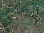
Flight Track Map
Larger image (new window) Download KMZ/KML File (right click, save as) |
Satellite ImageImage Unavailable MODIS/Aqua larger image (afternoon) - unavailable |
Satellite ImagesImage Unavailble |
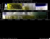
CAR - (QuickLook)
Imagery from CAR Instrument
Click browse image thumbnail to load more detailed version (images open in a new window)
| Flight Direction | Flight Direction |
|
|
|

|
Flight Mission Details
This was a transit flight out of Edmonton to Cold Lake, Canada. There were no science goals on this flight. Objective was to get to Cold Lake before dark. Most instruments were not turned on.
P-3B instrument payload:
AATS: Ames Airborne Tracking Sunphotomter (AATS. No reported measurements.
AERO3X: Status not known
BBR: Status not known
CAR - Cloud Absorption Radiometer measured angular distribution of scattered radiation and acquired imagery of clouds and surface for a short while before GPS data connection was lost in thunder ground.
CCN Counter - Continuous-Flow Streamwise Thermal Gradient Cloud Condensation Nuclei (CCN) Counter (CFSTGC) -Status not known.
COBALT - Carbon monOxide By Attenuated Laser Transmission (COBALT), an autonomous instrument based on off-axis integrated cavity output spectroscopy. Status not known.
HiGEAR - Hawii Group for Environmental Aerosol Research (HiGEAR) suite of instrument.Status not known
PDS Project Data System (PDS) measured base meteorological and navigational measurements. No issues reported.
REVEAL - The Research Environment for Vehicle-Embedded Analysis on Linux (REVEAL) system is a prototype next-generation tool for aerospace vehicle sensor webs and the future Earth Observation System. Status not known.
SSFR -Solar Spectral Flux Radiometer. status not known.
Flight Path, Timing, and Measurements
Approximate time in UTC ( Edmonton/Cold Lake: -6 hours). Activities during CAR flight 2013 on June 26, 2008 out of Edmonton to Cold Lake, Canada. Observations by CAR operator/PI, Charles Gatebe.
22:34 -- CAR computer power on.
22:39 -- CANS system power on. Delay in takeoff announced due to reports of lightning.
23:01 -- CANS data being saved.
23:32 -- Engines on.
23:35 -- aircraft power unit on.
23:38 -- taxing.
23:50 -- takeoff.
23:52 -- CAR instrument power on.
23:53 -- CAR scanning the surface from horizon to horizon perpendicular to the flight track. Active roll turned on.
23:56 -- flying through clouds. CAR scanning in the starboard from zenith to nadir.
23:58 -- in clouds -- diffusion domain sections encountered. No rain.
24:00 -- over cloud top.
24:02 -- in between clouds.
24:03 - CANS nav data not correct. Cloud above.
24:11 -- flying below cloud base; very thick cloud. Alt. 12000'. All heaters turned on.
24:12 -- very dark outside because of clouds.
24:14 -- CAR abrupt shutdown. CANS data to CAR lost. Raining outside. Pilot request CAR to be parked.
24:15 -- raining heavily. Was able to restart the CAR, parked the CAR, and closed the CAR door. Heaters kept on.
24:28 -- landed at Cold Lake.
24:31 -- CANS off.
24:33 -- all heaters turned off including IMU + motor.
24:38 -- John Doyle discovers CAR door not fully closed.
24:40 -- closed the door manually (would not close the door with the software -- glitch suspected) in outside rain.
