2008-06-28 (Flight #2014) |
Flight Photo Album |
Aircraft Flight SummaryDate: 2008-06-28 |
Flight Track Map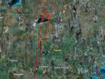
Larger image (new window) Download KMZ/KML File (right click, save as) |
Satellite Image from MODIS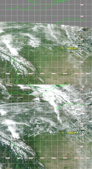
MODIS/Terra larger image (morning) (new window) MODIS/Aqua larger image (afternoon) (new window) |
Satellite Images from GOES-11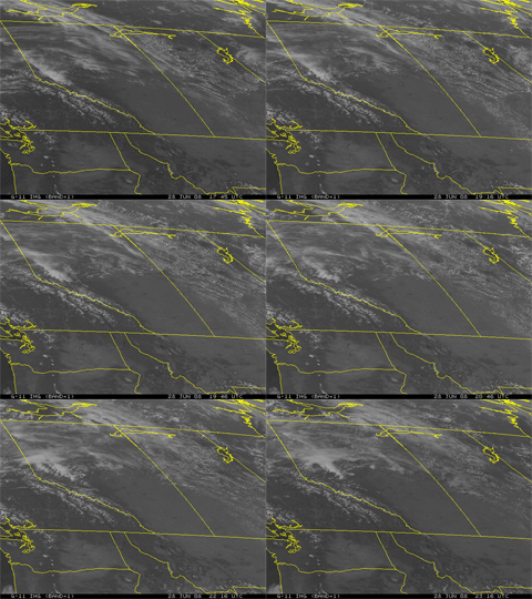 1745 - 2316 UTC |
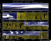
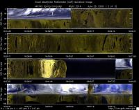
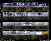
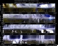
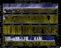
CAR - (QuickLook)
Imagery from CAR Instrument
Click browse image thumbnail to load more detailed version (images open in a new window)
| Flight Direction | Flight Direction |
|
|
|
|
|
|
|
|
Flight Mission Details
Overview:
This was the first flight out of Cold Lake, Canada. Science goals include: 1) test flight operations finding and sampling fires, 2) fly fire outflow at diverse altitudes and stages of development, 3) CALIPSO inter-comparison with B200, 4) fire plume under-flight with B200 and with P-3B below, and 5) radiation and AOD for clean and fire plume conditions.
P-3B instrument payload:
AATS: Ames Airborne Tracking Sunphotomter (AATS. Operational entire flight, but parked because of persistent cloud cover.
AERO3X: Partially successful.
BBR: No problems reported.
CAR - Cloud Absorption Radiometer measured angular distribution of scattered radiation and acquired imagery of cloud, smoke, and surface.
CCN Counter - Continuous-Flow Streamwise Thermal Gradient Cloud Condensation Nuclei (CCN) Counter (CFSTGC) -No problems reported.
COBALT - Carbon monOxide By Attenuated Laser Transmission (COBALT), an autonomous instrument based on off-axis integrated cavity output spectroscopy. Collected good data.
HiGEAR - Hawii Group for Environmental Aerosol Research (HiGEAR) suite of instrument. Excellent flight.
PDS Project Data System (PDS) measured base meteorological and navigational measurements. Fully operational.
REVEAL - The Research Environment for Vehicle-Embedded Analysis on Linux (REVEAL) system is a prototype next-generation tool for aerospace vehicle sensor webs and the future Earth Observation System. Xchat operational, data Ops links running fine, but no data to the B200.
SSFR -Solar Spectral Flux Radiometer. Reported good data.
Flight Path, Timing, and Measurements
Approximate time in UTC ( Local Edmonton/Cold Lake time: -6 hours). Activities during CAR flight 2014 on June 28, 2008 out of Cold Lake, Canada to look for fires. Observations by CAR operator/PI, Charles Gatebe. Some notes adapted from a report by Antony Clarke, flight scientist.
17:45 -- CAR door opened manually.
18:01 -- CANS system power on.
18:03 -- CANS system saving data. Nav temp. 27°C.
18:28 -- CAR instrument power on. Scanning the sky.
18:31 -- aircraft engines on.
18:37 -- taxing. Nav temp. 30°C.
18:40 -- instrument fans power on. Cirrus clouds in the airport vicinity.
18:42 -- take off. (18:41 reported by Tony Clarke).
18:43 -- active roll on.
18:45 -- CANS working fine.
18:47 -- cryopump on.
18:50 -- 7000' high organic in AMS, low SSA, scattering 15Mm-1. (Tony Clarke).
18:53 -- SO4 up and CO ~130 ppb.(Tony Clarke).
18:56 -- CAR scanning in the starboard from zenith to nadir. Clouds above flight level - 2330 m amsl.
18:59 -- climb to above cloud. (Tony Clarke).
18:58 -- filter wheel channels seem ok, but noisy.
19:01 -- climbing above clouds -- cumulus.
19:02 --10500' leg over cloud; CN drop from 2000 to 2000. Scatter from 10 to 1Mm-1, CCN down to 30/cc. (Tony Clarke).
19:03 -- Filter wheel channels show less noise.
19:12 -- penetrate cloud, PVM response est. LWC = 0.2 µg/m3. (Tony Clarke).
19:13 -- penetrate through clouds. CAR scanning the surface from horizon to horizon perpendicular to the flight track.
19:14 -- CAR scanning in the starboard from zenith to nadir.
19:15 -- drop to 7500' (Tony Clarke).
19:16 -- alot of cirrus clouds.
19:17 -- CANS heading doesn't look right. Reading about 177°; should be heading north not south.
19:20 -- CAR scanning the surface from horizon to horizon perpendicular to the flight track.
19:22 -- drop to 2000' (Tony Clarke).
19:23 -- vegetation changing from green to brown.
19:25 -- level at 2000' agl. Wind 20 knots at 206°. Pyrocumulus about 40 miles to the east evident. (Tony Clarke).
19:29 -- 2000'; clearly too many clouds for CALIPSO; CCN ~800/CC. (Tony Clarke).
1932 -- enhanced aerosol? downwind of Ft. McMurray Industrial complex? (Tony Clarke).
19:33 -- enhanced levels of SO2 and CCN reported. (Tony Clarke).
19:39 -- Athabasca sand dunes.
19:44 -- Lake Athabasca and Athabasca sand dunes - brownish in color.
19:48 -- CAR scanning in the starboard from zenith to nadir. Heading towards fires.
19:50 -- 4000 ft, hit center of pyrocumuli at 59°38', 108°53'. (Tony Clarke).
19:51 -- in the smoke plumes.
19:55 -- CANS roll reading doesn't look right.
19:56 -- circle and repeat at N. side of cumuli where entrainment is happening, scattering 700Mm-1. (Tony Clarke).
20:00 -- in a smoky region; too much smoke.
20:10 -- break off plume run. Scattering drops to 60Mm-1. (Tony Clarke).
20:13 -- below cloud base.
20:15 -- skimming the cloud base.
20:15 -- climb and reverse heading at base of clouds above plume. (Tony Clarke).
20:18 -- thick cloud above.
20:22 -- isolated cumulus clouds.
20:25 -- filter wheel channels a little noisier than normal.
20:26 -- going through smoke plumes.
20:27 -- very heavy smoke; almost in diffusion domain.
20:28 -- back to the fire at 59°38', 108°53'. (Tony Clarke).
20:29 -- descending down to 2000 ft.
20:30 -- drop to 1000' (Tony Clarke).
20:33 -- flying through smoke.
20:36 -- CANS looks ok.
20:37 -- B200 above us; heading 020 on plume. (Tony Clarke).
20:46 -- smoke plume seen to the right
20:46 -- turn 160 to get plumes downwind (to the NE) of a line of fires, smoke up to 16000'. (Tony Clarke).
20:49 -- big plume above aircraft.
20:51 -- flying through smoke plume.
20:52 -- fly fire plumes which were sampled by B200. (Tony Clarke).
20:54 -- head to more fires to the east, about 59°39.3', -107°38'.
20:55 -- filter wheel at 1.6 µm.
20:56 -- spikes in the 1.6 µm channel. Not sure it's noise; seems to come from hot fires.
20:57 -- fly down axis of plume. (Tony Clarke).
20:59 -- flying through smoke plumes.
21:00 -- climb through plume to anvil outflow. Lose AMS (crashed) for 30 min. (Tony Clarke).
21:01 -- in smoke plumes. Not very thick, but visibility is very low.
21:06 --in smoke plumes.
21:06 -- darkened cloud outflow evident about 16,000'. (Tony Clarke).
21:08 -- skimming over pyro-cumulus. Cirrus above.
21:08 -- out of time; head back home and climb. (Tony Clarke).
21:16 -- heading towards pyro-cumulus.
21:19 -- between clouds.
21:28 -- cryopump turned off. Noise in the filterwheel channels.
21:30 -- at 23000'. Larger aged BC in thin plume aloft; Siberian air? (Tony Clarke).
21:31 -- inside clouds.
21:32 -- Nav temp. 3°C.
21:36 -- CANS heading not working well. Changing continuously -- increasing.
21:37 -- in progress profile to surface. (Tony Clarke).
21:40 -- Nav temp -0.44°C.
21:44 -- into sub-cloud haze layer about 9200'. (Tony Clarke).
21:47 -- CAR scanning the surface from horizon to horizon perpendicular to the flight track.
21:54 -- low level 500' leg. (Tony Clarke).
21:57 -- UV signal very low.
21:59 -- at 500 ft above ground.
22:02 -- climb to 8400'. (Tony Clarke).
22:03 -- over pine trees, then climbing to higher altitude.
22:06 -- fly just below cloud base. (Tony Clarke).
22:07-- low signal at 0.682 µm.
22:10 -- CAR scanning in the starboard from zenith to nadir. Clouds above.
22:20 -- CAR door closed.
22:21 -- CAR door completely closed.
22:22 -- CAR power off.
22:29 -- landed.
22:33 -- CANS heading moving like a clock.
22:35 -- CANS power off.
