2008-06-29 (Flight #2015) |
Flight Photo Album |
Aircraft Flight SummaryDate: 2008-06-29 |
Flight Track Map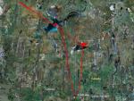
Larger image (new window) Download KMZ/KML File (right click, save as) |
Satellite Image from MODIS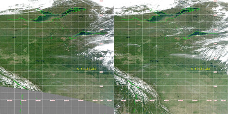
MODIS/Terra larger image (morning) (new window) MODIS/Aqua larger image (afternoon) (new window) |
Satellite Images from GOES-11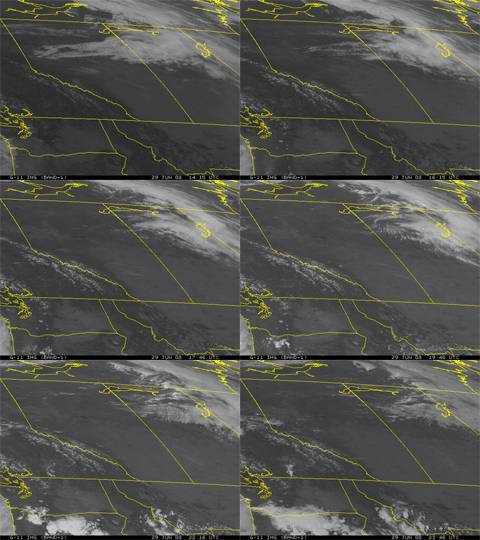 1415 - 2346 UTC |
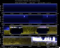
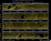
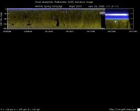
CAR - (QuickLook)
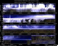
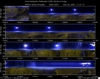
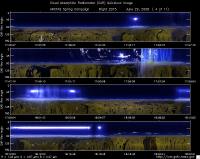
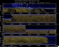
Imagery from CAR Instrument
Click browse image thumbnail to load more detailed version (images open in a new window)
| Flight Direction | Flight Direction |
|
|
|
|
|
|
|
|
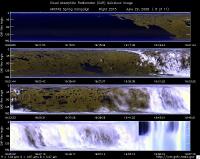
|
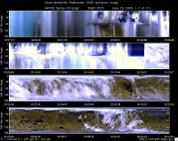
|
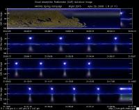
|
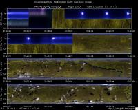
|
|
|
Flight Mission Details
Overview:
This was the second flight out of Cold Lake, Canada. Science goals include: 1) sample/study Fires A & B, 2) Terra overpass (18:53 UT) during Fire B sampling, 3) DC-8 comparison at 2 altitudes on CALIPSO track and 4), spiral down on CALIPSO track at CALIPSO overpass (20:50 UT).
P-3B instrument payload:
AATS: Ames Airborne Tracking Sunphotomter (AATS. worked well, but some experienced tracking problems during turns.
AERO3X: Partially successful. Good red and blue scattering.
BBR: No problems reported.
CAR - Cloud Absorption Radiometer measured angular distribution of scattered radiation and acquired imagery of cloud, smoke, and surface.
CCN Counter - Continuous-Flow Streamwise Thermal Gradient Cloud Condensation Nuclei (CCN) Counter (CFSTGC) -No problems reported.
COBALT - Carbon monOxide By Attenuated Laser Transmission (COBALT), an autonomous instrument based on off-axis integrated cavity output spectroscopy. Collected good data.
HiGEAR - Hawii Group for Environmental Aerosol Research (HiGEAR) suite of instrument. Excellent flight.
PDS Project Data System (PDS) measured base meteorological and navigational measurements. Fully operational.
REVEAL - The Research Environment for Vehicle-Embedded Analysis on Linux (REVEAL) system is a prototype next-generation tool for aerospace vehicle sensor webs and the future Earth Observation System. Operational the whole flight.
SSFR -Solar Spectral Flux Radiometer. Reported good data.
Summary (Colleen Kelly, 29 June 2008):
A partially successful flight. We succeeded in sampling smokes from fires near Lake Athabasca in the morning. This included sampling runs across plumes and along plumes from close in (with AOD >1, scattering > 5000 Mm-1, CO ~5.7 ppm) to farther away. It also included an attempt to measure smoke radiative effects by flying flux radiometer legs above and below the plume, linked by a spiral. However, the presence of clouds and the inhomogeneity of the plume are expected to make analysis of these data very difficult and maybe impossible. As we left the Lake Athabasca area en route to WP 4 we observed an impressive building pyro Cb visually, but our schedule did not allow time to sample it. We arrived at WP 4 on the CALIPSO track at the planned (as revised) time for the DC-8 intercomparison, but extensive clouds there would have made the intercomparison unsafe, so it was canceled. Nevertheless, our time in the clouds may yield CAR retrievals of cloud absorption, because the CAR-measured radiation field appeared to be in the diffusion domain. We headed back to Great Slave Lake and picked a spot that looked to have significant haze AOD below for a spiral down and CAR circles, with radiation legs above and below. The spiral down revealed max AOD of only ~0.03, but we were able to perform 4 CAR circles for BRDF measurements at 600 ft above the lake and 4 more over the adjacent land, both sets with an albedo leg bisecting the circles. Returning from Great Slave Lake to Cold Lake, our flight path took us over Ft. McMurray. We descended to the minimum allowed altitude there, 3,000 ft, and were able to sample some of the industrial plume.
Xchat was up and running for most of the flight (including on a cockpit laptop), and this provided improved communication for the Flight Scientist and others onboard. However, we are still learning how to best use Xchat, and it is likely that some messages went unseen because of the scrolling feature and frequent lists of participants leaving (e.g., because of their computer going to sleep). Seeing those messages would have provided better coordination with the B-200 and with Cold Lake base re fires to sample on our path home.
Flight Path, Timing, and Measurements
Approximate time in UTC ( Local Edmonton/Cold Lake time: -6 hours). Activities during CAR flight 2014 on June 28, 2008 out of Cold Lake, Canada to look for fires. Observations by CAR operator/PI, Charles Gatebe. Some notes adapted from a report by Phil Russell, flight scientist.
14:45 -- CAR door opened manually in preparation for the flight.
14:55 -- CAR Computer , motor, and IMU power.
15:01 -- CANS system power on.
15:14 -- CAR power on; scanning the sky.
15:21 -- engine on.
15:30 -- taxing.
15:36 -- take off. (Phil reported 15:35.)
15:39 -- CAR scanning the surface from horizon to horizon perpendicular to the flight track.
15:52 -- low signal in the UV channel (< 200 counts).
15:54 -- cloud above. Heading to Lake Athabasca.
15:55 -- cloud below and above. CAR scanning in the starboard from zenith to nadir.
16:01 -- Aircraft still climbing. Cirrus above.
16:04 -- skimming top of clouds.
16:10 -- 2.1 micron stable.
16:47 -- 2.1 micron channels a little noisy.
16:49 -- heaters turned on.
16:52 -- CAR scanning the surface from horizon to horizon.
16:53 -- reversing the course.
17:02 -- spiraling down north of Lake Athabasca.
17:03 -- telescope temp reading -53°C ?
17:09 -- pitch is reading -7 deg. (nose down).
17:12 -- pitch -11 deg.
17:17 -- 2.1 micron unstable.
17:21 -- penetrating smoke plume.
17:28 -- cryocooler turned off.
17:43 -- cryocooler turned on.
17:44 -- working smoke plumes north of Lake Athabaska. Too many clouds and too little AOD to attempt radiatin objectives. (Phil Russell).
17:45 -- fire penetration.
17:49 -- sampling plumes under Cam McNaughton's direction. (Phil Russell).
17:52 -- 2.1 micron looks stable.
17:55 -- passing through really dense smoke. AOD>1, scattering 5,000Mm-1, CO ~5.7 ppm for <1 min. Then AOD ~0.06. (Phil Russell)
17:56 -- fire penetration.
18:01 -- fire penetration.
18:09 -- five minutes radiation leg.
18:10 -- start 5 minutes radiation leg. Too many clouds? smoke pall below. Best spot in a bad situation. (Phil Russell)
18:11 -- straight and level for radiation leg - 2652 m amsl. 2.1 micron stable.
18:14 -- lots of clouds. (Phil Russell)
18:15 -- start descent, AOD 0.044 to 0.05 at 449 nm. (Phil Russell)
18:16 -- end of radiation leg. Descending to a lower level.
18:18 -- radiation leg at lower level.
18:19 -- low altitude leg, AOD ~0.085. (Phil Russell)
18:21 -- in low leg, fewer clouds now, AOD 0.123. AOD jumping from 0.1 to 1.0. Do we have Cu above smoke? (Phil Russell)
18:29 -- pyrocumulus - very spectacular.
18:27 -- heading for WP-4 and DC-* rendezvous. Very impressive pyro Cb on right. No time to sample. (Phil Russell)
18:53 -- can see thin dark layer out to the horizon (right wing). Ramesh calls it Asian plume.
19:00 -- south shore of Great Slave Lake. Looks good for clouds, haze, and BRDF. If we return here after other objectives.(Phil Russell)
19:02 -- heading to Great Slave Lake.
19:09 -- cryopump turned on.
19:12 -- over Great Slave Lake. Visibility is poor. A good area for BRDF & flux radiometers measurements.
19:21 -- visibility is better compared to over the Great Slave Lake.
19:26 -- green/brown pancakes-like features
19:30 -- over clouds (cu).
19:37 -- Halfway from GSL to WP-4. Clouds above and below. (Phil Russell).
19:38 -- Nav temp. -9.89°C.
19:49 -- 2.1 micron unstable.
19:51 -- over clouds.
19:54 -- penetrating clouds.
19:55 -- in diffusion domain. Nav temp. -7°C, corresponds to PDS temp.
19:57 -- in clouds. AATS parked. 12,500 ft dust in cloud. Charles notes that CAR data indicate we are in the radiation diffusion domain, good for measuring cloud absorption. (Phil Russell).
19:59 -- in diffusion domain. Can determine cloud absorption from these measurements.
20:03 -- 2.1 micron unstable again.
20:04 -- intercomparison with DC-8 cancelled.
20:04 -- pilots talking to DC08. Are conditions safe for intercomparison? Intercomparison cancelled. DC-8 plans to head for Athabaska Lake fires. We decide to retrace our path to Athabaska Lake, passing over GSL. (Phil Russell)
20:09 -- reverse the course through clouds. No diffusion conditions.
20:18 -- mirror heater turned off.
20:28 -- heading to Great Slave Lake.
20:30 -- Enroute, clear skies above. AATS attempts field-of-view measurements, HIGEAR performs zero. (Phil Russell)
20:55 -- passing over GSL, visual appearance of horizon and Lake below indicates significant haze AOD below, so we decide to spiral down for AOD and in situ profile with radiation legs above and below. (Phil Russell)
21:02 -- spiraling down over the lake.
21:06 -- AOD =0.24 at 449 nm.
21:11 -- 2.1 micron unstable on approach to the surface. AOD is 0.029 at 449 nm.
21:16 -- minimum safe altitude over lake. AOD is only 0.032 at 449 nm. In situ instruments encountered nothing significant in descent. Why were our eyes fooled into thinking there was sufficient AOD below P-3? Brown, murky water color ?? (Phil Russell).
21:18 -- radiation legs at 600 ft agl.
21:19 -- conditions are good for CAR BRDF measurements circles above lake & adjacent land, so we start first circle above lake. (Phil Russell)
21:20 -- reverse course.
21:21 -- BRDF circles.
21:23 -- circle 1
21:25 -- circle 2. water looks greenish.
21:27 -- circle 3. SZA is about 40 deg. AOD is 0.031 at 449 nm.
21:29 -- end of BRDF circles. 2.1 micron was stable during BRDF circles. (Phil reported end of circle #4).
21:30 -- heading for BRDF measurements over land next to the lake.
21:37 -- circle 1
21:39 -- circle 2.
21:40 -- in very bumpy CAR circles over land. (Phil Russell)
21:42 -- circle 3.
21:44 -- circle 4.
21:46 -- end of BRDF circles. Boundary layer was very bumpy.
21:48 -- end of circle #3, AOD 0.03 at 449 nm. (Phil Russell)
22:07 -- heading home, using Xchat to ask for guidance for fire close to our track that we can sample en route. First coordinates received were too far off-track. After flight we learn second fire coordinates were sent, but message must have scrolled out of view before any on board saw it. (Phil Russell)
22:10 -- heater 1 showing no response. Current goes up when heater 2 is turned on.
22:14 -- 2.1 micron stable on the way home.
22:31 -- Ft. McMurray is on our track home, so we descend to minimum allowed altitude (3000 ft?) and sample some industrial emissions. (Phil Russell)
22:44 -- tar sands.
22:53 -- climbing to higher altitude.
23:14 -- 2.1 micron stable
23:15 -- CAR scanning in the starboard from zenith to nadir.
23:17 -- shutting down the CAR door.
23:18 -- CAR power off/
23:20 -- land. (Phil recorded the same).
23:24 -- end of taxing.
23:25 -- CANS stopped.
23:28 -- CAR stored. Motor/IMU power off.
