2008-07-03 (Flight #2018) |
Flight Photo Album |
Aircraft Flight SummaryDate: 2008-07-03 |
Flight Track Map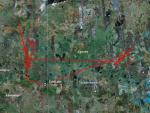
Larger image (new window) Download KMZ/KML File (right click, save as) |
Satellite Image from MODIS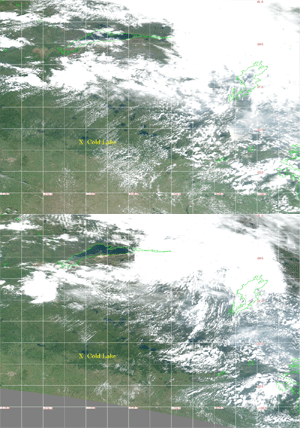
MODIS/Terra larger image (morning) (new window) MODIS/Aqua larger image (afternoon) (new window) |
Satellite Images from GOES-11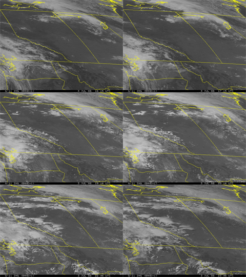 1615 - 2346 UTC |
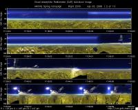
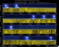
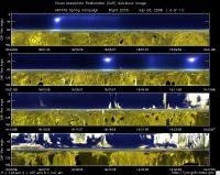
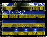
CAR - (QuickLook)
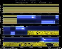
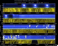
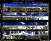
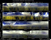
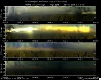
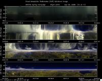
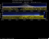
Imagery from CAR Instrument
Click browse image thumbnail to load more detailed version (images open in a new window)
| Flight Direction | Flight Direction |
|
|
|
|
|
|
|
|
|
|
|
|
|
|
Flight Mission Details
Overview:
This was the fifth flight out of Cold Lake, Canada. Science goals include: 1) Ft. McMurray AERONET: CAR circles, AERONET particle property validation & AOD comparison in Terra footprints (MODIS/MISR at 18:30 UT, 2) CALIPSO & Aqua-OMI overpass in A-Train (~20:24 UT) with B-200, 3) Reindeer fire, 4) Waskesiu AERONET: CAR circles, AERONET particle property validation & AOD comparison.
P-3B instrument payload:
AATS: Ames Airborne Tracking Sunphotomter (AATS. worked well, but shutdown part of the flight due to clouds.
AERO3X: Partially successful.Main AERO-3X instrument absent. Good data for relative humidity system.
BBR: No problems reported.
CAR - Cloud Absorption Radiometer measured angular distribution of scattered radiation and acquired imagery of cloud, smoke, and surface. Filter wheel channel occasionally unstable.
CCN Counter - Continuous-Flow Streamwise Thermal Gradient Cloud Condensation Nuclei (CCN) Counter (CFSTGC) -No problems reported.
COBALT - Carbon monOxide By Attenuated Laser Transmission (COBALT), an autonomous instrument based on off-axis integrated cavity output spectroscopy. Collected good data. Inlet problem solved.
HiGEAR - Hawii Group for Environmental Aerosol Research (HiGEAR) suite of instrument. Excellent flight. AMS had computer crashes - twice.
PDS Project Data System (PDS) measured base meteorological and navigational measurements. Fully operational.
REVEAL - The Research Environment for Vehicle-Embedded Analysis on Linux (REVEAL) system is a prototype next-generation tool for aerospace vehicle sensor webs and the future Earth Observation System. Operational the whole flight.
SSFR -Solar Spectral Flux Radiometer. Reported good data.
Summary (Colleen Kelly, 3 July 2008):
A successful flight that studied a fairly uniform regional biomass burning haze (AOD ~0.24) to the west and a huge fire complex to the east with dense smoke in a complex cloud field.
Accomplishments include:
1. A spiral down over the Ft. McMurray AERONET site (for comparisons of AATS-AERONET AODs and in situ-AERONET aerosol retrievals).
2. A spiral down on the CALIPSO track in the MISR, MODIS, & MOPITT footprints at Terra overpass time (~1830 UT, for aerosol & CO validation).
3. A radiation stack along the CALIPSO track (for retrieval of aerosol absorption spectra).
4. Additional work along the CALIPSO/A-Train track in the B200 HSRL curtain, including a spiral down at CALIPSO overpass time (2024 UT, for CALIPSO-MODIS-OMI aerosol validation).
5. CAR circles for bidirectional reflectance over forest near the CALIPSO track.
6. Extensive in situ sampling of the large complex of fire smokes near Reindeer Lake, including record high values of CO (10.6 ppm) and organics, and initial indications of particle size increases with distance downwind.
7. A ramped profile of radiative fluxes, AATS AOD, & in situ sampling on approach to Cold Lake for landing (AOD 0.23).
Clouds prevented CAR circles at the Ft. McMurray & Waskesiu AERONET sites and also radiation work in the eastern fire complex. These are continuing objectives for future flights.
Flight Path, Timing, and Measurements
Approximate time in UTC ( Local Edmonton/Cold Lake time: -6 hours). Activities during CAR flight 2018 on July 03, 2008 out of Cold Lake, Canada. Observations by CAR operator/PI, Charles Gatebe. Some notes adapted from a report by Phil Russell, flight scientist.
16:15 --opened the CAR door manually in preparation for take off.
16:23 -- CANS power on.
16:28 -- cryocooler power on.
16:37 -- engines on.
16:41 -- CAR in "park" position in prep for take off. Scanning the sky from horizon to horizon.
16:44 -- taxing.
16:47 -- filter wheel channels stable.
16:54 -- take off.
16:56 -- flow isokinetic (Phil Russell)
16:55 - -CAR in the starboard scanning from zenith to nadir.
16:58 -- very clear. No clouds, but hazy.
16:58 -- AATS parked, waiting to get above haze, keeping window clean. Looks like uniform smoke pall below. (Phil Russell).
17:04 -- thin Ci.
17:07 -- Ci, very thin and scattered.
17:18 -- filter wheel channels noisy.
17:24 -- AOD 0.025 at 499 nm. Puffy cumulus below aircraft.
17:26 -- filter wheel channels still unstable.
17:30 -- filter wheel channels beginning to stabilize.
17:36 -- Ci above.
17:39 -- start of level legs.
17:44 -- Cu below.
17:46 -- roll angle from CANS not making sense.
17:47 -- roll angle back to normal. Heater turned on.
17:50 -- spiraling down over Ft. McMurray. (Phil Russell)
17:51 -- roll angle readings questionable. Active roll turned off.
17:55 -- filter wheel channels noisy during aircraft spiral.
18:05 -- roll angle readings still erroneous.
18:05 -- 950 ft agl, AOD 0.23 heading for woods to get down to 500 ft agl. AOD 0.24 there . Cloud chase us west before we can do CAR circles. (Phil Russell).
18:06 -- AOD 0.24 at 499 nm; at low level.
18:12 -- roll angle readings still erroneous.
18:21 -- active roll correction turned on.
18:26 -- filter wheel channels stabilizing.
18:26 -- spiraling down over CALIPSO track. (Phil Russell)
18:29 -- AOD 0.24 on CALIPSO track at Terra track. (Phil Russell)
18:30 -- Terra overpass; low radiation legs. AOD 0.24.
18:33 -- climbing to higher levels.
18:41 -- spiraling up. Finish radiation stacks on CALIPSO track.
18:43 -- CANS pitch (-3 deg) does not look ok as the aircraft spiral upwards.
18:46 --doing level leg.
19:15 -- 2.1 micron ok. CANS working fine.
19:33 -- turning around and heading south to meet with B200. Broken clouds.
19:37 -- roll angle questionable.
19:40 -- roll angle probably ok.
19:41 -- under cloud. B200 above. CALIPSO overpass. Isolated thunder clouds.
19:51 -- heading south under B200. Broken clouds.
20:00 -- reverse course to avoid clouds.
20:14 -- roll angle error - oscillating.
20:14 -- turning N at S limit. (Phil Russell)
20:16 -- spiral down.
20:20 -- AOD 0.2 at 499 nm. Homogenous aerosol.
20:24 -- CALIPSO overpass. AOD 0.22 at 499 nm. B200 heads home.
20:17 -- looking for a BRDF site near CALIPSO track.
20:29 -- circle #1.
20:32 -- circle #2. AOD 0.23 at 499 nm.
20:34 -- circle #3.
20:37 -- circle #4.
20:39 -- end of BRDF circles.
20:40 -- 2.1 micron start to show some sign of instability.
20:45 -- heading E for Reindeer Lake fires. (Phil Russell).
21:02 -- transiting to the fires. Broken clouds.
21:21 -- 1.6 micron noisy.
21:26 -- More Ci above.
21:31 -- lots of fire and smoke below. (Phil Russell)
21:36 -- 2.1 micron stable again.
21:47 -- pyramid-like Cu, below it huge burning fires.
21:48 -- descending through clouds -- probably mixed with smoke.
21:56 -- in smoke plumes.
21:58 -- entering a plume - at 3.5 to 4 kft. Very smoky, CO 10.58 ppm. Organics - largest concentrations yet. (Phil Russell)
21:59 -- plume penetration.
22:07 -- very low visibility; widespread fire plumes.
22:14 -- heading downwind in plume. AOD 1. Ground barely visible below. (Phil Russell)
22:20 -- end of 20-min in plume at 3.5 kft. Particle size appeared to increase as we flew downwind. (Phil Russell).
22:21 -- reversing the course at a higher altitude.
22:22 -- spiraling up to 7500 ft. (Phil Russell)
22:25 -- start of the upwind leg. Clouds all around. AATS unparked but only reading cirrus above. In situ reading similar to at 3500 ft. (Phil Russell)
22:26 -- check the roll?
22:35 -- AATS parked. (Phil Russell)
22:39 -- preparing to penetrate a Cbs.
22:40 -- over initial head of fires. (Phil Russell). Descent to Cold Lake. AOD 0.04 at 6 km GPS. (Phil Russell)
22:52 -- S-pattern on a descent. 1.6 micron getting noisier.
22:54 -- at 1375 m msl. Very low visibility and can hardly see the ground.
23:07 -- sun nearly visible. Took a picture.
23:26 -- In smoke plume. Barely see the ground. Seems like there are clouds above smoke plumes.
23:31 -- pilot report rain ahead.
23:34 -- roll angle error. Rain reported.
23:38 -- climbing to higher altitude.
23:42 -- roll angle error.
23:44 -- inside cloud. Low light transmission.
23:47 -- small Cu below.
23:49 -- flying in diffusion domain.
23:52 -- flying between clouds.
00:21 -- flying in clear sky.
00:27 -- clear sky.
00:42 -- AOD 0.16, 1.75 km GPS. (Phil Russell)
00:43 -- AOD 0.185, 1.5 km GPS. (Phil Russell)
00:43 -- horizon off by 2 deg -- looking at 1.6 micron scan.
00:49 -- CAR in park position. Close the door in preparation for landing.
00:49 -- AOD 0.2, 1 km GPS. (Phil Russell)
00:50 -- CAR power off.
00:51 -- landed.
0051 -- AOD 0.23. (Phil Russell)
00:56 -- CANS power off.
