2008-07-06 (Flight #2019) |
Flight Photo Album |
Aircraft Flight SummaryDate: 2008-07-06 |
Flight Track Map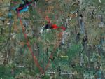
Larger image (new window) Download KMZ/KML File (right click, save as) |
Satellite Image from MODIS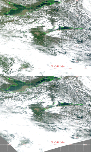
MODIS/Terra larger image (morning) (new window) MODIS/Aqua larger image (afternoon) (new window) |
Satellite Images from GOES-11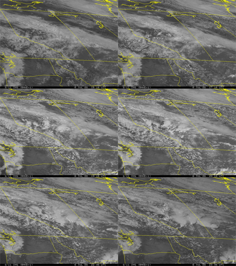 1616 - 2346 UTC |
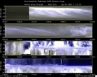
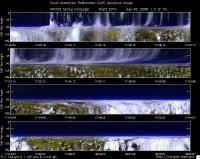
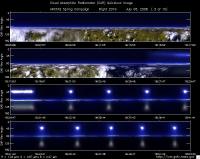
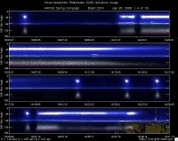
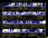
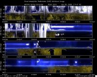
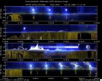
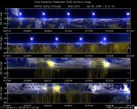
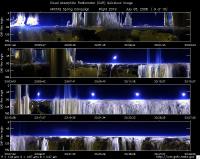
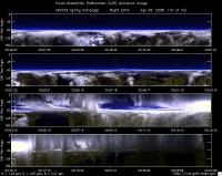
CAR - (QuickLook)
Imagery from CAR Instrument
Click browse image thumbnail to load more detailed version (images open in a new window)
| Flight Direction | Flight Direction |
|
|
|
|
|
|
|
|
|
|
|
|
|
Flight Mission Details
Overview:
This was the sixth flight out of Cold Lake, Canada. Science goals include: 1) Coordination with B200 for isolated plume near Great Slave Lake with TERRA-MISR underpass, 2) Cloud and smoke interaction study for radiation, aerosol and CCN near fires – Lake Athabasca, 3) Explore aerosol and optical differences in flaming (dark) and smoldering (light) fire plumes near source, 4) Fly fire PyroCu outflow for aerosol chem. and optics, 5) CAR opportunities in smoke and clouds, and 6) Model validation.
P-3B instrument payload:
AATS: Ames Airborne Tracking Sunphotomter (AATS. worked well, but shutdown part of the flight due to clouds.
AERO3X: Partially successful.Main AERO-3X instrument absent. Good data for relative humidity system.
BBR: No problems reported.
CAR - Cloud Absorption Radiometer measured angular distribution of scattered radiation and acquired imagery of cloud, smoke, and surface. Filter wheel channel occasionally unstable.
CCN Counter - Continuous-Flow Streamwise Thermal Gradient Cloud Condensation Nuclei (CCN) Counter (CFSTGC) -No problems reported.
COBALT - Carbon monOxide By Attenuated Laser Transmission (COBALT), an autonomous instrument based on off-axis integrated cavity output spectroscopy. Collected good data. Inlet problem solved.
HiGEAR - Hawii Group for Environmental Aerosol Research (HiGEAR) suite of instrument. Excellent flight. AMS had computer crashes - twice.
PDS Project Data System (PDS) measured base meteorological and navigational measurements. Fully operational.
REVEAL - The Research Environment for Vehicle-Embedded Analysis on Linux (REVEAL) system is a prototype next-generation tool for aerospace vehicle sensor webs and the future Earth Observation System. Operational the whole flight.
SSFR -Solar Spectral Flux Radiometer. Reported good data.
Summary (Colleen Kelly, 6 July 2008):
Excellent Flight: Hints of cloud openings and plume opportunities in the COAMPS model led us to attempt a MISR underpass with the B200 over Great Slave Lake in the morning and a radiation/aerosol/cloud study of fires north of Lake Athabaska in the afternoon. An early survey flight by the B200 revealed that the fires near Yellowknife had died early. In-flight communication with B200 allowed us to revise our plan. The B200 refueled while the P3b completed radiation profiles and legs under Terra in clean but cloud free air over Great Slave Lake. A dramatic separation of blue and muddy waters on the lake allowed us to do BRDF circles over both calm surfaces back to back under the same light conditions. We then rejoined the B200 to fly under it just below broken Cu en-route to the Athabaska fires. This provided preliminary statistical data for examining cloud edge effects.
We then worked the Athabaska fires in close co-ordination with the B200 lidar curtain and completed AATS/Aerosol spirals in dense smoke plumes over the lake. We were able to complete numerous objectives including gradient flights into plumes, radiation stacks, flux measurements, in-cloud CAR data, CAR circles, SSFR, and BBR measurements in and over smoke with embedded clouds. All of the above were carried out with concurrent full size resolved chemical and optical properties including cloud condensation nuclei (CCN). These were done along with in-cloud measurements of liquid water content (LWC), droplet surface area and effective radiance. Concurrent optical, physical and chemical characterizations were carried out on a range of plume types from “black” to “white” as well as an integrated assessment of these diverse plume types present during several cross wind runs for miles along the entire fire front. An excellent sampling of Pyro-Cu outflow included aerosol and radiation measurements below in and above the outflow region.
Flight Path, Timing, and Measurements
Approximate time in UTC ( Local Edmonton/Cold Lake time: -6 hours). Activities during CAR flight 2019 on July 06, 2008 out of Cold Lake, Canada. Observations by CAR operator/PI, Charles Gatebe. Some notes adapted from a report by Anthony Clarke, flight scientist.
16:15 -- opened the CAR door manually in preparation for take off.
16:21 -- CANS power on. File not saving. Restarted again at 16:28 UTC.
16:30 -- CAR power on.
16:43 -- engine on.
16:49 -- taxing.
16:55 -- take off.
16::55 -- climb between low and higher cloud. (Athony Clarke)
16:58 -- CAR in the starboard scanning from zenith to nadir.
17:00 -- lots of cloud beneath and above aircraft.
17:01 -- at 9000'. (Athony Clarke)
17:02 -- heaters turned on. Going through clouds, possible icing.
17:10 -- CANS heading changing continuously even though the aircraft's heading remains steady.
17:15 -- B200 takes off from Great Slave Lake; large clouds ahead too high to climb over. (Athony Clarke)
17:17 -- 20000' possible icing. (Athony Clarke)
17:19 -- two minutes warning for icing conditions.
17:20 -- RTMM down. (Athony Clarke)
17:21 -- clouds at 6 km.
17:23 -- crycooler power on.
17:33 -- filter channels unstable.
17:37 -- fair weather Cu below and Ci above.
17:39 -- Ci thinning out.
17:47 -- filter wheel channels still unstable.
18:00 -- RTMM up.
18:01 -- broken stratus and Cu below. B200 sees no plume ahead so goes to refuel and join us later at fires. (Athony Clarke)
18:02 -- broken clouds below.
18:03 -- no Ci above. AATS can track the sun.
18:31 -- start descent over Great Slave Lake.
18:31 -- perfect conditions over the lake - no Ci; start descent 1500'/min at 62.64N and -114.24'25''W. (Athony Clarke)
18:40 -- continue descent at 1000'/min. AERONET site near at 62 27'7''N, -114 24'25''W. (Athony Clarke)
18:44 -- AOD 0.037 at 499 nm.
18:44 --(entered as 18:54 in Tony's report) MISR overpass; end descent; AOD at 20000' is 0.015; at 5000' is 0.03 and at 200' is 0.056. (Anthony Clarke)
18:47 -- AOD 0.04.
18:49 -- CAR BRDF circle #1.
18:55 -- end of BRDF circles. Filter wheel set at 1.6 and 2.1 micron during BRDF circles.
18:56 -- complete two CAR circles over water, head SW looking for gradient in AOD at 200'. (Anthony Clarke)
18:57 -- 200 ft level run.
18:59 -- AOD 0.06 at 499 nm.
19:00 -- Terra overpass. (to be verified)
19:00 -- heading 190 deg. AOD 0.061 (Anthony Clarke)
19:08 -- still in low-level run. Clear sky above. Clouds towards horizon.
19:14 -- still at low-level run. Aircraft is level, but CANS reads -2.19 deg. Seems like an offset error.
19:18 -- AOD 0.039. (tony reports this at 19:17)
19:20 -- water color looks brown. Request for BRDF circles.
19:24 -- CAR circles over muddy brown water in Lake. (Anthony Clarke)
19:24 -- CAR BRDF circle #1.
19:27 -- circle #2.
19:31 -- end of BRDF circles. AOD 0.034-0.04 during BRDF circles.
19:32 -- end of CAR circles and spiral to thin layer between 6000' and 9000' waiting. (Anthony Clarke)
19:35 -- 9500' top of boundary layer. (Anthony Clarke)
19:38 -- still over Great Slave lake. Huge rocks on the shoreline.
19:38 -- AOD 0.02. (Anthony Clarke)
19:39 -- on flight line to fires with B200 eight miles behind us. (Anthony Clarke)
19:41 -- flying below cloud base 7500' in broken Cu; try as test run for "cloud edge effects" under B200 lidar. (Anthony Clarke)
19:45 -- clouds above aircraft.
19:47 -- precipitating cloud; try to avoid; bumpy; scattering increase to 20Mm-1, AOD 0.05. (Anthony Clarke)
19:48 -- broken clouds.
19:59 -- precipitating clouds.
20:04 -- broken clouds above. Scattered precip.
20:06 -- B200 above.
20:08 -- aerosol variable with lots of structure. (Anthony Clarke)
20:14 -- headed towards fire plumes.
20:23 -- fly plume in older burn area - plumes scattered. (Anthony Clarke)
20:26 -- turn around and do low cloud base leg. (Anthony Clarke)
20:31 -- below cloud base.
20:31 -- in cloud at base - in cloud and plume, ground occasionally visible. (Anthony Clarke)
20:35 -- turn for second pass higher in cloud for CAR. Need no ground in view for CAR. (Anthony Clarke)
20:40 -- clouds penetration.
20:40 -- start cloud leg heading to fire, middle of cloud, smoky; CO at 250 ppm; good cloud hit. (Anthony Clarke)
20:43 -- cloud penetration. Non-smoke type.
20:44 -- end of diffusion domain --smoky clouds.
20:45 -- diffusion domain in non-smoky clouds.
20:45 -- do comparison tun in nearby clean (no smoky) cloud; CO @120 ppm. (Anthony Clarke)
20:50 -- do above, below, and in-cloud with B200 above.
20:53 -- over major plume AOD 0.05. (Anthony Clarke)
20:54 -- AOD 0.05 at 499 nm.
20:55 -- spiraling down to the surface.
20:58 -- level at 800 m amsl (500 ft).
20:58 -- spiral down to 500'. (Anthony Clarke)
20:59 -- start 500' leg under plume layer near 7000'; lower plumes headed north with upper plume headed north with upper folding back to south over lake. (Anthony Clarke)
21:01 -- AOD 0.5 in plume.
21:03 -- AOD 0.1 out of plume.
21:05 -- reverse and fly plume at 4800'. (Anthony Clarke)
21:07 -- at 4000 ft, headed into the plumes.
21:07 -- peak concentration near 59 20'N, -105 47'W; run gradient. (Anthony Clarke)
21:09 -- AOD 1.5 over water.
21:12 -- AOD 0.055.
21:15 -- AOD 0.15. (Anthony Clarke)
21:17 -- at the bottom of the plume. AOD 0.52 increases to 0.7 and 1.2.
21:17 -- spiral up with AOD varying above 1 and upto 2. (Anthony Clarke)
21:19 -- spiraling up through haze.
21:19 -- at 4800' scattering is 500 Mm-1, CO 1000; AOD -2. (Anthony Clarke)
21:25 -- AOD 0.06 at 499 nm. End of spiral. start a level run at this altitude: 1726 m amsl, downwind.
21:25 -- drop to 5000' and head downwind with B200. (Anthony Clarke)
21:38 -- maneuver to head toward plumes. AOD ~3. (Anthony Clarke)
21:46 -- ramping down from 10,000 ft upto 500 ft.
21:46 -- reverse course and do flat descent for Anthony Bucholtz. (Anthony Clarke)
21:47 -- scattering less than 1000 Mm-1.
21:47 -- cross our other circles done earlier. (Anthony Clarke)
21:51 -- spiraling up.
21:55 -- start of BRDF circles over the lake.
21:57 -- circle #2. some clouds at ~80 deg from zenith.
21:57 -- CAR circle has some clouds embedded in smoke. (Anthony Clarke)
22:02 -- ended BRDF circles and climb to 12500'.
22:06 -- spiraling up.AOD 0.057 @8000'.
22:07 -- some clouds look brownish in color, while others are very white.
22:08 -- B200 fling our circles for lidar curtain. (Anthony Clarke)
22:10 -- spiraling up; most aerosols and clouds below.
22:12 -- B200 gone home. (Anthony Clarke)
22:16 -- spiral down.
22:18 -- spiral down in plume west (cloud free). (Anthony Clarke)
22:24 -- AOD 2.5; CO 400ppb, run LIGHT and DARK downwind; fly W-E in plume-front along lake shore on N side of Athabasca. Fly E-W with first plumes apparently darker. Fly W-E again. (Anthony Clarke)
22:29 -- end of downward spiral.. Heading for real smoke plumes.
22:31 -- in smoke plumes.
22:36 -- penetrating white smoke, black and then a mixture.
22:37 -- out of smoke plumes.
22:46 -- penetrating small smoke plumes
22:50 -- plume not going anywhere, just lofting up.
22:52 -- climb and look for plume-cloud interaction using CO. (Anthony Clarke)
22:54 -- Filter wheel channel showing spikes -- from hot fires.
22:58 -- pyro-Cu ahead. Plume feeding into the clouds.
23:00 -- fly pass under PyroCb outflow in smoke just below pyro-cloud at 8800' - lots of smoke in the cloud. (Anthony Clarke)
23:01 -- going through plume. Cloud above.
23:03 -- location 59 10'N, -106 12'W, start in-cloud PyroCb 500' above last run, CO 1200ppb. (Anthony Clarke)
23:07 -- roll angle -51 deg.
23:07 -- climb for above cloud run. (Anthony Clarke)
23:12 -- bumpy -- cloud processed run. (Anthony Clarke)
23:14 -- at the top of the cloud/smoke. Strong interaction between smoke and clouds.
23:14 -- fly cloud-smoke edge -detraining cloud. (Anthony Clarke)
23:16 -- penetrating cloud/smoke; pyro-Cu.
23:17 -- fly cloud processed smoke with embedded clouds. Heading over cloud. (Anthony Clarke)
23:18 -- embedded clouds/smoke.
23:20 --BRDF circles over smoke.
23:24 -- circle #2.
23:25 -- do radiation runs for Anthony Bucholtz over clouds with smoke and without smoke. (Anthony Clarke)
23:27 -- end of BRDF circles.
23:29 -- filter wheel channels unstable.
23:35 -- at 4922 m amsl and climbing higher.
23:36 -- encounter layer with elevated CO, AOD 0.05-0.028 about 18000' enhanced organic carbon and SO4 in layer. (Anthony Clarke)
23:38 -- filter wheel channels still unstable.
23:41 -- thin layer visually evident off to the east. (Anthony Clarke)
23:51 -- filter wheel channels now stable.
23:56 -- 2.1 micron not stable. Shallow descent requested. 500'/min from 24000' to 20800'.
00:00 -- approaching altostratus ahead - aerosol and CO drop. (Anthony Clarke)
00:04 -- continue ramp down to 20000'. (Anthony Clarke)
00:05 -- 2.1 micron not stable.
00:08 -- thin cloudl
00:09 -- cloud penetration.
00:14 -- initial descent to Cold Lake.
00:17 -- cloud penetration.
00:26 -- closing the CAR door.
00:27 -- CAR parked and powered off.
00:29 -- landed. (00:28 recorded in Tony' report).
00:32 -- end of taxing. cyro-pump off.
