2008-07-07 (Flight #2020) |
Flight Photo Album |
Aircraft Flight SummaryDate: 2008-07-07 |
Flight Track Map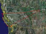
Larger image (new window) Download KMZ/KML File (right click, save as) |
Satellite Image from MODIS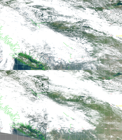
MODIS/Terra larger image (morning) (new window) MODIS/Aqua larger image (afternoon) (new window) |
Satellite Images from GOES-11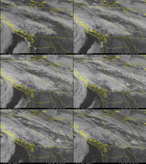 1715 - 2346 UTC |
CAR - (QuickLook)
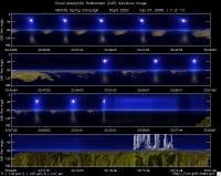
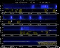
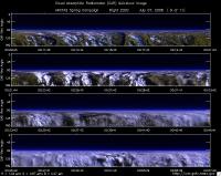
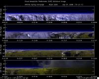
Imagery from CAR Instrument
Click browse image thumbnail to load more detailed version (images open in a new window)
| Flight Direction | Flight Direction |
|
|
|
|

|
|
|
|
|
|
|
|
|
|
Flight Mission Details
Overview:
This was the seventh flight out of Cold Lake, Canada. Science goals include: 1) Asian-Siberian plume, 2) Saturn Island AERONET (in situ aerosol, CO, O3, AATS spiral, radiation gradient & stack, CAR-AERONET) 3) Ice Field BRDF, Ice Field BRDF.
P-3B instrument payload: (no available instrument reports)
AATS: Ames Airborne Tracking Sunphotomter (AATS.
AERO3X: Partially successful.Main AERO-3X instrument absent. Good data for relative humidity system.
BBR: No problems reported.
CAR - Cloud Absorption Radiometer measured angular distribution of scattered radiation and acquired imagery of cloud, smoke, and surface. Filter wheel channel occasionally unstable.
CCN Counter - Continuous-Flow Streamwise Thermal Gradient Cloud Condensation Nuclei (CCN) Counter (CFSTGC) -No problems reported.
COBALT - Carbon monOxide By Attenuated Laser Transmission (COBALT), an autonomous instrument based on off-axis integrated cavity output spectroscopy. Collected good data. Inlet problem solved.
HiGEAR - Hawii Group for Environmental Aerosol Research (HiGEAR) suite of instrument. Excellent flight. AMS had computer crashes - twice.
PDS Project Data System (PDS) measured base meteorological and navigational measurements. Fully operational.
REVEAL - The Research Environment for Vehicle-Embedded Analysis on Linux (REVEAL) system is a prototype next-generation tool for aerospace vehicle sensor webs and the future Earth Observation System. Operational the whole flight.
SSFR -Solar Spectral Flux Radiometer. Reported good data.
Summary (Colleen Kelly, 7 July 2008):
The flight was 8.0 hours with a departure time of 1205 (L) and landing 2006 (L). A very successful flight that required combining elements of Plan A and Plan B while in flight, in response to very challenging cloud conditions. The in-flight changes required exceptionally good communication with collaborators on the ground, as well as a tremendous
effort by the P-3 Pilots to execute desired maneuvers in challenging locations. Accomplishments include:
1. Aerosol radiactive forcing efficiency measurements under edge of advancing Asian/Siberian plume
2. Measurements of aerosol effects on MODIS-Terra
3. Tests of model aerosol, CO, & O3 predictions at many locations
4. Radiant flux divergence stacks for SSA spectra at 2 locations
5.CAR circles over AERONET for CAR-AERONET retrievals
6.three-way closure (in situ, AATS, AERONET) in spiral
Flight Path, Timing, and Measurements
Approximate time in UTC ( Local Edmonton/Cold Lake time: -6 hours). Activities during CAR flight 2020 on July 07, 2008 out of Cold Lake, Canada. Observations by CAR operator/PI, Charles Gatebe.
17:35 -- CAR door opened manually.
17:38 -- power on all the systems.
17:46 -- CAR and CANS power on.
17:57 -- engines on. CANS data restarted.
18:05 -- taxing.
18:18 -- take off.
18:21 -- active roll on.
18:23 -- thunder clouds (Cb, Cu).
18:28 -- smell of burning wires.
18:43 -- AOD 0.0106 at 499 nm.
18:54 -- chan 1 &2 shows some spikes in the data.
19:13 -- dark layer spotted out to the horizon. Pilots thinks we are in the layer. Alt. 6.197 km msl.
19:17 -- Filter wheel channels unstable. AOD 0.084 at 499 nm.
19:20 -- lots of Ci above, Cu below.
19:22 -- very bright clouds below. 470 nm saturated.
19:24 -- Filter wheel channels stabilizing.
19:25 -- pilots warning on icing expected in 7 miles.
19:27 -- penetrated very bright clouds. Diffusion domain conditions encountered for a few seconds.
19:31 -- ozone 70 ppb.
19:38 -- AOD 0.06 at 499 nm. Alt. 6.224 km msl.
19:43 -- cloud below is no longer uniform, but has structure..
19:56 -- above clouds. Terra overpass 10 minutes ago.
19:58 -- check for bad data packet.
20:08 -- O3 75 ppb.
20:09 -- Ci above.
20:18 -- Ci above.
20:52 -- clouds above and below. Plan to spiral up, then down.
20:54 -- roll seems suspect. Confirm.
21:05 -- AOD 0.05 at 499 nm. Alt. 7.4 km msl.
21:08 -- Alt. 7.48 km msl.
21:09 -- ramping down for CALIPSO.
21:43 -- heading south to Vancouver island.
21:55 -- clear sky above. Stratus below.
22:03 -- break in cloud.
22:25 -- AOD 0.14. Low-level radiation leg at 200'.
22:28 -- beginning of spiral up.
22:30 -- 1.6 micron shows some spikes. AOD 0.13 at 200' and 0.07 at 3.4 km.
22:40 -- AOD 0.065 at 3.9 km msl, decreasing to 0.05 at 5.3 km.
22:48 -- spikes in 1.6 micron data. Ozone 71.8 ppb.
22:50 -- spiral down.
23:03 -- level at 1.075 km. Heading toward Saturn Island.
23:17 -- clouds above.
23:19 -- leaving clouds. Entering a clear area.
23:29 -- setting up for CAR BRDF measurements.
23:31 -- circle #1. Clear sky; surface dominated by water & forest.
23:34 -- circle #2.
23:38 -- circle #3. AOD 0.12. reset BRDF circles and center over dark water.
23:40 -- circle #4.
23:42 -- end of BRDF circles. AOD 0.124.
23:45 -- AOD 0.133. Radiation leg. Start 56 m msl.
23:49 -- end of radiation leg at low-level.
23:52 -- AOD 0.095 at 1.8 km.
23:54 -- AOD 0.088 at 2.4 km.
23:58 -- AOD 0.068 at 4.6 km.
23:59 -- AOD 0.062 at 5.1 km.
00:01 -- AOD 0.058 at 5.5 km. Dark aerosol layer seen at 5.465 km.
00:10 -- high concentration of pollutants reported.
00:11 -- AOD 0.03 at 7.6 km.
00:14 -- AOD 0.019 at 7.9 km.
00:18 -- distinct layer. AOD 0.012 at 7.9 km;
00:44 -- AOD 0.035 at 7.2 km; high organics and sulphates.
00:47 -- request to go higher.
00:58 -- AOD 0.018 at 7.9 km, CO 270 ppb. AOD 0.011 at 8 km.
01:00 -- Alt reading is -ve. (error). AOD 0.009.
01:33 -- Alt. 8.18 km. Start descent.
01:57 -- CAR door closed. CAR parked and power off.
02:02 -- landed.
02:06 -- stop taxing. CANS power off.
