2007-06-25 (Flight #1929) |
Flight Photo Album |
Aircraft Flight SummaryDate: 2007-06-25 |
Flight Track Map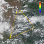
Larger image (new window) Download KMZ/KML File (right click, save as) |
Satellite Image from MODIS-Aqua/Terra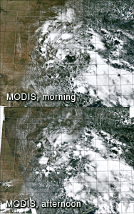
MODIS/Terra larger image (morning) (new window) MODIS/Aqua larger image (afternoon) (new window) |
Satellite Images from GOES-12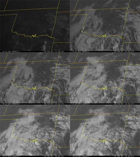 1132 - 1540 UTC |
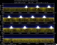
CAR - (QuickLook)
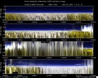
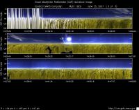
Imagery from CAR Instrument
Click browse image thumbnail to load more detailed version (images open in a new window)
| Flight Direction | Flight Direction |
|
|
|
|
|
|
Flight Mission Details
Overview:
This was the 11th flight and the last out of Ponca City. Preflight goals focused on measuring BRDF over the Southern Great Plain Central Facility (36.60°N, 97.48°W) -- CF under clear sky and measuring radiation in clouds en route from CF to Little Washita (35.04°N, 97.91°W) to Okmulgee Forest site-- FS (35.62°N, 96.06°W), and then back to Ponca City.
Good BRDF measurements with hazy conditions over the SGP Central Facility (CF), before clouds started to pop up. Made good measurements in clouds en route from CF to LW and from LW to FS.
J-31 Crew - David Thrasher (Pilot 1) & Scott Kaiser (Pilot 2).
Cabin Crew - Charles Gatebe (Flight scientist; GEST/GSFC) and Robert Billings (UC Santa Cruz/NASA Ames).
Flight Path, Timing, and Measurements
Timeline (UTC).
12:19 -- Engines on.
12:20 -- POS, Nose controller, and CAR instrument started normally.
12:25 -- CAR started recording data.
12:36 -- take off.
12:38 -- in a holding pattern en route to CF because of traffic at our vectoring altitude.
12:44 -- CAR computer frozen. [CAR had stopped working at 12:34 during takeoff - note take off has a 2 min offset].
12:46 -- CAR restarted and running again normally.
12:50 -- changed level from 4000’ msl to 1500’ msl.
12:52 -- orbited the CF for BRDF measurements at 600’ agl. The area looked quite hazy (below 1000’ agl).
12:55 -- camera out of memory.
12:57 -- small Cu clouds started to form below flight level.
13:01 -- no signs of Cu in the forward direction, only in the back scattering direction.
13:04 -- haze and little Cu reportely lifting up.
13:05 -- end of BRDF circles.
13:07 -- climbed to 2000’ agl.
13:10 -- orbited the CF for BRDF measurements at 2000’ agl.
13:11 -- more Cu clouds below flight level. Seemed to grow quite fast.
13:13 -- end of BRDF circles - discontinued due to increasing cloud amount.
13:26 -- en route to LW encountered scattered Cu below flight level.
13:29 -- increased cloudiness (Cu Humilis) reported.
13:32 -- overcast conditions reported at flight altitude of 4000’ msl; more clouds below aircraft.
13:35 -- above cloud deck; cloud bow and glory reported.
13:42 -- broken cloud reported approaching LW; 88.3 miles away.
13:46 -- almost completely overcast.
13:47 -- 3 minutes to LW.
13:50 -- over LW. Less cloud cover reported.
13:52 -- looked for an optically thick cloud for diffusion domain measurements.
13:54 -- in and out of clouds.
13:59 -- in and out of clouds.
14:03 -- climbed to 4000’ msl.
14:07 -- en route to FS.
14:08 -- 20 minutes to the FS.
14:10 -- completely overcast conditions en route to the FS .
14:13 -- in and out of cloud (2900’ - 4000’ agl). Aircraft speed reported at 160 knots.
14:20 -- broken cloud reported at 4000’ agl.
14:21 -- scattered clouds reported.
14:24 -- 6 minutes to the FS.
14:26 -- thin Ci reported.
14:27 -- 3 minutes to the FS.
14:29 -- Hazy outside.
14:31 -- over the FS. Ground reportedly flooded. Scattered clouds reported.
14:32 -- large forest reported. En route to Ponca City.
14:39 -- 15 minutes to Ponca City. Scattered Cu reported.
14:43 -- filter wheel showed large spikes.
14:45 -- more scattered Cu.
14:49 -- shutdown the CAR. CAR door can’t close automatically.
14:50 -- restarted the CAR to fix the door problem.
14:54 -- door closed - by somewhat “cheating” the software.
14:54 -- CAR shutdown.
14:55 -- touchdown.
15:03 -- Engines off.
