2014-07-08 (Flight #2037) |
Aircraft Flight SummaryDate: 2014-07-08 |
Flight Track Map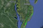
Larger image (new window) Download KMZ/KML File (right click, save as) |
Satellite Image from MODIS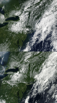
MODIS/Terra larger image (morning) (new window) MODIS/Aqua larger image (afternoon) (new window) |
Satellite Images from GOES-13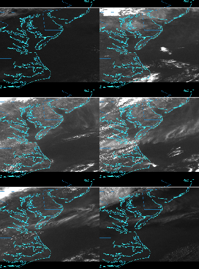 |
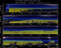
CAR - (QuickLook)
Imagery from CAR Instrument
Click browse image thumbnail to load more detailed version (images open in a new window)
| Flight Direction | Flight Direction |
|
|
|
|
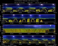
|
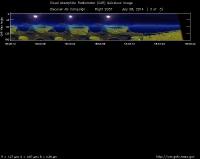
|
Flight Mission Details
This was P-3B Project Check Flight (PCF) out of Wallops Flight Facility, Virginia, USA. It was the first opportunity to test the instruments in flight before the transit to Colorado. Key instruments on P-3B include:
1. LARGE (Langley Aerosol Research GroupE): aerosols.
2. PDS (Project Data System): base meteorological and navigational measurements.
3. TD LIF: NO2, HNO3, PNs, ANs;
4. DLH (Diode Laser Hygrometer), H20.
5. DACOM (Differential Absorption CO Measurement): CO, CH4
6. DFGAS (Difference Frequency Generation Absorption Spectrometer): CH20
7. Chemiluminescence (NCAR 4-channel Chemiluminescence Instrument): O3, NO2, NO, NOy
8. PTR-MS (Proton-Transfer-Reaction Mass Spectrometer): non-methane hydrocarbons.
9. AVOCET (Atmospheric Vertical Observations of CO2 in the Earth's Troposphere): CO2.
10. CAR (Cloud Absorption Radiometer): scattered light and surface radiance that is reflected off of surfaces.
11. Fast Ethane Spectrometer: ethane, methane.
Flight Path, Timing, and Measurements
Approximate time in UTC (US east coast time - 4 hours). Activities during CAR flight 2037 on July 8, 2014 out of Wallops Flight Facility for test flights along the US East coast. Observations by CAR operator/PI, Charles Gatebe.
15:00 -- test all the sensors (CAR, CANS). In good working conditions.
16:20 -- CANS power on. Saved data. Aircraft door closed.
16:23 -- Aircraft engines power on.
16:33 -- delayed takeoff due to aircraft problems. Powered down the engines. Temp. 34°C
17:02 -- Engines power on again.
17:06 -- taxing.
17:08 -- CANS collecting data.
17:13 -- aircraft take off.
17:16 -- CAR instrument power on.
17:17 - CAR in the imaging mode.
17:18 -- active roll correction on.
17:19 -- filter wheel at 2.2 microns.
17:20 -- filter wheel still cooling down.
17:22 -- power draw/CAR - 1.55 amps.
17:24 -- filter wheel stable.
17:25 -- filter wheel in automatic mode.
17:26 -- power draw between 1.57 - 1.80 amps. Higher power draw during filter wheel transition.
17:29 -- filter wheel signal noise.
17:30 -- filter wheel reading - ve, followed by a spike in the data.
17:31 -- fans power on. Nav temp = 28°C.
17:35 -- Nav temp = 25.4°C.
17:37 -- all CAR channels working.
17:38 -- aircraft - straight and level.
17:41 -- filter wheel reading - ve. Nav temp= 21°C.
17:43 -- signal spike in the filter wheel.
17:44 -- CANS running well. But spike in the filter wheel/CAR.
17:46 -- Alt. 5575 m (above mean sea level).
17:48 -- aircraft attempt descent, but cancelled.
17:53 -- Nav temp. 15°C.
17:56 -- Alt. 5554 m.
17:59 -- aircraft circling at an altitude of 5570 m.
18:09 -- aircraft start descent.
18:05 -- roll angle about 20°.
18:07 -- cabin temp = 11.4°C, similar to Nav temp.
18:09 -- took some pictures during the spiral down. Alt. 3000m.
18:15 -- aircraft still spiraling down, aiming to go down to 600 m above ground.
18:18 -- Alt. 341 m.
18:19 -- aircraft circling at 304 m.
18:21 -- Roll angle = 36°.
18:23 -- pictures taken. Aircraft - straight and level. CAR/CANS working fine.
18:25 -- Jim Crawford inquires whether CAR is in the starboard imaging mode.
18:26 -- Filter wheel in automatic mode. Alt. = 307 m, straight and level.
18:32 -- pictures taken over a forest.
18:33 -- filter wheel channel unstable.
18:34 - coastline imaging. 470 nm channel saturating in the ocean glint.
18:37 -- filter wheel auto mode off. Spiralling up. Filter wheel - spike in the data.
18:38 -- Roll angle = 35°, during upward spiral.
18:45 -- cloudy (lots of mixed clouds).
18:47 -- took pictures.
18:54 -- Alt. 5594 m.
18:58 -- close CAR door in preparation for landing.
19:00 -- CAR power off.
19:01 -- CANS collecting data.
19:09 -- aircraft lands.
19:15 -- stop taxing
