2014-07-22 (Flight #2042) |
Aircraft Flight SummaryDate: 2014-07-22 |
Flight Track Map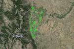
Larger image (new window) Download KMZ/KML File (right click, save as) |
Satellite Image from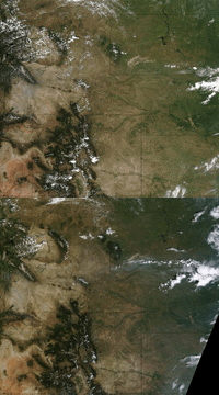
MODIS/Terra larger image (morning) (new window) MODIS/Aqua larger image (afternoon) (new window) |
Satellite Images from GOES-13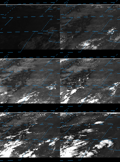 |
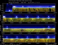
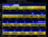
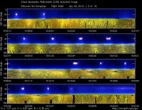
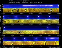
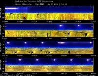
CAR - (QuickLook)
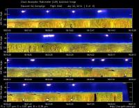
Imagery from CAR Instrument
Click browse image thumbnail to load more detailed version (images open in a new window)
| Flight Direction | Flight Direction |
|
|
|
|
|
|
|
|
|
Flight Mission Details
This was P-3B the fourth flight out of Bloomfield Municipal Airport, Colorado. The aircraft took measurements over the six D-AQ sites: Fort Collins/site-1, Platteville/site-2, Golden NREL/site-3, BAO Tower/site-4, Denver/La Casa/site-5, and Chatfield Park/site-6.
Key instruments on P-3B include:
1. LARGE (Langley Aerosol Research GroupE): aerosols.
2. PDS (Project Data System): base meteorological and navigational measurements.
3. TD LIF: NO2, HNO3, PNs, ANs;
4. DLH (Diode Laser Hygrometer), H20.
5. DACOM (Differential Absorption CO Measurement): CO, CH4
6. DFGAS (Difference Frequency Generation Absorption Spectrometer): CH20
7. Chemiluminescence (NCAR 4-channel Chemiluminescence Instrument): O3, NO2, NO, NOy
8. PTR-MS (Proton-Transfer-Reaction Mass Spectrometer): non-methane hydrocarbons.
9. AVOCET (Atmospheric Vertical Observations of CO2 in the Earth's Troposphere): CO2.
10. CAR (Cloud Absorption Radiometer): scattered light and surface radiance that is reflected off of surfaces.
11. Fast Ethane Spectrometer: ethane, methane.
Flight Path, Timing, and Measurements
Approximate time in UTC (Colorado, -6 hours). Activities during CAR flight 2042 on July 22, 2014 out of Bloomfield Municipal Airport. Observations by CAR operator/PI, Charles Gatebe, accompanied by Bryan James, CAR engineer.
12:55 -- preflight checks.
13:05 -- CAR powered on and running smoothly. Cryo-pump power on.
13:20 -- closing CAR door.
13:43 -- P-3B door closed in preparation for take off.
13:50 -- aircraft engines on.
13:57 -- all systems on, but CAR door closed.
14:00 -- CAR current draw, 0.5A.
14:00 -- cryo-pump power on.
14:02 -- filter wheel at 2.1 µm.
14:05 -- taxing.
14:06 -- filter wheel nice and cool.
14:08 -- very clear sky.
14:13 -- take off.
14:14 -- CAR door open.
14:15 -- CAR imaging in the starboard direction. All systems normal. Clear sky.
14:20 -- flying low, alt. 2035 m. Heading to Fort Collins.
14:24 -- missed approach at Fort Collins/at Christman Air Field.
14:25 -- spiral up at Fort Collins/site-1.
14:30 -- generally clear, but some puffy clouds towards the horizon seen in the principal plane.
14:34 -- Alt. 4619 m.
14:36 -- Alt. 5252 m. Clear sky. CAR in good shape.
14:38 -- Alt. 5589 m.
14:39 -- Alt. 5619 m; end of the spiral/Fort Collins.
14:42 -- 340 nm and 682 nm at 90° show some interesting relationship.
14:45 -- at Platteville/site-2, start of spiral down.
14:59 -- end of spiral. Generally clear sky, but small puffy cloud seen on one side of the spiral circle.
15:03 -- missed approach at Greeley/Weld County airport.
15:06 -- over a tower.
15:08 -- flying low, alt. 1822 m. Very clear sky.
15:10 -- over Platteville. Ozone: 33-40 ppb.
15:15 -- approaching Denver.
15:17 -- approaching Front Range (from Denver).
15:19 -- over Golden/site-3. Spiral up.
15:29 -- Alt. 5606 m. Pictures taken during spiral up.
15:31 -- end of spiral at Golden.
15:34 -- over BAO tower/site-4. Clear sky.
15:35 -- spiral down over the tower.
15:44 -- very clear sky.
15:47 -- Ozone - 53 ppb, NO2 very low.
15:49 -- NO2 > 10 ppb, aerosols increasing.
15:49 -- end of spiral.
15:50 -- missed approach at Parkland airport.
15:56 -- spiral up at Denver LaCasa/site-5.
15:57 -- almost clear sky.
16:03 -- generally very clear, small cloud pops, and hazy. Took some pictures.
16:06 -- Alt. 4953 m. Nav temp, 23°C.
16:07 -- dark current noise appear.
16:10 -- Alt. 5581 m. End of spiral.
16:12 -- suspect cyopump problem.
16:15 -- descent over Chatfield/site-6.
16:17 -- filter wheel still unstable.
16:18 -- very clear sky.
16:21 -- few cloud pops, but looks insignificant in the signal.
16:22 -- cyopump power off for a minute.
16:24 -- cryopump powered on. Will leave it on until the end of the flight.
16:27 -- heading towards Golden for balloon launch. Alt. 2056 m.
16:29 -- cyopump seems to be working fine. Alt. 2065 m
16:31 -- filter wheel channels sometime a little noisy, but tied to cyopump problems.
16:32 -- over wind mill. Clear sky, but a few Cu noted.
16:36 -- flying low. Alt. 1980 m.
16:37 -- headed toward Fort Collins.
16:43 -- over Fort Collins/site-1. Spiral up. Ozone: 53 ppb.
16:45 -- filter wheel channels look ok.
16:51 -- generally clear sky, but a few puffy clouds starting to develop.
16:52 -- cloud scatter peak at 80°.
16:53 -- haze layer towards the horizon.
16:54 -- Alt. 5229 m.
16:56 -- Alt. 5576 m. Almost above the haze layer. End of spiral at Fort Collins.
17:02 -- Alt. 5622 m.
17:03 -- At Platteville/site-2. Start spiral down.
17:06 -- all systems normal. Very clear sky, but some isolated cloud pops.
17:12 -- clear sky.
17:13 -- dark current noise observed. Alt. 2286 m.
17;16 -- end of spiral. Filter wheel channel unstable.
17:18 -- filter wheel still unstable.
17:20 -- missed approach at Greeley/Weld County airport.
17:21 -- end of missed approach.
17:24 -- low level run/gradient. Alt. 1728 m.
17:35 -- reset the cryopump.
17:26 -- big NO2 spike.
17:28 -- scattered Cu. Filter wheel channel noisy.
17:29 -- Filter wheel becoming stable. Alt. 1809 m.
17:31 -- Filter wheel channel stable.
17:34 -- heading towards Denver.
17:35 -- scattered Cu starting to form.
17:36 -- at Golden/site-3. Spiral up; Cu developing.
17:48 -- clouds mostly on one side. Filter wheel very stable.
17:49 -- Alt. 5624 m. End of spiral. Very low gas concentration reported. Aerosols reported to be high.
17:50 -- heading towards BAO tower. Alt. 5619 m. Clear sky, but clouds starting to form.
17:53 -- aerosols decrease reported. Alt. 5594 m.
15:54 -- circling at one altitude because of air traffic. Spiral delayed by 8 minutes. Alt. 5608 m.
18:10 -- slow descent as commanded by Air Traffic Controller. Alt. 2534 m.
18:11 -- continuing with descent.
18:12 -- scattered Cu. End of spiral.
18:13 -- missed approach at Parkland airport.
18:14 -- heading towards Denverat low level, Alt. 1900 m.
18:17 -- scattered Cu, increasing as we head towards Denver. Ozone 73 ppb reported.
18:20 -- Over Denver LaCasa/site-5. Spiral up.
18:24 -- generally clear sky, but some high Cu on one side of the spiral.
18:31 -- Alt. 5609 m. End of spiral. Heading towards Chatfield Park. High level scattered Cu, but generally clear.
18:39 -- Bryan James takes pictures.
18:42 -- scattered clouds over the Front Range.
18:46 -- Ozone: 86 ppb reported.
18:47 -- end of spiral.
18:49 -- heading toward Golden for balloon launch.
18:52 -- CAR parked in preparation for landing.
18:53 -- pilot reports that CAR was not properly parked, but reading from the CAR show it was parked properly.
18:59 -- landing.
19:01 -- stop taxing.
