2014-07-28 (Flight #2047) |
Aircraft Flight SummaryDate: 2014-07-28 |
Flight Track Map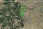
Larger image (new window) Download KMZ/KML File (right click, save as) |
Satellite Image from MODIS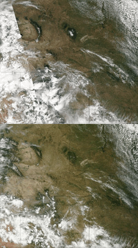
MODIS/Terra larger image (morning) (new window) MODIS/Aqua larger image (afternoon) (new window) |
Satellite Images from GOES-13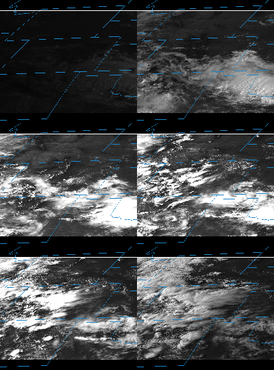 |
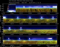
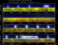
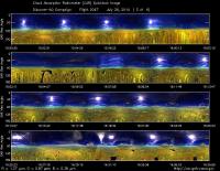
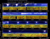
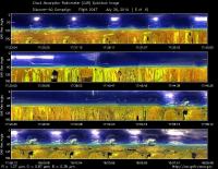
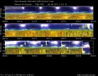
CAR - (QuickLook)
Imagery from CAR Instrument
Click browse image thumbnail to load more detailed version (images open in a new window)
| Flight Direction | Flight Direction |
|
|
|
|
|
|
|
|
|
Flight Mission Details
This was P-3B ninth flight out of Bloomfield Municipal Airport, Colorado. The aircraft took measurements over the six D-AQ sites: Fort Collins/site-1, Platteville/site-2, Golden NREL/site-3, BAO Tower/site-4, Denver/La Casa/site-5, and Chatfield Park/site-6.
Key instruments on P-3B include:
1. LARGE (Langley Aerosol Research GroupE): aerosols.
2. PDS (Project Data System): base meteorological and navigational measurements.
3. TD LIF: NO2, HNO3, PNs, ANs;
4. DLH (Diode Laser Hygrometer), H20.
5. DACOM (Differential Absorption CO Measurement): CO, CH4
6. DFGAS (Difference Frequency Generation Absorption Spectrometer): CH20
7. Chemiluminescence (NCAR 4-channel Chemiluminescence Instrument): O3, NO2, NO, NOy
8. PTR-MS (Proton-Transfer-Reaction Mass Spectrometer): non-methane hydrocarbons.
9. AVOCET (Atmospheric Vertical Observations of CO2 in the Earth's Troposphere): CO2.
10. CAR (Cloud Absorption Radiometer): scattered light and surface radiance that is reflected off of surfaces.
11. Fast Ethane Spectrometer: ethane, methane
Flight Path, Timing, and Measurements
Approximate time in UTC (Colorado, -6 hours). Activities during CAR flight 2047 on July 28, 2014 out of Bloomfield Municipal Airport. Observations by CAR PI, Charles Gatebe, CAR operator.
13:00 -- preflight checks.
13:23 -- CAR door stuck while closing. Performed a manual assist. Could be a friction issue.
13:34 -- CAR/CANS turned on.
13:36 -- cryopump powered.
13:41 -- aircraft engines on.
13:45 -- power shift (from ground power generator to aircraft APU).
14:05 -- Ch 9 noise. Looks like a sine wave. Delay in taxing because of reported instrument problem (not CAR) during power transfer.
14:11 -- start taxing.
14:17 -- take off.
14:19 -- CAR door fully open.
14:20 -- CAR imaging in the starboard.
14:22 -- thin Ci.
14:24 -- Ch 9/2.1 µm.
14:27 -- 3 minutes away from Fort Collins.
14:29 -- missed approach at Fort Collins/Christman Air Field.
14:34 -- pictures taken over Fort Collins. Thin Ci, not as bad as expected.
14:35 -- Ozone jumped from 40 to 60 ppb during spiral up.
14:41 -- thin Ci signal seen at 70-80 deg zenith. Sun at 60 deg. zenith.
14:40 -- Altitude, 5545m. Out of the ? layer.
14:46 -- end of spiral up at Fort Collins.
14:50 -- heading toward Platteville/site-2. Thin Ci noted. Partly cloudy. Alt. 5591 m.
14:53 -- smoke plume layer, clearly observable in the forward camera. Ozone, 82 ppb.
14:54 -- descent over Platteville. Thin Ci.
14:59 -- halted spirals alt. 4620 m. Ozone, 60 ppb.
15:03 -- spiral down resume, but at a different location, close to Greeley.
15:05 -- reflectance peak at 40 deg from clouds.
15:11 -- high trace gas concentration reported.
15:13 -- missed approach at Greeley/Weld County airport.
15:16 -- thin Ci fanning out in thin 'cloud streets." Wide variability in aerosols reported.
15:18 -- heading towards Golden via Platteville. Alt. 1820 m.
15:21 -- increase in trace gases and aerosols during the transit. Alt. 1798m. A layer noticeable in the forward camera.
15:23 -- more clouds.
15:26 -- Denver LaCasa -- seems to be in a layer. Widespread Ci.
15:29 -- spiral up at Golden/site-3.
15:31 -- very cloudy. Ozone increase from 40 to 65 ppb during the spiral.
15:35 -- widespread Ci including contrail. Pictures taken.
15:41 -- layer at 5526 m.
15:42 -- end of spiral over Golden.
15:44 -- heading towards BAO tower/site-4.
15:47 -- spiral down at the BAO tower.
15:54 -- widespread Ci and developing Cu.
15:55 -- strong signal in the red channel/band 4 over some places.
15:57 -- end of spiral down over the BAO tower. Alt. 1930 m.
15:58 -- missed approached at Parkland airport.
16:03 -- heading toward Denver LaCasa/site 5. Alt. 1854 m. Widespread clouds.
16:07 -- LaCasa spiral up setup.
16:09 -- spiral up begins.
16:16 -- back to the seat. Observed clouds over LaCasa/widespread. Condensation mirror reading > 300%.
16:22 -- Alt. 5460 m. Layer observable in the forward camera. Trace gas increase noted (e.g. ozone, FRH = 1, scattering 35).
16:24 -- end of spiral. Roll , -45 deg to head back to LaCasa as directed by ATC.
16:27 -- heading towards Chatfield. Alt. 5595 m. Clouds widespread.
16:31 -- descent over Chatfield/site-6. Partly cloudy. Ci dominated. Pictures taken.
16:46 -- heading towards Golden at low level, alt. 2123 m.
16:47 -- Ozone about 50 ppb. CO, 160 ppb.
16:50 -- Condensation reading/CAR mirror - 478%.
16:51 -- headed toward Fort Collins. Alt. 2149 m.
16:56 -- Ozone, 46 ppb, same as in the morning.
16:59 -- missed approach at at Fort Collins/Christman Air Field.
17:01 -- spiral up at Fort Collins. Widespread Ci, cumulus forming over the mountain.
17:11 -- pollution layer, alt. 4650 m.
17:16 -- end of spiral at Fort Collins. Alt. 5592 m. Water vapor gradient reported during the ascent from low to high.
17:19 -- Condensation reading/CAR mirror - 46%.
17:21 -- spiral down over Platteville. High concentration of black carbon, CO, etc. Widespread Ci, cumulus forming over the mountain. Alt. 4500m. In a pollution layer.
17:24 -- layer seen. Ozone increases to more than 60 ppb/northern side.
17:29 -- Water vapor, ozone decrease noted.
17:31 -- Alt. 2235 m. Water vapor, ozone increase noted.
17:32 -- gas flare.
17:34 -- end of spiral over Platteville.
17:37 -- over a reservoir.
17:39 -- missed approach at Greeley/Weld County airport.
17:42 -- low level leg toward Golden via Platteville. Alt. 1720m.
17:49 -- level leg, alt. 1866 m, more widespread clouds.
17:52 -- over Denver LaCasa heading towards Golden. Ozone > 60ppb.
17:54 -- widespread clouds/Cbs. Spiral up at Golden starts. Ozone > 70 ppb.
17:59 -- widespread clouds.
18:08 -- end of spiral. Heading towards the BAO tower. Ch9/1.6 µm. Alt. 5584m. Ozone, 21 ppb.
18:12 -- Ch9 noisy/spikes. Appears to be a dark current problem.
18:14 -- spiral down at BAO tower.
18:23 -- dark current noise changing with filter wheel position.
18:24 -- maneuvering for missed approach at Parkland airport.
18:29 -- strong signal in the red channel over some places. Investigate; could be interesting.
18:33 -- spiral up at LaCasa. Very cloudy.
18:45 -- parked the CAR in preparation for landing due to worsening weather conditions/ thunderstorms.
18:47 --landed.
18:51 -- stop taxing.
18:53 -- engines power off.
