2014-08-08 (Flight #2058) |
Aircraft Flight SummaryDate: 2014-08-08 |
Flight Track Map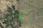
Larger image (new window) |
Satellite Image from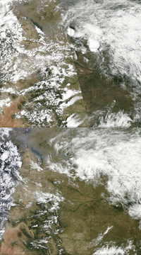
MODIS/Terra larger image (morning) (new window) MODIS/Aqua larger image (afternoon) (new window) |
Satellite Images from GOES-13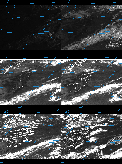 |
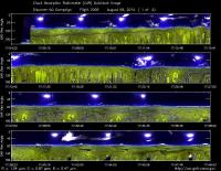
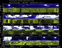
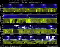
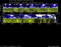
CAR - (QuickLook)
Imagery from CAR Instrument
Click browse image thumbnail to load more detailed version (images open in a new window)
| Flight Direction | Flight Direction |
|
|
|
|
|
|
|
Flight Mission Details
This was P-3B nineteenth flight out of Bloomfield Municipal Airport, Colorado. The aircraft took measurements over the six D-AQ sites: Fort Collins/site-1, Platteville/site-2, Golden NREL/site-3, BAO Tower/site-4, Denver/La Casa/site-5, and Chatfield Park/site-6.
Key instruments on P-3B include:
1. LARGE (Langley Aerosol Research GroupE): aerosols.
2. PDS (Project Data System): base meteorological and navigational measurements.
3. TD LIF: NO2, HNO3, PNs, ANs;
4. DLH (Diode Laser Hygrometer), H20.
5. DACOM (Differential Absorption CO Measurement): CO, CH4
6. DFGAS (Difference Frequency Generation Absorption Spectrometer): CH20
7. Chemiluminescence (NCAR 4-channel Chemiluminescence Instrument): O3, NO2, NO, NOy
8. PTR-MS (Proton-Transfer-Reaction Mass Spectrometer): non-methane hydrocarbons.
9. AVOCET (Atmospheric Vertical Observations of CO2 in the Earth's Troposphere): CO2.
10. CAR (Cloud Absorption Radiometer): scattered light and surface radiance that is reflected off of surfaces.
11. Fast Ethane Spectrometer: ethane, methane.
Flight Path, Timing, and Measurements
Approximate time in UTC (Colorado, -6 hours). Activities during CAR flight 2058 on August 18, 2014 out of Bloomfield Municipal Airport. Observations by CAR operator/PI, Charles Gatebe.
13:35 -- Preflight checks by Bryan James and Rajesh Poudyal. System ok.
13:45 -- CANS system recording data.
14:15 -- Rajesh and Bryan leave aircraft.
14:25 -- aircraft door closed.
14:32 -- aircraft engines power on.
14:36 -- CAR power on.
14:37 -- taxiing.
14:40 -- Filter wheel channel at 2.1 µm.
14:42 -- Cryopump on. Current draw 1.89 A. Changed from 0.62 A before power to cryopump.
14:44 -- very clear sky.
14:45 -- take off.
14:46 -- CAR door opening.
14:47 -- CAR door fully open. CAR in science mode.
14:50 -- clear sky with few scattered cumulus clouds.
14:51 -- Nav temp. = 22°C. Alt. = 5280 m.
14:54 -- a little hazy as seen through the forward camera.
14:56 -- east of Fort Collins. Alt. = 3289 m. Aircraft turning towards northeast - heading to the aircraft inter-comparison site with the NCAR C-130.
15:01 -- took some pictures. Clear sky with isolated clouds. Alt. 3870 m. P-3 climbing slowly to 15000 feet (4572 m).
15:05 -- scattering going up. Alt. = 4850 m. FRH : 1.5-1.6. Current draw = 1.78 A.
15:07 -- Alt. 4881 m.
15:09 -- CAR in the downward scanning mode.
15:10 -- Filter wheel channels noisy.
15:12 -- cryopump off.
15:13 -- cryopump on again.
15:14 -- cloud increase.
15:15 -- Filter wheel channels stabilizing
15:20 -- Over US 26 - Nebraska. Alt. 5152 m (16500 feet). Waiting for C-130.
15:22-- Filter wheel channel stable.
15:24 -- wispy clouds. P-3 doing anti clockwise loop. Nice cloud. Very isotropic.
15:25 -- Nav temp = 11 deg. Very nice structured cloud.
15:30 -- C-130 arrives.
15:35 -- pictures of C-130 during the inter comparison. Very clear sky. Alt. 4921 m.
15:40 -- inter-comparison in progress. Haze layer seen through the forward camera.
15:43 -- thin cirrus (isolated) - about 60° from zenith.
15:45 -- Correlation between CO2 and H20 observed.
15:49 -- end of the inter comparison. Sky very clear.
15:50 -- descend to 1000 ft. Gliding down.
15:53 -- very clear sky. Nav temp. = 9.8°C. Alt.= 3613 m.
16:00 -- at the lowest level. Alt. = 2134 m.
16:03 -- inter-comparison at the low level starts. Generally clear sky, cloud band seen on the horizon.
16:05 -- windmills below. Alt. 2256 m.
16:10 -- pictures of C-130. Heading towards Colorado Springs.
16:13 -- Filter wheel OK. Nav temp = 18°C.
16:18 -- end of the inter comparisons. Took nice pictures during the separation. Clear sky. Cloud bands towards the horizon.
16:22 -- Ch6 looks very uniform.
16:25 -- Nav temp. 22°C.
16:27 -- red soil makes channel 4 to increase dramatically more than the other channels.
16:30 -- Filter wheel channels very stable.
16:34 -- very clear sky.
16:41 -- scattered Cu over Chatfield. Alt. 1984m.
16:43 -- Hatfield lake. Nav temp. 25°C. Heading towards Golden.
16:45 -- scattered Cu above the plane.
16:46 -- spiral up at Golden. Scattered Cu. F(R/H) = 1.2.
16:49 -- roll data has some issues.
16:52 -- roll data problem. Pitch values look awkward.
16:58 -- end of spiral up.
17:00 -- restarted CANS system and CAR.
17:05 -- CAR in the science mode. Filter wheel turned on.
17:07 -- cryopump turned on.
17:08 -- Filter wheel channels cooling down as expected. Ch = 2.1 µm. Scattered clouds.
17:13 -- spiral down at the BAO tower.
17:14 -- end of spiral down. Alt. 1900 m.
17:16 -- missed approach at Parkland airport. Lowest alt. - 1589 m.
17:18 -- heading toward La Casa.
17:24 -- spiral up over La Casa. Scattered clouds.
17:30 -- scattered Cu over La Casa. Looks hazy.
17:34 -- Haze layer. Alt. = 5100 m.
17:35 -- end of spiral up at La Casa. Heading toward Chatfield.
17:37 -- clouds (Cb) - increasing, but scattered.
17:41 -- start spiral down over Chatfield. Scattered clouds.
17:43 -- Haze layer. Alt. = 4603 m. Scattered clouds.
17:47 -- Cb developing over the mountain.
17:53 -- end of spiral down. Heading to Golden.
17:54 -- clouds increasing. Balloon launch at Golden seen at 1000 ft (304 m).
17:58 -- heading towards Fort Collins. Scattered Cu.
18:04 -- bright clouds. Saturating the detector/472 nm. NH3 spike reported.
18:08 -- broken clouds above.
18:10 -- missed approach at Christman Air Field, Fort Collins. Lowest alt. = 1586 m. Start of spiral up. Broken clouds, low and high level clouds.
18:17 -- thick cloud above.
18:21 -- below cloud base. Radiance field show some structure. Alt. = 5412 m.
18:23 -- end of spiral; below cloud base. Radiation very isotropic. Alt. 4821m.
18:25 -- heading towards Platteville. Scattered clouds.
18:30 -- spiral down over Platteville. Alt. 5108 m. See a clear haze layer. Spotty wispy clouds.
18:35 -- pictures showing the wispy clouds/haze and cloud decks over the mountain range taken.
18:39 -- oil and gas spike. Alt. = 2611 m. Aerosol spikes reported.
18:45 -- final loop. Alt. = 1821 m over Platteville.
18:46 -- heading toward Greely.
18:47 -- Ozone = 72 pp. reported. Agricultural farms. Interesting to look at NDVI over this area.
18:51 -- missed approach at at Weld County airport, Greeley. Lowest alt. =1424 m. Scattered Cu.
18:53 -- headback to Platteville. Alt. 1741 m. Ozone = 80 ppb reported.
18:57 -- over Platteville. Heading toward Denver.
18:59 -- clouds in the zenith.
19:00 -- more scattered clouds.
19:02 -- Nav temp = 26.5°C.
19:06 -- spiral up over Golden. Broken clouds. F (R/H)=1.3.
19:11 -- rainy clouds over the mountain. Might be impacted by the rain. Alt. = 3998 m. Pollution layer.
19:16 -- on the edge of a cloud.
19:17 -- end of spiral. Going to BAO tower.
19:19 -- cloud base, Alt. = 5332 m.
19:22 -- spiral down over the BAO tower. Broken clouds. Pollution layer. Alt. = 5020 m.
19:26 -- took pictures showing clouds over BAO including cloud shadows.
19:29 -- bumpy. Alt. = 3000m - entering the boundary layer.
19:34 -- spiral down. Alt. = 1814 m. Took pictures of BAO tower. Alt. = 1618 m.
19:35 -- missed approach at Parkland airport. Lowest alt.= 1618 m.
19:38 -- heading towards Denver. Alt. = 1890 m. Cloud deck above.
19:42 -- CAR parked in preparation for landing. Door closed.
19:43 -- CAR power off.
19:47 -- Landed.
19:53 -- stop taxiing.
19:54 -- aircraft engines off.
19:55 -- CANS off.
