2011-08-19 (Flight #2024) |
Aircraft Flight SummaryDate: 2011-08-19 |
Flight Track Map
Larger image (new window) Download KMZ/KML File (right click, save as) |
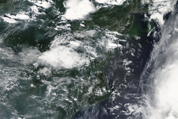
Satellite Image from MODIS
|
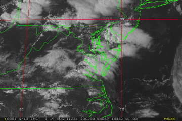
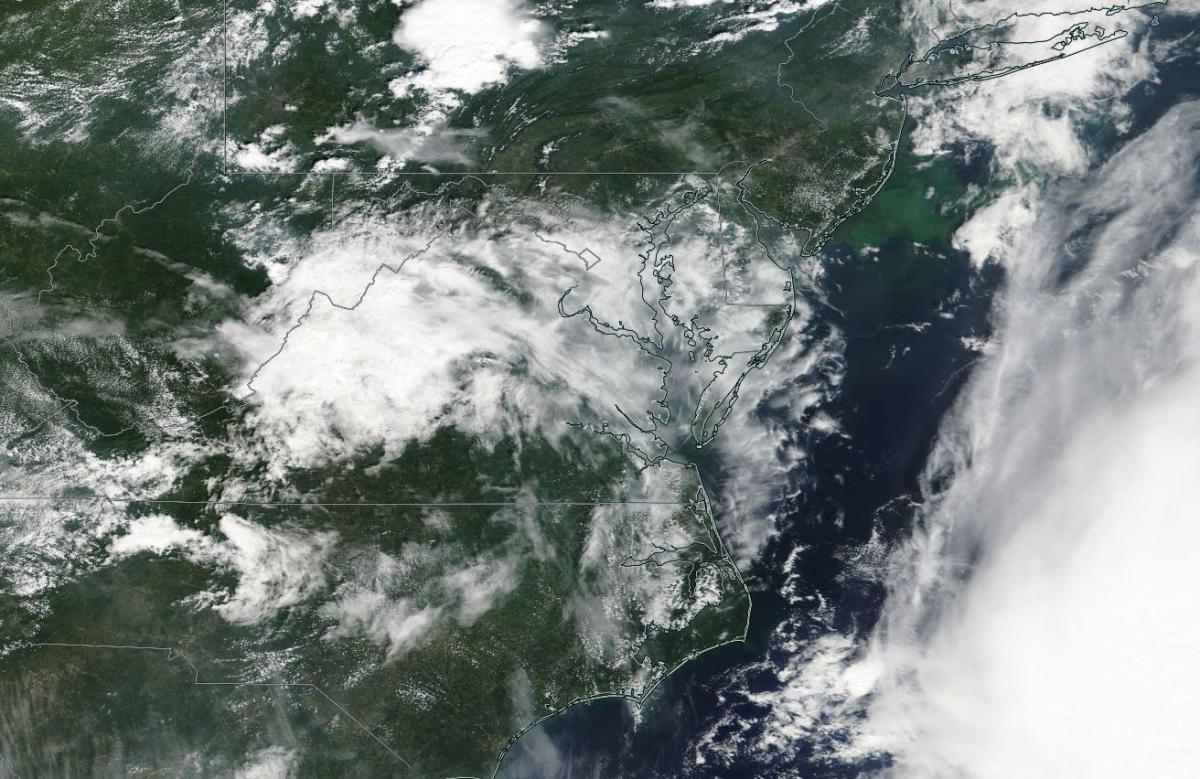
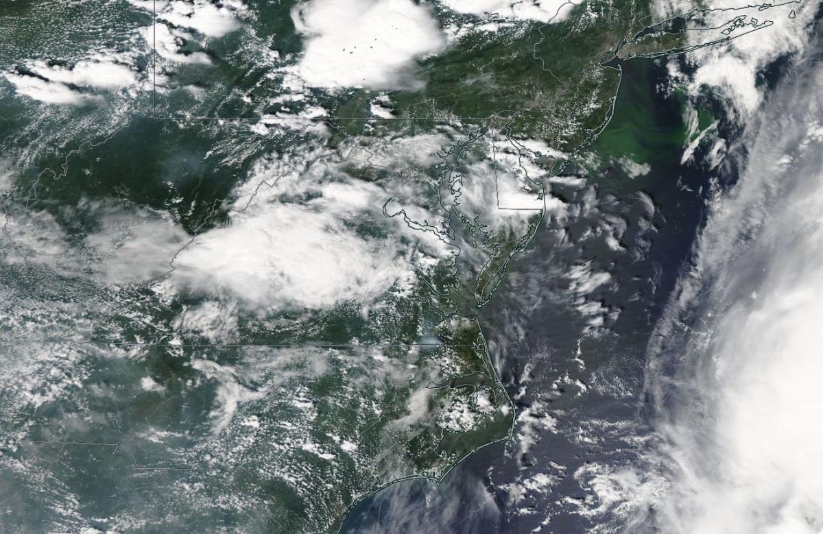
Satellite Images from GOES-13
|
CAR - (QuickLook)
Imagery from CAR Instrument
Click browse image thumbnail to load more detailed version (images open in a new window)
| Flight Direction | Flight Direction |
 |
 |
Flight Mission Details
Overview:
This was the first flight operating from Wallops Flight Facility (WFF). This was a PCF (project check flight) to check the performance of all the instruments: P-3B Instrument Payload:
CAR - Cloud Absorption Radiometer measured angular distribution of scattered radiation and acquired BRDF measurements over SERC site near Wallops Flight Facility. Fully operational the entire flight.
SIMPL: no instrument report, but was fully operational.
SIMPL is an innovative dual-wavelength, polarimetric, photon counting lidar that provides high-resolution information on the physical properties of terrestrial surfaces based on their light scattering signatures.
PDS Project Data System (PDS). No instrument report. Fully operational. Acquired base meteorological and navigational measurements.
DBSAR - No instrument report. Fully operational.
DBSAR: Digital Beamforming SAR (PI Rafael Rincon). DBSAR is a new generation airborne L- Band radar system that provides two- and three-dimensional fine-scale measurements of biomass.
Flight Path, Timing, and Measurements
Approximate time in UTC (US east coast time - 4 hours). Activities during CAR flight 2024 on August 19, 2011 out of Wallops Flight Facility (WFF), Virginia. Observations by CAR operator/PI, Charles Gatebe.
21:30 - CANS power on.
21:47 - taxing.
21:53 - take off.
22:00 - CAR power on.
22:01 - CAR door open. CAR will operate in the upward scanning mode.
22:23 - filter wheel at 2.1 µm.
22:24 - coastline. DBSAR flight lines. A little bumpy. Alt. 3035 m.
22:28 - Nav temp 19 degC. (seems high given P-3 alt: 3042 m).
22:33 - pictures taken. DBSAR flight lines.
22:34 - went through some clouds.
22:36 - inside a cloud.
22:37 - broken clouds.
22:40 - overcast sky.
22:42 - multilayer cloud above. Horizon looks reddish.
22:45 - bumpy.
22:49 - almost overcast. Sunlight breaking through in some cases.
22:50 - DBSAR reporting data problems. SIMPL to start collecting data.
22:53 - descent to 1500 m for SIMPL lines.
22:55 - SIMPL lines. Heading 030 (reported by pilot).
22:58 - broken clouds. Nice blue sky.
23:01 - anticlockwise turn at 14 deg.
23:03 - Alt. 1583 m. Scattered Cu below P-3.
23:04 - sunlight breaking through clouds.
23:07 - SIMPL lines. Scattered clouds above.
23:09 - SIMPL off; reported some problems. Groundspeed 250 knots.
23:11 - Groundspeed 175 knots. P-3 in a circle, bank angle 14 deg.
23:12 - over ocean. Scattered clouds.
23:14 - SIMPL on.
23:26 - over WFF. SIMPL on.
23:29 - climbing to a higher altitude.
23:30 - Alt. 2500 m. DBSAR lines begin.
23:33 - filter wheel at 1.6 µm.
23:34 - roll angle problems. Filter wheel at 1.6 µm.
23:35 - filter wheel at 1.7 µm.
23:36 - some light clouds. Filter wheel at 2.1 µm.
23:37 - filter wheel at 2.2 µm. Scattered clouds. Changed filter wheel to 2.3 µm.
23:39 - CAR door close command not working.
23:42 - CAR instrument power off.
00:00 - CAR powered on. Tried to close the door again, but failed.
00:05 - preparing for landing. CANS ok.
00:07 - landed.
00:12 - complete stop. Engines off.
00:13 - CANS power off.