2011-08-22 (Flight #2025) |
Aircraft Flight SummaryDate: 2011-08-22 |
Flight Track Map
Larger image (new window) Download KMZ/KML File (right click, save as) |
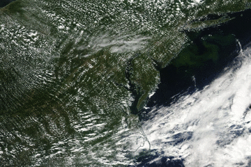
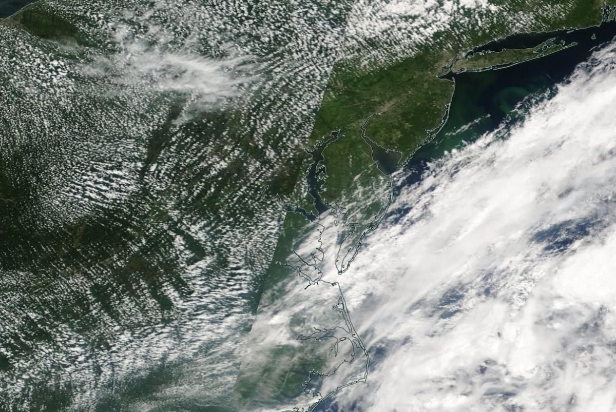
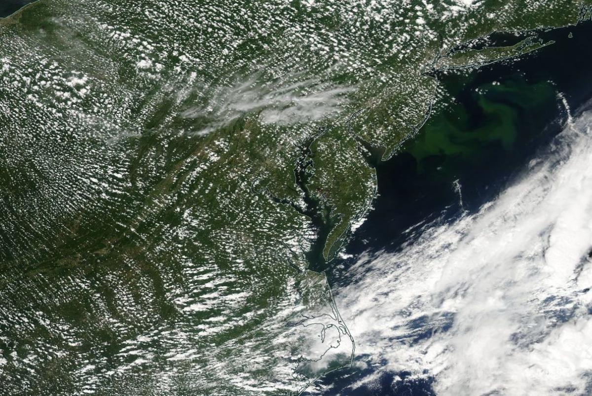
Satellite Image from MODIS
|
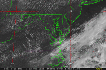
Satellite Images from GOES-13
|
CAR - (QuickLook)
Imagery from CAR Instrument
Click browse image thumbnail to load more detailed version (images open in a new window)
| Flight Direction | Flight Direction |
 |
 |
 |
 |
Flight Mission Details
Overview:
This was the second flight operating from Wallops Flight Facility (WFF). Science goals include:
1. CAR BRDF
2. SIMPL/DBASR lines over WFF.
P-3B Instrument Payload:
CAR - Cloud Absorption Radiometer measured angular distribution of scattered radiation and acquired BRDF measurements over SERC site near Wallops Flight Facility. Fully operational the entire flight.
SIMPL: no instrument report, but was fully operational.
SIMPL is an innovative dual-wavelength, polarimetric, photon counting lidar that provides high-resolution information on the physical properties of terrestrial surfaces based on their light scattering signatures.
PDS Project Data System (PDS). No instrument report. Fully operational. Acquired base meteorological and navigational measurements.
DBSAR - No instrument report. Fully operational.
DBSAR: Digital Beamforming SAR (PI Rafael Rincon). DBSAR is a new generation airborne L- Band radar system that provides two- and three-dimensional fine-scale measurements of biomass.
Flight Path, Timing, and Measurements
Approximate time in UTC (US east coast time - 4 hours). Activities during CAR flight 2025 on August 22, 2011 out of Wallops Flight Facility (WFF), Virginia. Observations by CAR operator/PI, Charles Gatebe.
16:29 - CANS power on.
16:43 - CAR power on.
16:45 - CAR door open.
16:56 - Ch 3 (0.47 µm) saturated looking at the sun.
16:58 - filter wheel power on.
16:59 - power draw is 1.50 amps.
17:03 - filter wheel channels stable.
17:13 - power draw 1.51 amps.
17:20 - still on the ground. Had requested more time.
17:23 - engines on.
17:28 - taxing. CAR running. Power draw 1.52 amps.
17:30 - cloudy.
17:32 - take off.
17:34 - CAR in the starboard mode.
17:36 - bumpy.
17:37 - active roll on.
17:39 - ascent.
17:40 - inversion/boundary layer (2000 m).
17:43 - unknown city.
17:47 - inside a cloud.
17:48 - FMS system engaged.
17:50 - cloud below.
17:51 - power draw 1.51 amps.
17:53 - bright cloud below.
17:58 - start BRDF.
18:03 - second circle.
18:06 - end of BRDF circles at upper level (2000 m).
18:10 - BRDF at 300 m.
18:12 - multilayer cloud, end of first circle.
18:14 - end of second circle.
18:15 - scattered clouds above.
18:16 - end of third circle. Going to a higher level.
18:18 - inside a cloud.
18:20 - downward imaging mode.
18:23 - scattered Cu. Alt. 5400 m. Ci above P-3.
18:28 - very clear sky above P-3, but scattered Cu below.
18:30 - SIMPL lines.
18:32 - skimmed top of a cloud.
18:35 - cloud above. Alt. 1434 m. Coastline.
18:40 - coastline. SIMPL lines.
18:41 - glint at near nadir.
18:42 - roll/altitude maneuvers.
18:47 - over WFF.
18:50 - power draw 1.43 amps.
18:51 - clouds clearing over WFF.
18:53 - over water; scattered clouds. Alt. 1433 m.
18:55 - clouds above.
18:57 - lots of clouds; hazy below. Alt. 1411 m.
18:59 - changing altitude. Clouds at 2200 m; leaving the boundary layer.
19:02 - over water; scattered Cu. Alt. 3600 m.
19:04 - scattered Cu (very bright).
19:06 - coastline.
19:10 - DBSAR lines. Alt. 5500 m.
19:19 - glint region.
19:24 - DBSAR lines.
19:30 - heading back to WFF.
19:32 - CAR power off.
19:37 - landed.
19:42 - end of taxing. engines off.
19:43 - CANS power off.