2011-08-25 (Flight #2027) |
Aircraft Flight SummaryDate: 2011-08-25 |
Flight Track Map
Larger image (new window) Download KMZ/KML File (right click, save as) |
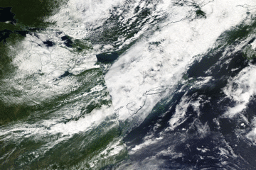
Satellite Image from MODIS
|
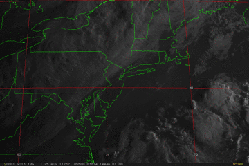
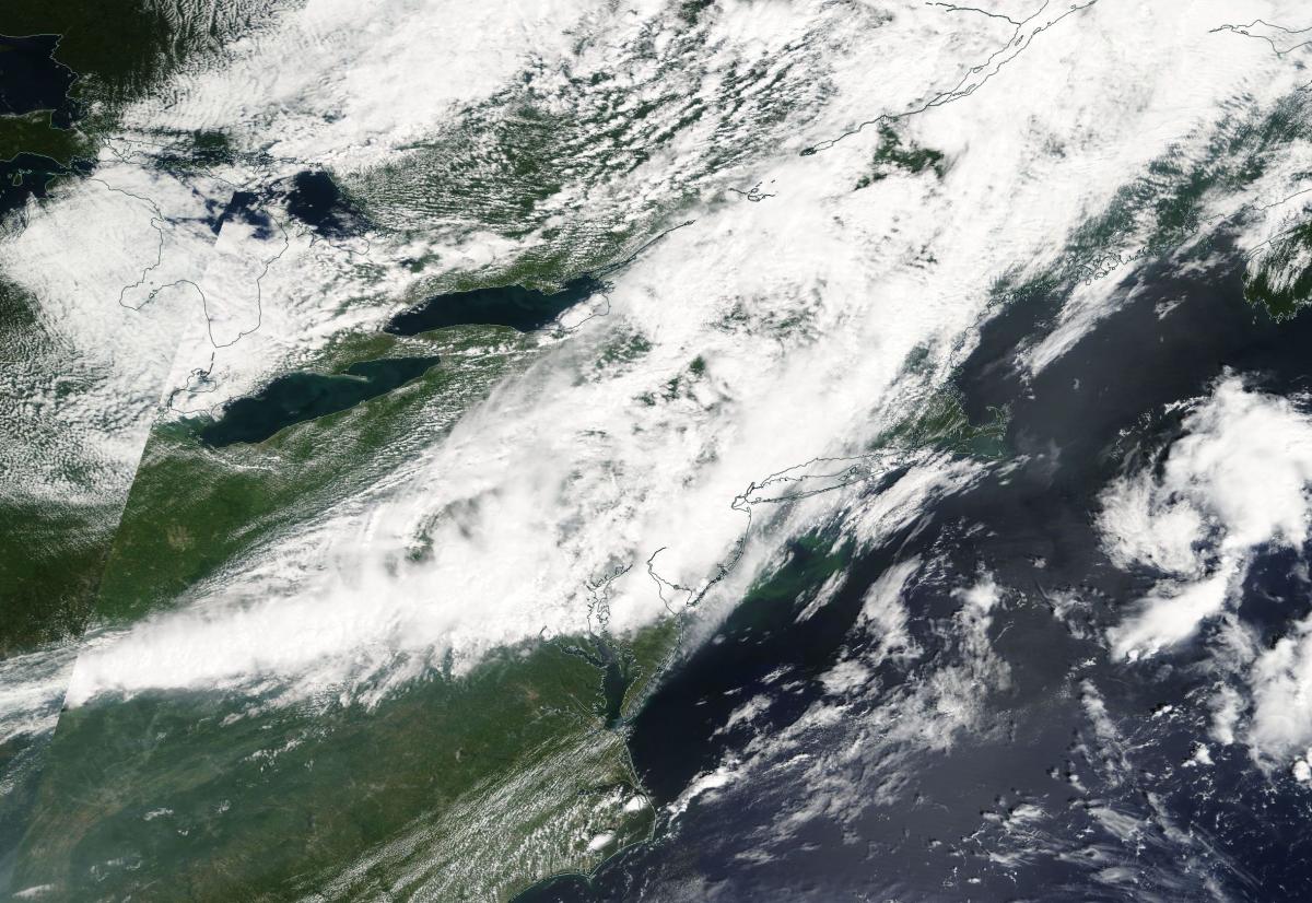
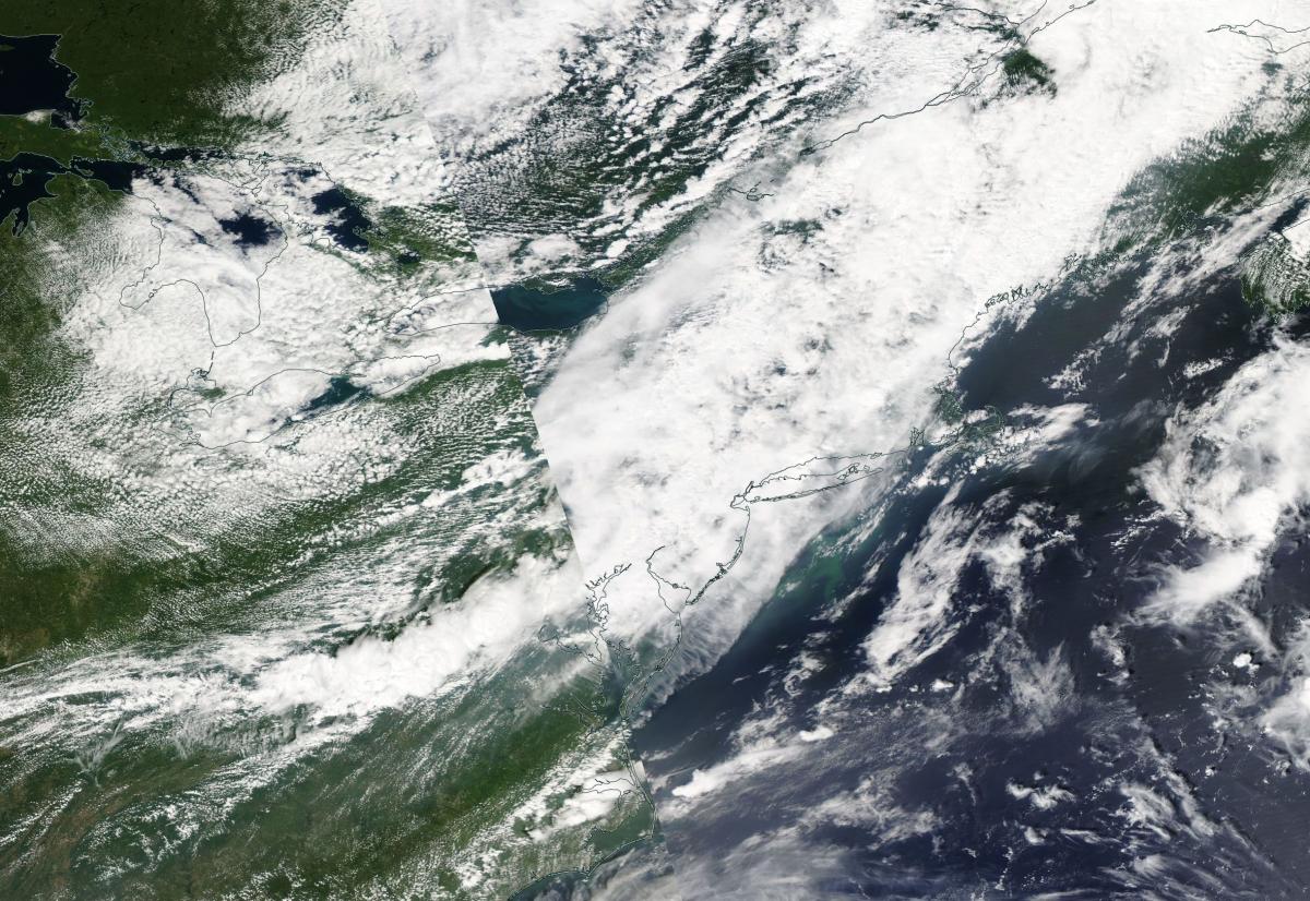
Satellite Images from GOES-13
|
CAR - (QuickLook)
Imagery from CAR Instrument
Click browse image thumbnail to load more detailed version (images open in a new window)
| Flight Direction | Flight Direction |
 |
 |
 |
 |
 |
 |
 |
Flight Mission Details
Overview:
This was the fourth flight starting from Wallops Flight Facility to Howland Forest, Maine and Bangor Airport, Maine. Science goals include:
1. SIMPL/DBASR lines over Howland forest.
P-3B Instrument Payload:
CAR - Cloud Absorption Radiometer measured angular distribution of scattered radiation and acquired BRDF measurements over SERC site near Wallops Flight Facility. Fully operational the entire flight.
SIMPL: no instrument report, but was fully operational.
SIMPL is an innovative dual-wavelength, polarimetric, photon counting lidar that provides high-resolution information on the physical properties of terrestrial surfaces based on their light scattering signatures.
PDS Project Data System (PDS). No instrument report. Fully operational. Acquired base meteorological and navigational measurements.
DBSAR - No instrument report. Fully operational.
DBSAR: Digital Beamforming SAR (PI Rafael Rincon). DBSAR is a new generation airborne L- Band radar system that provides two- and three-dimensional fine-scale measurements of biomass.
Flight Path, Timing, and Measurements
Approximate time in UTC (US east coast time - 4 hours). Activities during CAR flight 2027 on August 30, 2011 out of Wallops Flight Facility (WFF), Virginia to Howland Forest, Maine and landing at Bangor Airport, Maine. Observations by CAR operator/PI, Charles Gatebe.
11:25 - computer power on. CANS power on. CAR packed for take off.
11:39 - CANS data begin.
11:46 - engines on.
11:50 - taxing. Clear day at WFF, except for some thin Ci.
11:57 - take off.
12:01 - CAR power on. CAR door closed.
12:03 - CAR door open.
12:04 - starboard imaging. Active roll on. Very clear day.
12:06 - filter wheel channels stable.
12:09 - Alt. 4363 m.
12:10 - mirror heater on.
12:12 - over water.
12:16 - very clear sky, except for some few clouds towards the horizon. Very hazy below P-3.. Alt. 6266.
12:19 - scan angle 180-185 has some issues. Check lab data.
12:22 - mirror heater off.
12:24 - Nav temp 10 deg. C.
12:29 - very clear sky above, except for some Cb towards the horizon. Alt. 6718 m. Hazy below with some scattered clouds barely visible through the haze.
12:38 - clouds below. Alt. 6715 m.
12:42 - broken clouds. Glint apparent towards the horizon.
12:44 - roll maneuver.
12:46 - over land.
12:49 - clouds below; lots of haze especially looking towards the horizon.
12:53 - developing Cb below P-3. Alt. 6711 m.
12:56 - clouds disappearing. No Ci; Nav temp 3.5 degC.
13:10 - downward imaging mode. SIMPL on.
13:12 - clouds below; seen at a view zenith angle of 120-180 deg.
13:16 - SIMPL on.
13:18 - Cu (broken) below.
13:20 - spike in the data.
13:22 - Ci above P-3, broken Cu below.
13:23 - descent.
13:28 - multilayered clouds. Alt. 3971 m.
13:31 - approaching Howland Forest, Maine.
13:34 - starboard imaging. Ci above P-3, Cu below. Alt. 3973 m.
13:35 - SIMPL off.
13:37 - Cu below P-3.
13:40 - setting up for DBSAR lines.
13:42 - downward imaging mode. Lots of Ci above P-3, and Cu below. Alt. 3969 m.
14:07 - temp readings from CANS and PDS very close.
14:21 - SIMPL on. Thin Cu below and and Ci above.
14:23 - clouds started to clear. CAR in the imaging mode.
14:40 - homogenous clouds below P-3; thin Ci above.
14:41 - filter wheel at 2.099 µm.
14:47 - Ch 1 (0.34 µm) and 2 (0.38 µm) show a flat line over the clouds; no angular variation in the signal.
14:52 - end of second DBSAR line.
14:54 - roll data problems.
15:04 - starboard imaging.
15:05 - Cb developing.
15:22 - between clouds. Alt. 3931 m.
15:40 - called Miguel through Iridium phone.
15:50 - talked to Miguel over the phone again; asked him to arrange someone to take sunphotometer data when he leaves Howland.
15:56 - lots of clouds, below and above P-3.
16:00 - collecting data at different filter wheel channels.
16:23 - few/scattered Ci above; broken Cu below.
16:27 - cloud bands towards the horizon.
16:36 - Lots of thin Ci above and lots of Cu below P-3.
16:42 - end of DBSAR line.
16:45 - Ch 3 (0.47 µm) saturating over bright clouds. Alt. 3926 m.
16:59 - bad weather developing. Head to Bangor airport.
17:00 - CANS ok.
17:02 - thin Ci above, broken Cu below.
17:12 - CAR door closed.
17:14 - CAR power off.
17:17 - inside a thick cloud.
17:26 - landed.
17:30 - engines off.
17:31 - CANS off.