2011-08-26 (Flight #2028) |
Aircraft Flight SummaryDate: 2011-08-26 |
Flight Track Map
Larger image (new window) Download KMZ/KML File (right click, save as) |
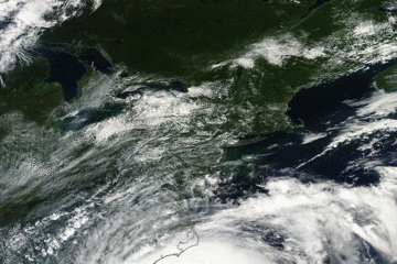
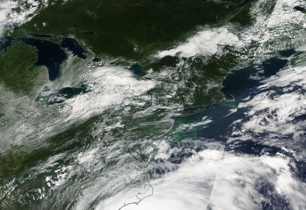
Satellite Image from MODIS
|
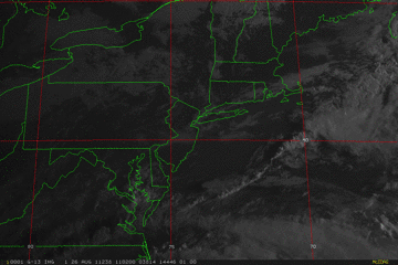
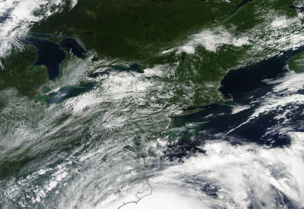
Satellite Images from GOES-13
|
CAR - (QuickLook)
Imagery from CAR Instrument
Click browse image thumbnail to load more detailed version (images open in a new window)
| Flight Direction | Flight Direction |
 |
 |
Flight Mission Details
Overview:
This was the fifth flight. It a return flight from Bangor Airport, Maine to Wallops Flight Facility (WFF), Virginia due to Hurricane Irene evacuation. There were no science goals but CAR data was collected. Other instruments (DBSAR and SIMPL) were not operated for the most part.
CAR - Cloud Absorption Radiometer measured angular distribution of scattered radiation and acquired BRDF measurements over SERC site near Wallops Flight Facility. Fully operational the entire flight.
SIMPL: operated toward the end of the flight.
SIMPL is an innovative dual-wavelength, polarimetric, photon counting lidar that provides high-resolution information on the physical properties of terrestrial surfaces based on their light scattering signatures.
PDS Project Data System (PDS). No instrument report. Fully operational. Acquired base meteorological and navigational measurements.
DBSAR - Not operated.
DBSAR: Digital Beamforming SAR (PI Rafael Rincon). DBSAR is a new generation airborne L-Band radar system that provides two- and three-dimensional fine-scale measurements of biomass.
Flight Path, Timing, and Measurements
Approximate time in UTC (US east coast time - 4 hours). Activities during CAR flight 2028 on August 26, 2011 out of Bangor Airport, Maine transit to Wallops Flight Facility (WFF). Observations by CAR operator/PI, Charles Gatebe.
11:40 - CANS and CAR computer power on.
11:50 - engines on.
11:54 - taxing. Clear day.
12:00 - takeoff.
12:03 - CAR power on.
12:04 - CAR door open.
12:07 - starboard imaging mode. Generally clear sky, but a few scattered clouds.
12:20 - Alt. 6344 m. Nav temp 8.9 deg C. Ch 4 (0.68 µm) signal too low; suspected a problem.
12:29 - airport on the right hand side. Very clear sky.
12:32 - over a river/bridge and a town nearby; took a picture. Clear sky, but some few clouds towards the horizon.
12:33 - instrument problems - missing data. Turned heaters on.. Nav temp 7.4 deg. C.
12:35 - instrument problem again.
12:37 - over a city; clear sky; few low level cloud.
12:42 - mine dump. Over un unidentified city.
12:43 - thin stratus below P-3. Alt. 6391 m.
12:44 - cloud disappearing.
12:47 - thin scattered clouds below P-3.
12:49 - large white building; clouds with rainbow.
12:52 - thin clouds; small town below.
12:53 - over ocean; coastline.
12:54 - uniform stratus.
13:01 - SIMPL turned on.
13:02 - gravity waves over the stratus clouds.
13:04 - gravity waves.
13:09 - scattered stratus. Alt. 6417 m. Very clear sky above.
13:12 - coastline.
13:14 - starboard imaging.
13:16 - clear sky above. Over a coastline.
13:18 - unidentified city.
13:21 - descent.
13:22 - clouds towards the horizon.
13:24 - clouds above P-3.
13:31 - end of SIMPL data.
13:35 - CAR power off.
13:45 - landed.
13:48 - end of taxing. Engines off.