2011-08-30 (Flight #2029) |
Aircraft Flight SummaryDate: 2011-08-30 |
Flight Track Map
Larger image (new window) Download KMZ/KML File (right click, save as) |
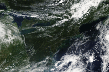
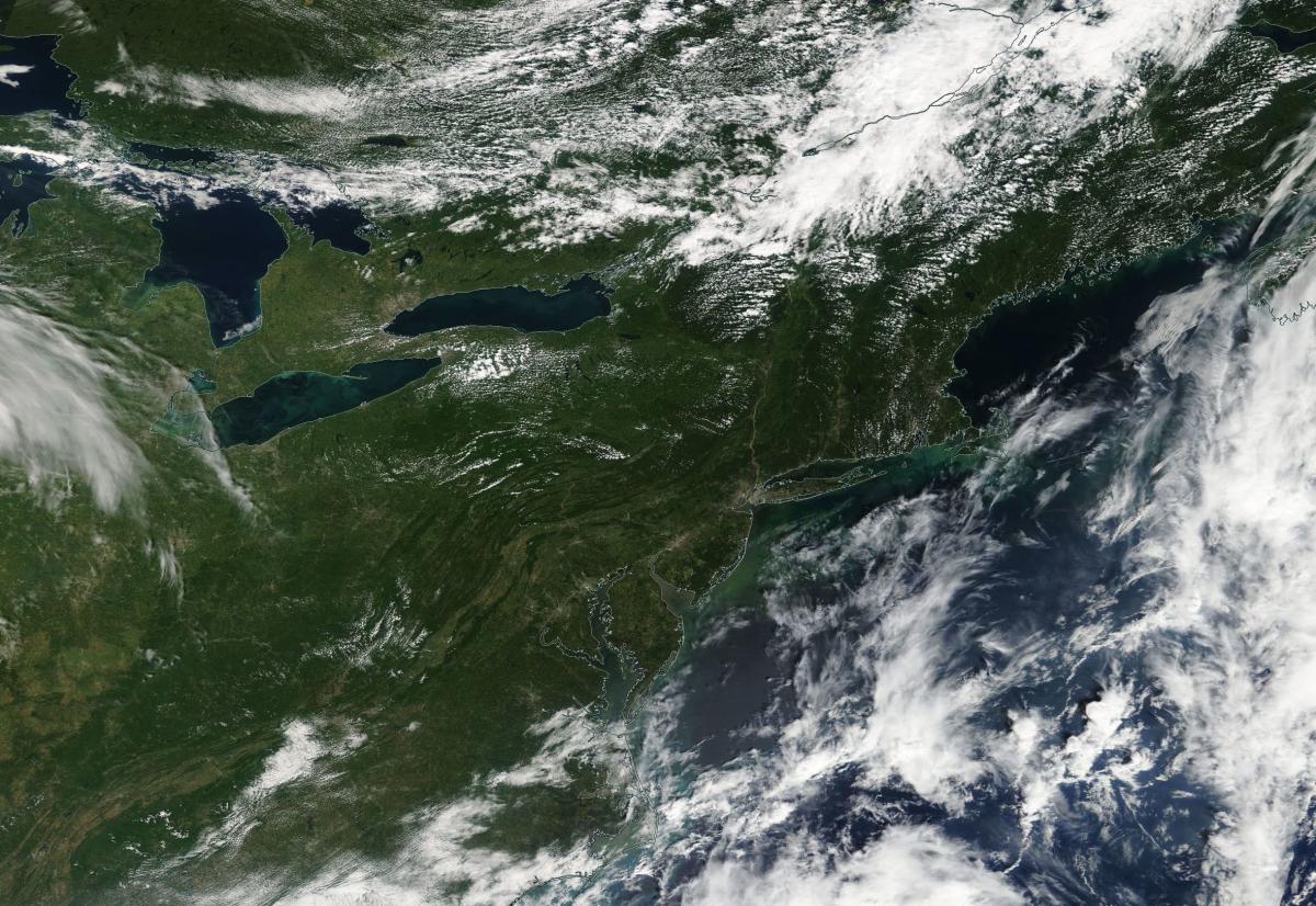
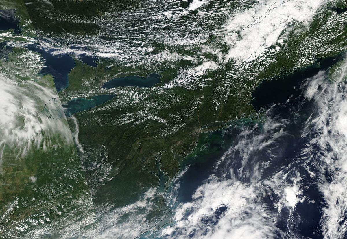
Satellite Image from MODIS
|
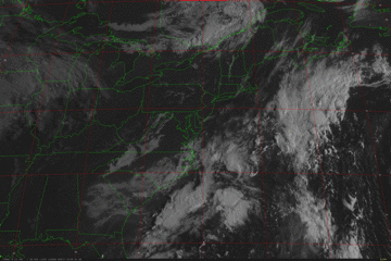
Satellite Images from GOES-13
|
CAR - (QuickLook)
Imagery from CAR Instrument
Click browse image thumbnail to load more detailed version (images open in a new window)
| Flight Direction | Flight Direction |
 |
 |
 |
 |
 |
 |
Flight Mission Details
Overview:
This was the sixth flight. Flight was out of Wallops Flight Facility to Bangor Airport, Maine. Science goals include:
1. SIMPL/DBASR lines over Howland forest.
P-3B Instrument Payload:
CAR - Cloud Absorption Radiometer measured angular distribution of scattered radiation and acquired BRDF measurements over SERC site near Wallops Flight Facility. Fully operational the entire flight.
SIMPL: no instrument report, but was fully operational.
SIMPL is an innovative dual-wavelength, polarimetric, photon counting lidar that provides high-resolution information on the physical properties of terrestrial surfaces based on their light scattering signatures.
PDS Project Data System (PDS). No instrument report. Fully operational. Acquired base meteorological and navigational measurements.
DBSAR - No instrument report. Fully operational.
DBSAR: Digital Beamforming SAR (PI Rafael Rincon). DBSAR is a new generation airborne L- Band radar system that provides two- and three-dimensional fine-scale measurements of biomass.
Flight Path, Timing, and Measurements
Approximate time in UTC (US east coast time - 4 hours). Activities during CAR flight 2029 on August 30, 2011 out of Wallops Flight Facility (WFF), Virginia to Howland Forest, Maine and landing at Bangor Airport, Maine. Observations by CAR operator/PI, Charles Gatebe.
12:40 - checked the entire CAR system. Ok.
13:32 - CANS powered on and collecting data.
14:09 - engines on. Clear/sunny sky, but some Ci over Wallops.
14:13 - taxing.
14:18 - takeoff.
14:22 - CAR power on. Took 100 scans with door closed.
14:24 - CAR door fully open. Starboard imaging.
14:26 - downward imaging.
14:30 - Ci above, but sparse.
14:31 - starboard imaging.
14:34 - widespread Ci. Alt. 6303m.
14:43 - downward imaging mode. Coastline/town at view angle of 170 deg.
14:45 - all heaters on. Nav temp. 5.8 degC.
14:47 - clear sky above P-3.
14:53 - glint seen at a view angle of 40 deg.
15:10 - flooding on the coastline from Hurricane Irene.
15:14 - scattered Cu below P-3, Ci above.
15:18 - lanes of Cu casting shadows on the ocean.
15:26 - runway/city. Alt of P-3: 6630 m.
15:27 - Ch 4 signal is too low. Problem suspected.
15:30 - glint at nadir.
15:32 - glint on one side of the scan and coastline on the other end.
15:35 - Cu developing over the coastline.
15:36 - Nav temp: -2.43 degC. DC Amps: 4.09.
15:37 - clear sky above P-3; flying over the coastline.
15:39 - ship wake (5-6 ships/boats visible).
15:42 - over land. Descent.
15:42 - scattered Cu.
15:51 - starboard imaging. Alt. 1375 m.
15:56 - SIMPL lines setup.
15:59 - below cloud base.
16:07 - scattered clouds. Nav. temp: 15.2 degC. Current: 1.49 amps.
16:08 - winding river.
16:23 - SIMPL lines.
16:31 - Alt. 1393 m.
16:34 - climbing to a higher level above clouds ( ~2000 m).
16:37 - roll data problems.
16:39 - climbing to a higher level.
16:43 - over Bangor city, cloudy.
16:48 - roll data problems.
16:49 - Alt. 2312 m. Scattered clouds below. Doing SIMPL lines.
17:01 - climbed to a higher level.
17:05 - Bangor airport.
17:07 - roll data seems ok.
17:10 - DBSAR lines started. Alt. 5131 m.
17:23 - Ci above, Cu below P-3.
17:25 - DBSAR line 2. Scattered clouds above P-3. Alt. 5115 m.
17:28 - over Howland Forest tower site. Cloudy, not good for BRDF measurements.
17:43 - DBSAR line. Alt. 5130 m.
17:48 - cloudy below and above P-3. Clouds increasing with time.
17:51 - starboard imaging. End of DBSAR line.
17:54 - clear sky above and scattered Cu below P-3.
17:55 - tenuous Ci above P-3; can be seen in the data.
18:09 - downward imaging mode. no clouds above P-3.
18:14 - thin Ci. Starboard imaging.
18:17 - downward imaging mode. No clouds above except towards the horizon.
18:19 - roll data problems.
18:26 - clear sky above, scattered Cu below P-3.
18:32 - Bangor city. North-South transect for DBSAR.
18:37 - DBSAR lines.
18:45 - Ci above, seen in the data.
18:51 - widespread Ci.
18:56 - decreasing Ci and Cu.
18:58 - imaging mode. Clear sky above, scattered Cu below.
19:00 - glint (river) near Bangor.
19:02 - descent.
19:05 - CAR power down and packing.
19:05 - landed.
19:16 - aircraft stop.
19:17 - engine off. CANS power down.