2011-09-12 (Flight #2032) |
Aircraft Flight SummaryDate: 2011-09-12 |
Flight Track Map
Larger image (new window) Download KMZ/KML File (right click, save as) |
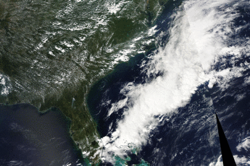
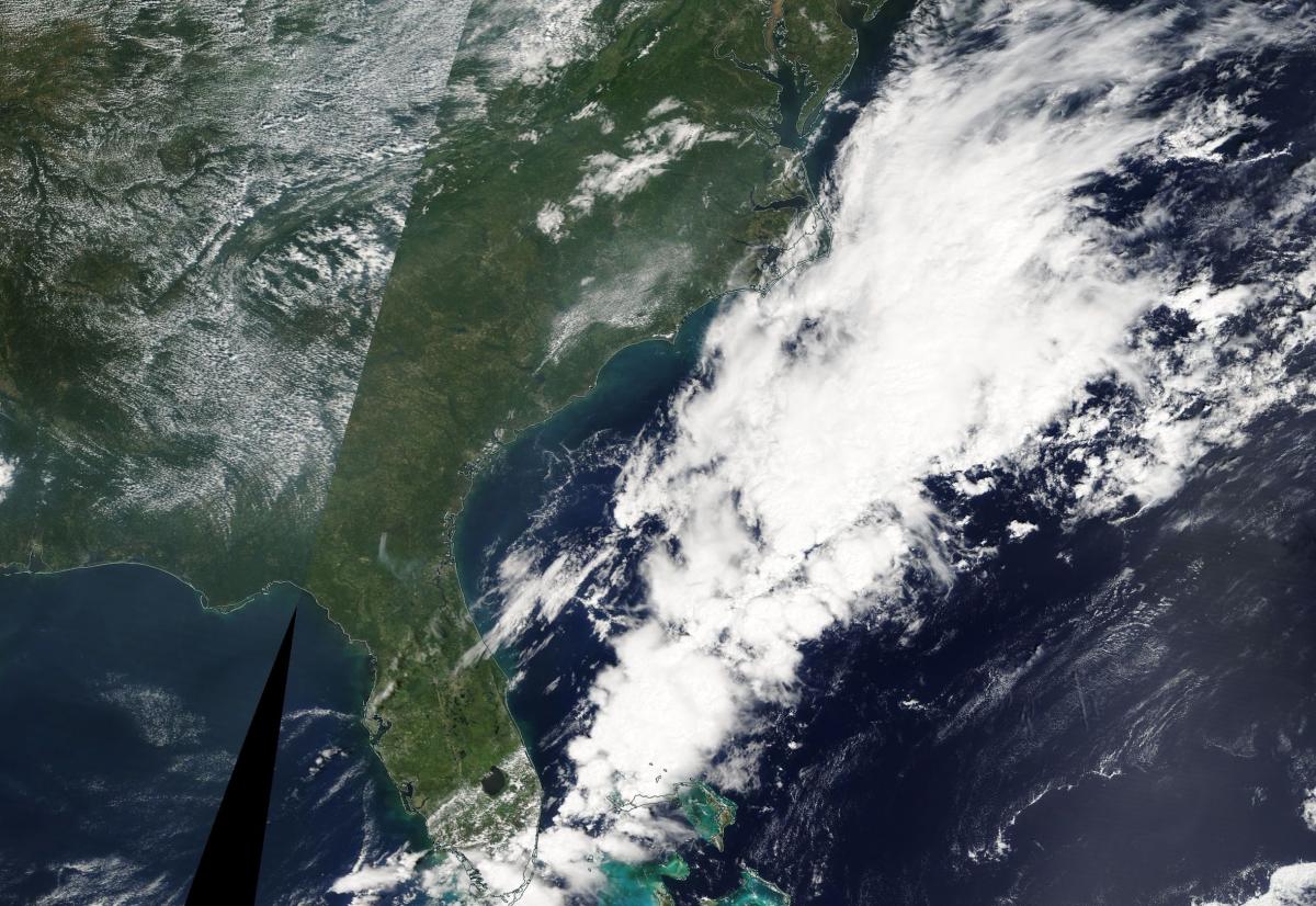
Satellite Image from MODIS
|
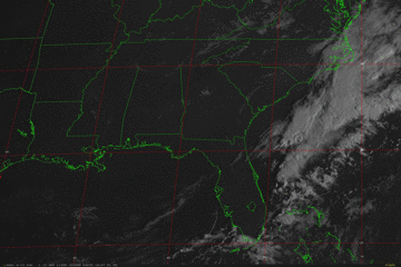
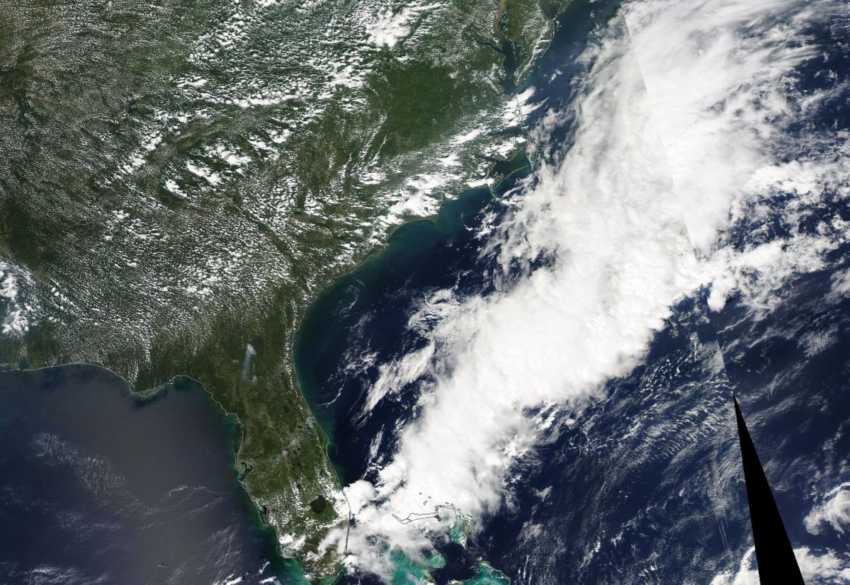
Satellite Images from GOES-13
|
CAR - (QuickLook)
Imagery from CAR Instrument
Click browse image thumbnail to load more detailed version (images open in a new window)
| Flight Direction | Flight Direction |
 |
 |
 |
 |
 |
 |
 |
 |
 |
Flight Mission Details
Overview:
This was the ninth flight out of Wallops Flight Facility (WFF), Virginia (P-3B home base). Science goals include:
1. SIMPL/DBASR lines in North Carolina.
3. CAR circles at SERC
3. Transit to Homestead/Florida.
P-3B Instrument Payload:
CAR - Cloud Absorption Radiometer measured angular distribution of scattered radiation and acquired BRDF measurements over SERC site near Wallops Flight Facility. Full operational the entire flight.
SIMPL: no instrument report, but was fully operational. Phil Dabney operated the instrument.
SIMPL is an innovative dual-wavelength, polarimetric, photon counting lidar that provides high-resolution information on the physical properties of terrestrial surfaces based on their light scattering signatures.
PDS Project Data System (PDS). No instrument report. Fully operational. Acquired base meteorological and navigational measurements.
DBSAR - No instrument report. Fully operational.
DBSAR: Digital Beamforming SAR (PI Rafael Rincon). DBSAR is a new generation airborne L- Band radar system that provides two- and three-dimensional fine-scale measurements of biomass.
Flight Path, Timing, and Measurements
Approximate time in UTC (US east coast time - 4 hours). Activities during CAR flight 2032 on September 12, 2011 out of Wallops Flight Facility in Virginia heading to Florida. Observations by CAR operator, Rajesh Poudyal.
11:26 - Motor/Nav turned on.
12:17 - takeoff.
12:19 - CAR turned on.
12:22 - Starboard mode. Hazy cloudy condition, Filterwheel (FW) at 2.1 µm.
12:26 - FW cooling to normal, still noisy.
12:28 - noticed roll issue.
12:31 - CANS running ok.
12:33 - imaging mode over Potomac river.
12:38 - contrast in water clear/sediment loaded water.
12:42 - starboard mode, roll issue.
12:43 - DBSAR lines. Changed to imaging mode clear conditions above, some clouds towards the horizon; roll issue, negative roll putting CAR to the pilot side. Stop automatic roll correction and put on starboard.
12:51 - back to imaging mode during the DBSAR lines, roll correction off.
12:59 - some thin cirrus cloud.
13:10 - Starboard mode, auto roll on, spiraling down to 2 km.
13:22 - BRDF circle 1 at 5500 ft clear condition, some haze, clouds on the horizon.
13:26 - BRDF circle 2.
13:29 - BRDF circle 3.
13:33 - BRDF circle 4 at 2500 ft.
13:35 - BRDF circle 5.
13:37 - BRDF circle 6.
13:42 - BRDF circle 7 1000 ft.
13:44 - BRDF circle 8.
13:46 - BRDF circle 9.
13:51 - Imaging mode, stop roll correction.
14:07 - above thin clouds.
14:08 - Thin hazy clouds (boundary layer??). Transiting to NC.
14:10 - Starboard mode, turn on roll correction.
14:22 - flying along shore, above clouds.
14:31 - fire smoke next to a lake.
14:32 - getting ready for DBSAR/SIMPL lines, turn off auto roll. On imaging mode.
14:34 - going down to 6500 ft.
14:39 - SIMPL lines.
14:44 - over agricultural fields, end of first line.
14:49 - SIMPL line.
14:50 - DBSAR line.
14:55 - End of data line, noticed blue green on water (algae ?) light clouds above clear below, cloud shadow on the ground.
14:58 - Clear above.
15:03 - data line.
15:04 - contamination on lake (picture).
15:07 - agriculture field.
15:08 - end of SIMPL line.
15:17 - data line, agriculture field.
15:20 - contaminated water (oil slick??).
15:21 - end of data line.
15:27 - ship on water, on data line, same contaminated water.
15:43 - Starboard, roll correction on, above boundary cloud
15:46 - DBSAR lines. Imaging mode, no roll correction. Hazy conditions below.
15:53 - DBSAR lines.
16:03 - End DBSAR line, repeat pass starting.
16:31 - Water with oil slick.
16:33 - DBSAR line.
16:37 - some clouds below.
16:43 - end data line.
16:45 - thin clouds below.
16:49 - on DBSAR line.
16:51 - Finish NC, headed to FL.
16:52 - starboard mode, roll correction on.
17:02 - puffy clouds.
17:05 - cumulous cloud??.
17:25 - similar cloud fields.
17:37 - imaging mode, clouds, no active roll.
17:50 - Paris island marine core base on one side.
17:52 - along coastline, starboard mode, roll correction on.
18:10 - along coastline.
18:16 - noticed ship from 7km up.
18:24 - imaging ocean, stop roll correction, some glint effect
18:32 - looking at sun, good for saturation point
18:54 - inside land, imaging mode, little visible below, diffusion domain??.
18:57 - possible diffusion domain; imaging mode.
19:07 - door closed, turn to -90, stop data; exit.
19:22 - landed