2011-09-19 (Flight #2036) |
Aircraft Flight SummaryDate: 2011-09-19 |
Flight Track Map
Larger image (new window) Download KMZ/KML File (right click, save as) |
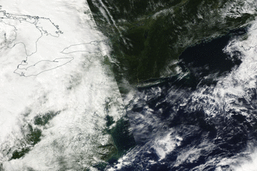
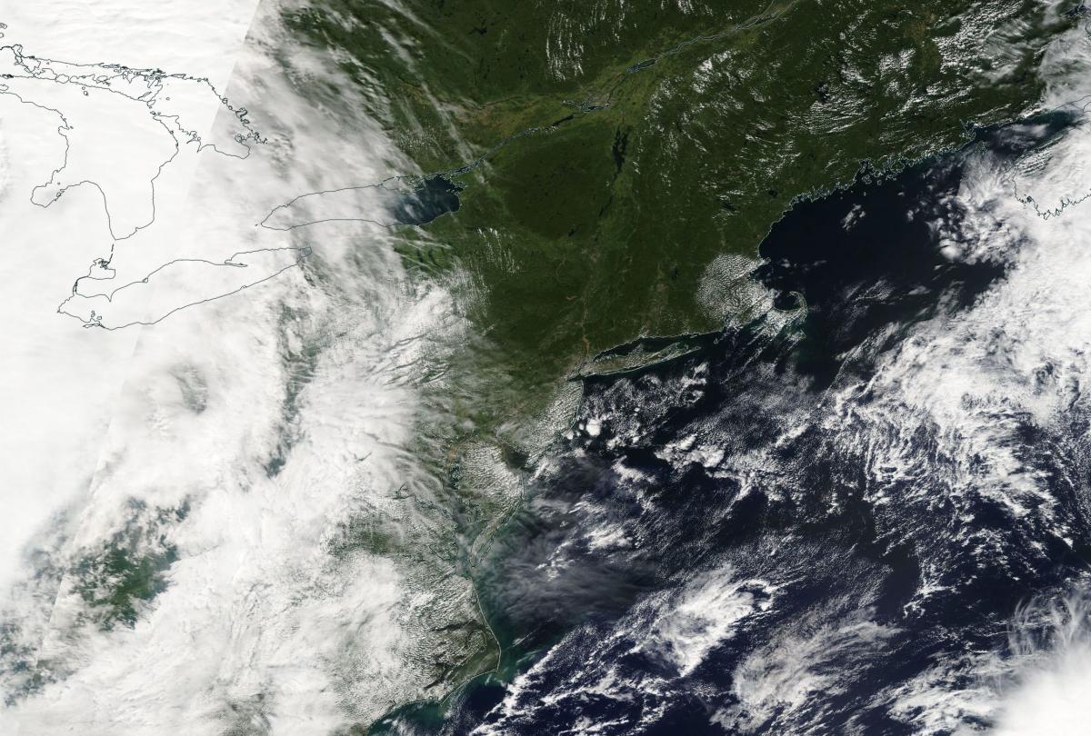
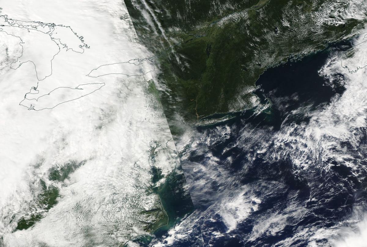
Satellite Image from MODIS
|
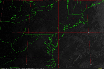
Satellite Images from GOES-13
|
CAR - (QuickLook)
Imagery from CAR Instrument
Click browse image thumbnail to load more detailed version (images open in a new window)
| Flight Direction | Flight Direction |
 |
 |
 |
 |
 |
 |
 |
 |
Flight Mission Details
Overview:
This was the thirteenth and last flight out of Wallops Flight Facility (WFF), Virginia (P-3B home base). Science goals include:
1. 2 SIMPL lines at Wallops: 15 minutes (weather permitting).
2. 3 SIMPL lines at Harvard Forest: 30 minutes.
3. CAR circles at Harvard Forest (42° 32.280', -72° 10.260'): 45 minutes.
4. 5 SIMPL lines in New Hampshire (Bartlett/Hubbard
Brook lines): 45 minutes.
5. CAR circles in New Hampshire (Bartlett: 44° 3.900', -71° 17.280': 45 minutes.
Total of 3 hours science, leaving 3 hours transit.
P-3B Instrument Payload:
CAR - Cloud Absorption Radiometer measured angular distribution of scattered radiation and acquired BRDF measurements over Harvard Forest (Massachusetts) and Bartlett Forest (New Hampshire). Full operational the entire flight.
SIMPL: no instrument report, but was fully operational. Phil Dabney operated the instrument.
SIMPL is an innovative dual-wavelength, polarimetric, photon counting lidar that provides high-resolution information on the physical properties of terrestrial surfaces based on their light scattering signatures.
PDS Project Data System (PDS) measured base meteorological and navigational measurements. Fully operational.
DBSAR - did operate on this flight.
DBSAR: Digital Beamforming SAR (PI Rafael Rincon). DBSAR is a new generation airborne L- Band radar system that provides two- and three-dimensional fine-scale measurements of biomass.
Summary of the flight (Gatebe, 19 September 2011):
In deed, our decision to go North paid handsomely. We found very good weather for CAR/SIMPL measurements both in Massachusetts and New Hamphshire. Many thanks to Dave for making the call at yesterday telecon (18 Sep. 2011).
We had no instrument issues and we got a tour of many states: Virginia, Maryland, Delaware, New Jersey, Massachusetts, New Hampshire, Vermont, New York, and Pennsylvania.
We took a lot of pictures, e.g. at Harvard Forest site, showing two Eddy Flux Towers. We managed to take measurements over both towers.
Our instruments will be deinstalled tomorrow (20 September 2011) and the hard work of analyzing data will begin after performing post-flight calibration.Thanks for the great team work.
Flight Path, Timing, and Measurements
Approximate time in UTC (US east coast time - 4 hours). Activities during CAR flight 2036 on September 19, 2011 out of Wallops Flight Facility in Virginia heading to Massachusetts and New Hampshire. Observations by CAR operator/PI, Charles Gatebe.
11:45 - engines start.
11:49 - taxing. Revving the engine up/down.
11:55 - take off. Bright morning; lots of contrails and Ci clouds.
11:57 - CAR power on.
12:00 - CAR door open.
12:02 - SIMPL data lines over Wallops. Contrails visible in 0.47 µm.
12:05 - hazy over Wallops.
12:06 - end of 1st SIMPL line.
12:08 - developing Cu below (over ocean). Alt. 1979 m asl.. Ci/contrail above.
12:11 - second SIMPL line.
12:14 - end of SIMPL lines. Heading to Harvard Forest.
12:18 - filter wheel at 2.1 µm. Widespread Ci clouds, scattered Cu clouds below.
12:24 - lots of Cu below (alt. 4679 m).
12:29 - nice cloud shadows over the ocean.
12:32 - clear sky above, broken Cu below.
12:39 - clear above, broken Cu below.
12:50 - clear sky above, broken Cu below (alt. 4623 m).
13:02 - scanning in the principal plane, clear sky above, scattered Cu below.
13:14 - very clear weather. Heading to the BRDF site (Harvard Forest). Requested to take BRDF at three altitudes: 200m, 600m, and 2000 m.
13:25 - very clear sky all the way.
13:26 - first BRDF circle. Level 1 (about 2000 m).
13:29 - second BRDF circle.
13:32 - third BRDF circle.
13:34 - end of BRDF circles. Level 1.
13:37 - first BRDF circle, Level 2 (600 m)
13:38 - second BRDF circle.
13:40 - third BRDF circle. Thin clouds spotted.
13:43 - end of BRDF, level 2. Going down to 1000 ft agl (305 m).
13:44 - first BRDF circle, level 3 (305 m agl).
13:47 - second BRDF circle.
13:49 - end of BRDF circles.
13:54 - imaging mode; flying over an urban area.
14:02 - hazy. On the way to New Hampshire, Bartlett site.
14:06 - low level cloud deck, alt. of aircraft is 2605 m.
14:08 - cloud deck below, clear/hazy above.
14:14 - SIMPL lines.
14:18 - very rugged terrain. Scattered Cu lined along the mountain range, clear sky above.
14:22 - cloud cells below. End of first SIMPL line.
14:27 - cloud deck below; can see cloud bow (rainbow), sign of water in the cloud.
14:29 - second SIMPL line.
14:33 - end of SIMPL line.
14:34 - third SIMPL line.
14:40 - end of 3rd SIMPL line (2599 m).
14:42 - cloud deck below.
14:46 - end of 4th SIMPL line.
14:52 - 6th SIMPL line. Clear sky above, cloud deck below.
14:55 - end of SIMPL lines.
14:59 - first BRDF circle, level 1
15:05 - third BRDF circle.
15:06 - end of BRDF circles (level 1).
15:09 - first BRDF circle, level 2.
15:12 - second BRDF circle.
15:14 - third BRDF circle.
15:20 - climbing to a higher level to pick SIMPL lines.
15:32 - SIMPL line starts. Scattered clouds below, clear sky above.
15:33 - imaging mode.
15:44 - 0.87 µm and 2.1 µm are anticorrelated over certain areas. Find out the reason during the analysis. Check their relationship with 0.34 µm.
15:49 - 0.87 µm and 2.1 µm are anticorrelated with 0.34 µm and 0.38 µm.
15:52 - doing SIMPL lines. Clear sky above, scattered Cu below.
15:54 - SIMPL lines. Cloud cells below.
15:58 - end of SIMPL lines.
15:59 - winding river and a small lake below.
16:01 - puffy Cu below.
16:07 - 0.47 µm vs 0.87 µm looks interesting; in some instances they are anticorrelated.
16:08 - some clouds cells below.
16:10 - SIMPL lines.
16:13 - over a city. Setting for a new SIMPL line.
16:15 - dirty lake/dam. Scattered Cu; clear above.
16:16 - roll data (very high values). Check data.
16:23 - lines of clouds due to orographic lifting.
16:26 - end of SIMPL lines. Heading back to Wallops.
16:28 - climbing to cruising altitude. Pitch ~5 deg., roll <2 deg.
16:32 - sudden drop in altitude (not much) but significant.
16:36 - dirty lake and a dark lake, clear, but hazy.
16:45 - river below.
16:48 - city, river winding/dirty.
16:54 - just passed over a "red river".
16:55 - starboard imaging. Lots of Ci and contrail above. No clouds below.
17:09 - over fires/city.
17:11 - airport. Our alt. 4963 m.
17:13 - roll data does not look good.
17:14 - scattered Cu, almost overcast, Ci above.
17:40 - overcast above, broken clouds below.
17:45 - CAR packed ready for landing.
17:46 - closing CAR door.
17:47 - CAR power off.
17:52 - landed at Wallops.
17:54 - CANS turned off.
17:56 - stop taxing, engines off.