1998-05-30 (Flight #1757) |
Aircraft Flight SummaryDate: 1998-05-30 |
Flight Track Map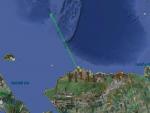
Larger image (new window) Download KMZ/KML File (right click, save as) |
Satellite ImageImage Unavailable MODIS/Aqua larger image (afternoon) - unavailable |
Satellite Images from goes-09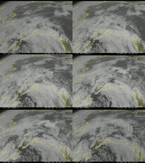
1830-0115 UTC |
CAR - (QuickLook)
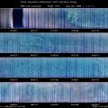
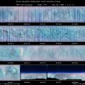
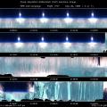
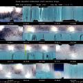
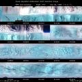
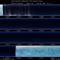
Imagery from CAR Instrument
Click browse image thumbnail to load more detailed version (images open in a new window)
| Flight Direction | Flight Direction |
 |
 |
 |
 |
 |
 |
 |
 |
 |
Flight Mission Details
For this flight, we mainly concentrated on measurements over the SHEBA ship. Take off was at 19:10. There was stratus cloud cover below on the way out to the ship with clear skies above. The cloud layer became thin and patchy at times. We did BRDF measurements above the altocumulus cloud layer over the ship. The cloud layer was patchy and some sea ice visible. At other points during the BRDF measurements, the cloud layer was uniform and no ground was visible. We then did a pass through the center of the BRDF measurements above the altocumulus cloud layer over the ship. There was another set of BRDF measurements taken over the ship below cloud layer. During these circles, the car was in position 3, BRDF mode with sea ice below with large leads and broken clouds above. For the last part of the flight, we flew in the cloud layer over the ship before returning to Barrow.
Climbed out through altocumulus cloud layer over Barrow, switched CAR to nadir imaging mode, filterwheel was locked on 2.2 µm band, imaged clouds then clear ice, pure first year ice, brighter in the 0.47 µm band then in the other bands, leads apparent in the ice.
Flight Path, Timing, and Measurements
1700: perfectly clear ice, switched filterwheel to 1.6 µm band.
3600: full halo.
5688: switched filterwheel to 2.2 µm band, imaging stratocumulus clouds.
6030: stratus cloud layer below breaking, open ice appearing, cruising at 17,454 ft.
6384: albedo ~ 0.68.
6878-7229: some ice is visible through patchy altocumulus clouds, albedo ~ 0.63.
7366: sea ice is very visible, very thin cloud layer below.
8444: very solid cloud layer below, albedo ~ .79.
9260: switched to position 3 to BRDF mode, 4 miles to SHEBA ship.
9479: uniform altocumulus below, GPS altitude 9,263 and leveling off.
9748: cloud layer breaking up below, ice is visible.
10032: starting BRDF circles .
10291: glory visible, attempted to take a picture of glory but failed.
10376-10533: ground is visible through patchy altocumulus, GPS altitude 8,900 ft .
10855: altocumulus cloud layer over the SHEBA ship breaking up at points during the BRDF measurements , sea ice visible through breaking cloud layer.
11175: switched filterwheel to 1.64 µm band at GPS altitude 9,000 ft.
11787: clouds thicker here, no ground is visible.
12166: completing 9th turn, thin cloud layer with some ice visible.
12430-12520: switched CAR to nadir imaging mode, specular reflection of the sun off of the clouds.
13144: CAR was switched to position 2, penetrate cloud layer at 8500 ft.
13253-13339: below cloud layer at GPS altitude 6500 ft.
13476: broken stratus below, sea ice visible, reff = 8 µm.
13728: descending at 6,200 ft.
13942: glory visible.
14105-15805: clear view of ice below, no lower cloud layer, CAR in nadir imaging mode with the SHEBA ship on the right side of plane .
14798: CAR switched to zenith scanning mode, patchy altocumulus clouds above.
15290: CAR switched to nadir imaging mode.
15917: altocumulus clouds on top, stratus below.
16187: CAR is in zenith imaging mode, broken clouds.
16505: CAR was switched to BRDF mode, ice with large leads.
16770: start BRDF measurements, broken altocumulus above, start 1.64 µm filterwheel.
16975: big lead in scan.
17127: over the SHEBA ship.
17555: switched CAR to 2.2 µm filterwheel.
18099: CAR is now in zenith imaging mode.
18788: band of blue on the horizon.
19033: switched to BRDF mode, ice with large leads.
19134: cloud base at 7400 ft, super cooled water droplets.
19405: CAR is in nadir position, GPS altitude 8100 ft, well outside of cloud thickness, 7777 ft cloud top reff = 6µm, very few columns.
19820: switch to starboard position, precip out of this stratus.
24500: switched to zenith mode, overlying cirrostratus.
28455: turned CAR to nadir mode, scan near principle plane, auto filterwheel.
29244: clouds left, only ice, nadir scan, leads in ice visible.

