2006-03-17 (Flight #1915) |
Aircraft Flight SummaryDate: 2006-03-17 |
Flight Track Map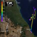
Larger image (new window) Image by Gala Wind, NASA GSFC Download KMZ/KML File (right click, save as) |
Satellite Image from MODIS-Aqua/Terra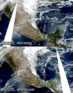
MODIS/Terra larger image (morning) (new window) MODIS/Aqua larger image (afternoon) (new window) Imagery by Bill Ridgway, NASA GSFC |
Satellite Images from GOES-12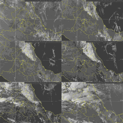 1302 - 2345 UTC |
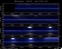
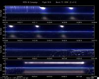
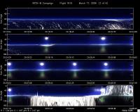
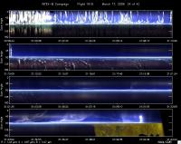
CAR - (QuickLook)
Imagery from CAR Instrument
Click browse image thumbnail to load more detailed version (images open in a new window)
Images by Tom Arnold, NASA GSFC
| Flight Direction | Flight Direction |
|
|
|
|
|
|
|
Flight Mission Details
By Dr. Philip Russell
Preflight goals focused on underflying Aqua over the Gulf to study aerosols or clouds depending on conditions encountered.
CAR Glitch on takeoff w computer. Got past that. Will shut down before landing in future.
Flight Path, Timing, and Measurements
1805: Engines on
1824: AATS darks
1827: AATS unparked & taking data before taxi, AOD(520 nm)~0.15, CWV 4.1 cm
1835: Take off
1837: Takeoff, scattered Ci
1845: Distinct haze layer below all around. ZGPS=2.7 km, AOD(520)=0.02
1857: Still scattered Ci, another layer above low layer of aerosol
Found hole above around 20 deg 20’ 20”, 96 deg 17’ 30”.
1920: Still in spiral descent
1929: 200 ft, under low clouds. Haze layers from spiral: 0.7, 1.5, 2.5 km? AOD(520)~0.18
1930: AOD(520)~0.18
1931: Begin ascent. Altitude of low clouds ~500-600 m?
2004: Beginning perpendicular leg. Aqua overpass.
2006: Crossing the track
2010: A little Ci. Terminating perpendicular run heading to do CAR measurements
2023: Ramping down to 2000 ft for CAR maneuvers in clear, then will attempt above/below cloud street (Kirk taking a picture)
2035-2047: CAR maneuver at 2000 ft. AOD(520) ~0.09. Very scattered stratus below
2049: Starting transit above cloud layer at ZGPS=745 m
2051: Heading 330 deg, now begin cloud run over 98% overcast stratocumulus
2056: Flew thru wisp of cloud on descent below cloud.
2058: Under cloud flying 158 deg heading, back along same track AATS lost tracking during horizontal transect under cloud.
2105: Good AATS AOD measurements for short period at 300 ft
2110: Begin ramp up to ~14,000 ft heading back to VER.
2118: 4.3 km, AOD(520)~0.018. On outbound leg, AOD(520) ~0.010 for same altitude, but later in the flight ~0.013
2143: Land
2143: Engine off
