2006-03-19 (Flight #1917) |
Aircraft Flight SummaryDate: 2006-03-19 |
Flight Track Map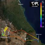
Larger image (new window) Image by Gala Wind, NASA GSFC Download KMZ/KML File (right click, save as) |
Satellite Image from MODIS-Aqua/Terra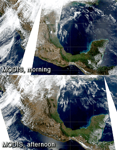
MODIS/Terra larger image (morning) (new window) MODIS/Aqua larger image (afternoon) (new window) Imagery by Bill Ridgway, NASA GSFC |
Satellite Images from GOES-12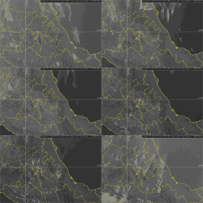 1302 - 2345 UTC |
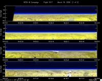
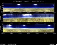
CAR - (QuickLook)
Imagery from CAR Instrument
Click browse image thumbnail to load more detailed version (images open in a new window)
Images by Tom Arnold, NASA GSFC
| Flight Direction | Flight Direction |
|
|
|
|
|
Flight Mission Details
By Dr. Philip Russell
Preflight goals focused on profiling at T2 with the DC-8, flying principal plane legs and spirals near T2 under Aqua, POLDER, and Aura, and flying CAR circles and spirals at T0.
CAR worked great for 8100 scans of data (81 min). Then it stopped. Looks like power problem, probably in instrument. Can’t close door now. Probably can’t be fixed for tomorrow’s flight. Question for tomorrow’s flight: fly CAR with cover? [Update: CAR flown 20 Mar with CAR door closed].
Flight Path, Timing, and Measurements
1750: Engines on
Problem w POS laptop—would not open program. Finally did after reboot.
1807 : AATS darks
1810: AATS tracking on ground. AOD(520)=0.25, AOD(1019)=0.096. P=1003.3 mb
1813 : POS fine, now taxing
Excellent AOD & H2O profile after takeoff. About 50% of AOD(520) below 800 m. AOD ~0.05 at 1.5 km, ~0.011 above 2.4 km. No Ci in sight, only a few cumulus humilis capping haze.
1816: Takeoff
1902: ZGPS 6.524 km, Tstat=-13.1 C, P=457.9 mb
1919: No Ci, only some scat capping cumulus—looks clear over T2
1923 : Begin spiral descent (Rec ~1145)
1926: ATC stopped our descent at 5.78 km—above haze.
1929 : Begin descent again. Top of haze ~4.7 km, need 16 kft for top run
1934 : Descending to 9500 ft, very bumpy
1935: Leveling at 9500 ft, heading to SE for principal plane run. AOD~0.21, DC-8 at 15 kft
1936 -1941: Principal plane low alt run at 9500 ft, 213 deg heading
1941: Begin ascent
Very flat AOD wavelength dependence at bottom. ~0.33 Tracking error??
1944: AOD(520)=0.024 at 3.6 km
1950 : Level at 16 kft
2000 : Completed other principal plane run back along same track at 17 kft. Will descend to 12500 ft and perform another level leg.
2007 -2011: Begin mid-level (12,500’) principal plane run.
Proceed to T0 at 12,500 ft.
2018 : Much clearer as we approach T0.
2022 : In spiral down to 9000 ft; then heading of 320 deg. AOD(520): 0.22, AOD(1020) 0.176
2023 To 2030: two low level runs at 9000 ft
2030: spiraling up
2034: heading away from MEX to VER—passed just E (?) of MEX airport. Took several pix with Tom’s camera--#s 521++
2047 : flying back at 6.018 km
2122 : Land VER. AOD(520)=0.156; P=999.8 mb
2124: AATS off; POS off
2122: Land. AOD(520) at VER 0.18
2126: Engine off
