1995-08-25 (Flight #1693) |
Aircraft Flight SummaryDate: 1995-08-25 |
Flight Track Map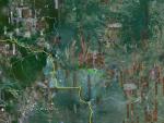
Larger image (new window) Download KMZ/KML File (right click, save as) |
Satellite ImageImage Unavailable MODIS/Aqua larger image (afternoon) - unavailable |
Satellite ImagesImage Unavailble |
CAR - (QuickLook)
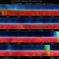
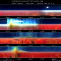
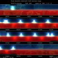
Imagery from CAR Instrument
Click browse image thumbnail to load more detailed version (images open in a new window)
| Flight Direction | Flight Direction |
 |
 |
 |
 |
 |
 |
Flight Mission Details
Profile a thick smoke layer; BRDF study over dense forest (trees with large canopy) for 1.6 and 2.2 µ band.
The objective of the first part of the mission is to rendezvous with ER-2 in the north-west or due west of Cuiaba.
Flight Path, Timing, and Measurements
17:35:36 UTC, scan count = 2480: IR detector temperature is -195 °K, cold enough for all filterwheel channels. The sky looks very hazy.
17:51:42 UTC, scan count = 4061: inside thick smoke plume, one could even smell it.
18:01:30 UTC, scan count = 5050: smoke plume at the starboard of the C131A.
18:14:30 UTC, scan count = 6360: at top of the smoke layer.
18:37:30 UTC, scan count = 8685: profiling the smoke layer in the last five minutes, now we are on our way down beneath the smoke layer.
18:42:30 UTC, scan count = 9170: still within the thick smoke layer. The 0.47 µ channel shows a decrease in signal strength from the zenith to nadir, while channels with wavelength longer 0.87 µ shows the opposite. Very interesting results.
19:05:55 UTC, scan count = 11530: found an isolated area where there are dense forest (large canopy type) coverage. Nearby, we can see the destruction of the forest. Commence the BRDF circles now. Lock the filterwheel position onto 2. Smoke and hazy condition.
19:12:47 UTC, scan count = 12235: lock the filterwheel position onto 5.
19:14:43 UTC, scan count = 12422: interrupt the circle because the center of the circle drifted due to the cross wind.
19:17:23 UTC, scan count = 12684: back to the 20° right bank again. Filterwheel position is on 5.
19:24:52 UTC, scan count = 13441: start the left bank with the roll of 20°. Lock the filterwheel position onto 5.
19:27:25 UTC, scan count = 13705: still in the left bank turn, but this time the filterwheel position is on 2.
19:29:52 UTC, scan count = 13960: completed the BRDF study over the forest area.
19:50:07 UTC, scan count = 15988: turn off the CAR.
20:44 UTC: C-131A landed in Cuiaba.

