1995-08-27 (Flight #1694) |
Aircraft Flight SummaryDate: 1995-08-27 |
Flight Track Map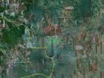
Larger image (new window) Download KMZ/KML File (right click, save as) |
Satellite ImageImage Unavailable MODIS/Aqua larger image (afternoon) - unavailable |
Satellite ImagesImage Unavailble |
CAR - (QuickLook)
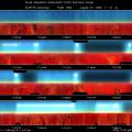
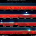
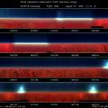
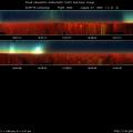
Imagery from CAR Instrument
Click browse image thumbnail to load more detailed version (images open in a new window)
| Flight Direction | Flight Direction |
 |
 |
 |
 |
 |
 |
Flight Mission Details
Profile thick smoke layer over NASA Sunphotometer site near INPE.
Basically there are two layers of smoke. The lower thicker layer has a base at 900 feet also and a top at 7500 feet. The Upper thinner smoke layer is at 8000 - 9000 feet. There is a clear gap in between two layers of smoke, revealed by the lidar measurements.
Flight Path, Timing, and Measurements
16:59:55 UTC, scan count = 1: IR detector temperature is -195° K, still too hot for 2.29 µ channel. Its signal is saturated. Within the thick smoke layer, 0.47 µ blue channel signal strength decreases from the zenith to the nadir, while 0.67 µ and 0.87 µ channel have a large peak at the horizon. 1.03, 1.27 and 1,22 µ channels have small signal in zenith direction, larger signal from horizon to nadir quadrant.
GPS altitude of 3685 feet, CNC1 = 2000 /cc, pressure = 902.8 mb and relative humidity is at 714 g/m3.
17:17:50 UTC, scan count = 1790: IR detector temperature remain -196 °K and steady.
17:19:52 UTC, scan count = 1995: at altitude of 3700 feet doing race track type of flight pattern. It is now about 45 minutes before rendezvous with ER-2.
17:39:30 UTC, scan count = 3977: at altitude of 2000 feet and continue down towards the base of the lower smoke layer. CNC1 count is going up. 0.67 µ channel shows up double peaks.
17:42:36 UTC, scan count = 4288: altitude at 500 feet, pressure = 986.8 mb. CNC1 jumps up to 3000 /cc.
17:46:32 UTC, scan count = 4685: at altitude of 1200 feet. The plane started climbing towards the top of the smoke layer.
18:05:35 UTC, scan count = 6604: still in the lower smoke layer at around 8909 feet.
18:09:43 UTC, scan count = 7022: at top of the lower smoke layer.
19:28:20 UTC, scan count = 14950: at altitude of 1000 feet. The city skyline is on the starboard and shown up on CAR signals.
19:44:33 UTC, scan count = 16585: first attempt to close the CAR door.
19:44:45 UTC, scan count = 16607: second attempt to close the CAR door.
20:25 UTC: C131A landed in Cuiaba.

