1995-08-30 (Flight #1696) |
Aircraft Flight SummaryDate: 1995-08-30 |
Flight Track Map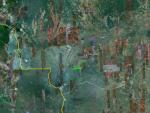
Larger image (new window) Download KMZ/KML File (right click, save as) |
Satellite ImageImage Unavailable MODIS/Aqua larger image (afternoon) - unavailable |
Satellite ImagesImage Unavailble |
CAR - (QuickLook)
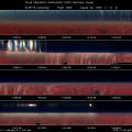
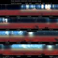
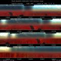
Imagery from CAR Instrument
Click browse image thumbnail to load more detailed version (images open in a new window)
| Flight Direction | Flight Direction |
|
|
|
|
|
|
|
Flight Mission Details
Vertical profile of very thick smoke over NASA Sunphotometer site in Pantanal. The lower thicker smoke layer has a base at 900 feet and a top at 7500 feet. The uppder thinner smoke layer is at 8000 - 9000 feet.
Flight Path, Timing, and Measurements
13:34:35 UTC, scan count = 10: altitude around 4000 feet and climbing through a thick smoke layer. IR detector temperature is -17.2, still too hot for some filterwheel IR channels. CNC1 = 3000 /cc and LWC (J-W) = 0.1 g/m3. The base of the smoke layer is not very well defined.
13:43:30 UTC, scan count = 890: C131A is at 9500 feet, barely see the ground, CNC1 = 2848 /cc and remain largely constant, LWC = 0.1 g/m3. Altocumulus clouds above us with 30 - 50% coverage.
13:51:11 UTC, scan count = 1661: at the top of the smoke layer (13000 feet), altocumulus overcast condition, CNC1 = 970 /cc
14:04:?? UTC: CAR clock is not running, the reading is frozen at 14:00:36 UTC. Jack Russell restarted the computer at 14:08:57 UTC. CAR time code running again at 14:10:08 UTC.
14:11:39 UTC, scan count = 3724: see a layer of thin smoke above bulk thick layer we have been in, altitude 15000 feet CNC1 = 150 /cc
14:14:58 UTC, scan count = 4056: we are in the upper thin smoke layer, the peak CNC1 = 200 /cc. Geographically, we are just above the sun photometer site.
14:21:45 UTC, scan count = 4741: drop altitude and dip into the lower cloud/smoke layer again. West of the sun photometer site, more patches of clouds, while less and less clouds present in the East.
14:44:15 UTC, scan count = 7004: altitude 9859 feet, within smoke layer. Ground is barely visible. CNC1 = 2000 /cc. This is a very thick regional haze layer.
15:24:22 UTC, scan count = 11050: near the sun photometer site and go over a lake. The bottom of the smoke layer is just couple of hundred feet above the surface.
15:46:18 UTC: due the constraint of visual flight rule at Cuiaba airport. The mission is cut short.
16:04:06 UTC, scan count = 15051: flick the door close switch.
