1995-09-06 (Flight #1701) |
Aircraft Flight SummaryDate: 1995-09-06 |
Flight Track Map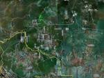
Larger image (new window) Download KMZ/KML File (right click, save as) |
Satellite ImageImage Unavailable MODIS/Aqua larger image (afternoon) - unavailable |
Satellite ImagesImage Unavailble |
CAR - (QuickLook)
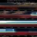
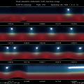
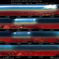
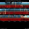
Imagery from CAR Instrument
Click browse image thumbnail to load more detailed version (images open in a new window)
| Flight Direction | Flight Direction |
|
|
|
|
|
|
|
Flight Mission Details
BRDF study of a thick smoke layer at 12000 ft. Cloud cover in the vicinity is much less than 1%. Sky radiances above the BRDF site are also measured.Conducted BRDF flight over a thick smoke layer.
Flight Path, Timing, and Measurements
12:45:05 UTC, scan count = 400: heading South-East of Porto Velho. Altitude around 4600 feet and climbing through a hazy smoke layer. CNC1 = 1500 /cc. Alto cumulous clouds above the haze layer. IR detector temperature is -173°K and falling, still too hot for 2.29 µ, the rest of filterwheel channels appear to be O.K. Gain setting is on 5 (amplification factor = 2) as usual.
12:55:25 UTC, scan count = 1293: clear the top of the lower smoke layer. CNC1 = 744 /cc. Climbing towards the alto cumulous above.
13:05:50 UTC, scan count = 2340: see a very fine cirrus above the alto cumulous clouds. Present aircraft altitude is at 13000 feet. Then give up on climbing and head north for my BRDF study.
13:14:32 UTC, scan count = 3216: maybe because of the position of the sun relative to the aircraft, the maximum signals at all channels are reaching saturation while gain is on the lowest setting of 1 (amplifier factor of 0.125). Present aircraft altitude at 11250 feet. LIDAR measurements show that a smoke layer is sandwiched in between two relatively clear layers.
13:41:55 UTC, scan count = 5966: begin BRDF over smoke layer. Filterwheel is locked onto position 2 (1.64 µ). Cloud cover in vaccinate is much below 1% and they are relatively far away from the area of operation. CNC1= 800 /cc and aircraft is at 12000 feet, near the very top of the smoke layer but still within the smoke layer. From this altitude, the uniform ground (very densely forest) appears to be blur but still visible. One or two isolated very small puffs of cumulous clouds are present in the scene, I do not think they will affect the observations.
13:49:04 UTC, scan count = 6687: completed three circles and now switch the filterwheel onto position 5 (2.20 µ).
13:56:43 UTC, scan count = 7455: completed right banking of the aircraft. Now bank to the left and characterize the sky radiance. Doing aerial maneuvering so that the left bank circles will lay on top of right bank circles we have just completed.
14:00:53 UTC, scan count = 7870: lock onto filter 5 and start the left bank circles, approximately two circles completed.
14:07:37 UTC, scan count = 8549: lock onto filterwheel position 2 and continue banking to the left, approximately two circles completed.
14:11:11 UTC, scan count = 8910: break out the circular flight pattern and conclude the BRDF study.
14:28:52 UTC, scan count = 10688: see fantastic cloud streets (altocumulus undulatus) below the aircraft and also cumulus Humilis, cumulus fractus type of clouds. Present aircraft altitude is around 8000 feet.
15:12:52 UTC, scan count = 15111: on the way home, flying through individual clouds. Altitude at 2000 - 3000 feet.
15:44:03 UTC, scan count = 18253: close the door
16:04 UTC: plane landed in Porto Velho Airport
