2005-05-18 (Flight #1900) |
Aircraft Flight SummaryDate: 2005-05-18 |
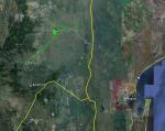
Flight Track Map
Larger image (new window) Download KMZ/KML File (right click, save as) |
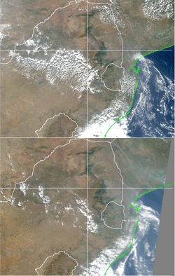
Satellite Image from MODIS
MODIS/Terra larger image (morning) (new window) MODIS/Aqua larger image (afternoon) (new window) |
Satellite ImagesImage Unavailble |
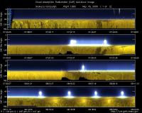
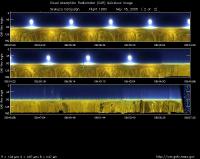
CAR - (QuickLook)
Imagery from CAR Instrument
Click browse image thumbnail to load more detailed version (images open in a new window)
| Flight Direction | Flight Direction |
|
|
|

|

|
Flight Mission Details
Overview:
This was the 1st flight out of Nelspruit, South Africa in the morning. Preflight goals included testing the functionality of the CAR on the new platform, South Africa Weather Service, Aerocommander 690A (wing mont), especially in taking BRDF measurements over Skukuza.
Second flight took place in the afternoon (with engines on at 11:02 UTC), but the instrument could not power on during takeoff. Flight was cancelled.
Flight Path, Timing, and Measurements
Approximate time in UTC (South Africa local time: +2 hours). Activities during CAR flight 1900 on June 18, 2005 out of Nelspruit Airport, South Africa heading south towards Skukuza. Observations by CAR operator/PI, Charles Gatebe.
6:15: Several tests were conducted before the flight. These included: Power test --powered the CAR from ground power and without reading the navigation information. Test 2 included reading the aircraft navigation data. Test 3 involved aircraft power and reading the navigation data. All the tests were successful.
7:18 -- engine on.
7:26 --CAR computer power on.
7:34 -- taxing.
7:36 -- takeoff.
-- CAR power on. Alt. 3500 ft cruising to Skukuza. Julian day seems wrong. Aircraft speed (indicated) - 160 knots. Weather - hazy.
8:00 -- over Skukuza and surveying the area. Cumulus clouds over Sambie river (scan # 3200). Lat. -24.95°/lon:31.67°.
8:15 -- Start of BRDF circles. Filter wheel at 1.6 µm.
8:17 -- circle 2.
8:20 -- circle 3.
8:25 -- circle 4. Filter wheel at 2.1 µm.
8:28 -- circle 5. Aircraft 10 miles west of Skukuza airport. No drift.
8:32 -- circle 6.
8:35 -- circle 7. Filter wheel at 2.2 µm.
8:36 -- scattered clouds observed.
8:38 -- circle 8. Scan number 6500 -- roll angle reading more than 40 deg, looks suspect.
8:40 -- circle 9.
8:43 -- end of BRDF circles. Return to Nelspruit.
8:57 -- close CAR door.
8:58 -- door fully closed. Instrument power off. Scan number 8257.
9:00 -- CAR computer power off.
9:11 -- landed.
