Flight Time: 16:54 UTC -20:49 UTC
Data Time: 16:55 UTC -20:46 UTC
Aircraft Type: NRL P-3
Flight Scientist: Dr. Charles K. Gatebe
Flight Number: 2065
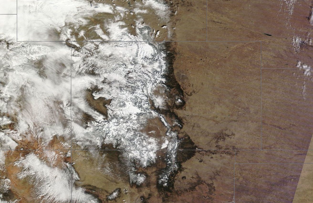
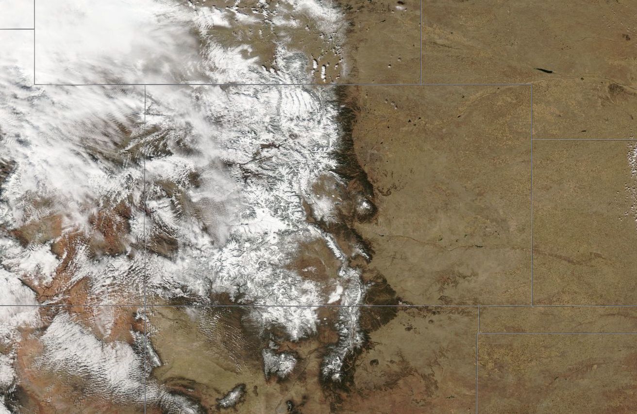
Mission Location: Colorado Springs, CO.
Lat/Lon Coverage: 40.1097° N 38.3566°S -104.681°E -108.346°W
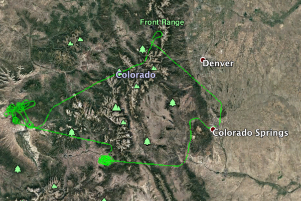
This was the third Navy Research Laboratory (NRL) P-3B flight out of Peterson Air Force Base (AFB), Colorado Springs (KCOS), Colorado. The aircraft took measurements over Grand Mesa and Senator Beck under partially cloudy conditions. Key instruments include:
• Cloud Absorption Radiometer (CAR from NASA/GSFC) for Bidirectional Reflectance Function (BRDF) measurements
• SnowSAR (Snow Synthetic Aperture radar) - a dual frequency (X- and Ku-band) from MetaSensing, Netherlands - Radar (volume scattering).
• Quantum Well Infrared Photodetector (QWIP) infrared imaging camera system from NASA/GSFC - records IR images of target sources in the 8-10 µm band.
• Thermal infrared non-imager from U. Washington, Seattle. Has IR sensitivity in the 8-14 µm range.
• Video camera from GSFC
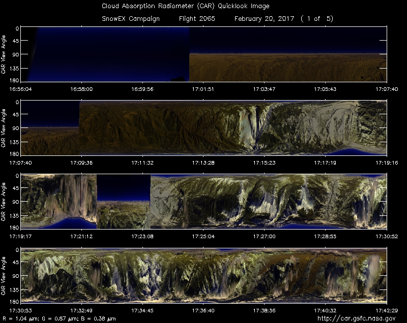
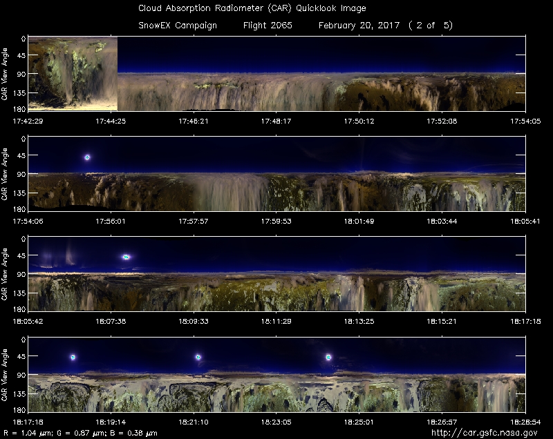
Approximate time in UTC (Colorado, -7 hours). Activities during CAR flight 2065 on February 20, 2017 out of Peterson Air Force Base (AFB) Airport. Observations by CAR operator Rajesh Poudyal, and Kurt Rush, CAR engineer.
15:05 Motor power on, Nav power, computer on. CAR door test, CANS data save
15:33 Engine on, Power swap lost all aircraft power.
Power back up
16:11 Computer on, Nav/Motor on, save CANS data
16:46 taxi
16:54 take off
16:56 CAR on, door open.
16:57 Scanning sky.
16:49 FW on
17:01 starboard / active roll on. No clouds, slightly hazy
17:09 Imaging mode
17:14 some scattered clouds
FW 2.2 , starboard mode. Start of Fraser line mostly Clear sky
17:27 End Fraser line. Clouds forming over mountains
17:36 FW 1.6
17:40 Heading to Grand Mesa, Starboard mode, over clouds
17:54 SnowSAR calibration run
17:58 Start of in-bound calibration line, FW 2.2, over clouds
18:00 End of calibration line.
18:10 going up for car circle, but partly cloudy
18:17 circle 1, cloud contamination, circle over mesa
18:22 circle 2
18:26 complete brdf circle, fw 2
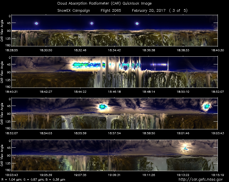
18:43 spiral up
18:56 SnowSAR calibration run
19:01 broken clouds below, cirrus clouds above
19:06 Start of SAR line, SnowSAR getting interference, pilots turned off cabin exhaust to check source of interference
19:07 over Grand Mesa
19:08 flying perpendicular to the reflectors
19:14 flying in circles with clouds above
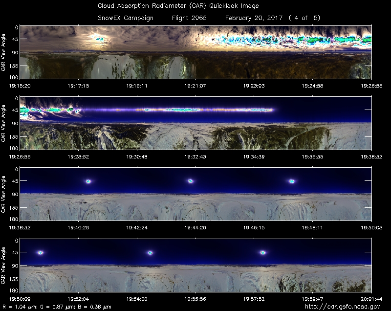
19:24 FW5
19:40 found good spot for snow BRDF measurement, Completed 3 circles 2500 ft agl
19:56 Spiral up for next level (+ 3000 ft)
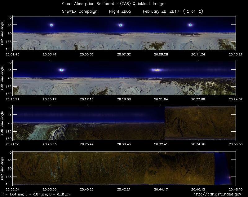
20:11 completed CAR circles
20:12 Spiral climb up
20:18 Complete spiral up, heading back to base
20:32 Imaging mode
20:47 Scanning sky
20:47 Close door
20:48 CAR off
20:49 land